Drytown in Amador County, California — The American West (Pacific Coastal)
Salute to Early Amador Miners
E Clampus Vitus
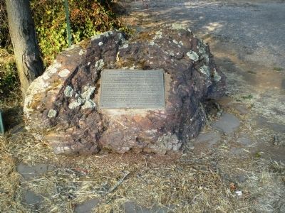
This plaque is dedicated on September 10, 1960 by the ancient and honorable society of E Clampus Vitus to honor the memory of the early miners, both placer and quartz, of Amador County on the Mother Lode in California.
It marks the place where in May 1848 some gold miners from Monterey began to mine for gold on the south bank of Dry Creek. That year, and in 1849, Eastman and Thomas and others, including some Mexicans, found the nearby gulches and ravines to be very rich.
In February 1851, Davidson, a Baptist minister, saw gold in quartz on the south side of Amador Creek in Amador City, with Glover, Herbert, Cool, and Hill he formed the Spring Hill Company, which formed the first gold mill in Amador County, later part of the Keystone Mine.
James W. Marshall Chapter, No. 49
Erected 1960 by E Clampus Vitus.
Topics and series. This historical marker is listed in this topic list: Industry & Commerce. In addition, it is included in the E Clampus Vitus series list. A significant historical month for this entry is February 1851.
Location. 38° 26.488′ N, 120° 51.322′ W. Marker is in Drytown, California, in Amador County. Marker is on State Highway 49, on the left when traveling south. Touch for map. Marker is at or near this postal address: 15950 State Highway 49, Drytown CA 95699, United States of America. Touch for directions.
Other nearby markers. At least 8 other markers are within 3 miles of this marker, measured as the crow flies. Early Day Butcher Shop (within shouting distance of this marker); Drytown (within shouting distance of this marker); a different marker also named Drytown (about 700 feet away, measured in a direct line); New Chicago (approx. 1.1 miles away); Fremont-Gover Mine (approx. 1.3 miles away); Treasure Mine (approx. 1.7 miles away); Bunker Hill Mine (approx. 2 miles away); Amador City Cemetery (approx. 2.2 miles away). Touch for a list and map of all markers in Drytown.
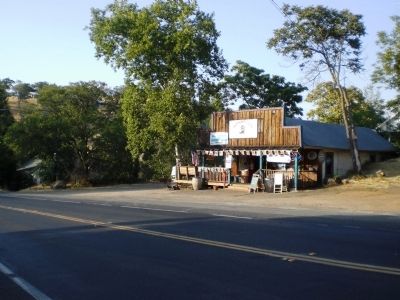
More about this marker. The marker is a few yards north of the Drytown Club - easy to miss as it stands on a rock in the shadows of some trees.
Regarding Salute to Early Amador Miners. For those unfamiliar with the gold mining techniques mentioned on the marker, placer mining is mining for gold nuggets or flakes, usually using a pan or a rocker to let the water wash out the non-gold bits. Quartz mining is done by mining underground deposits of ore, bringing it to the surface, crushing it, and then treating it with mercury to obtain the gold. Placer mining was prevalent from the start of the Gold Rush, but by the

Photographed By Andrew Ruppenstein, August 16, 2008
2. E Clampus Vitus Marker - Wide Shot
The marker is a few yards north of the Drytown Club, the "only wet spot in Drytown".
As the Club's web page dryly noted, “In its Gold Rush heyday, the town featured 26 saloons to quench the thirst of the miners. Perhaps coincidentally, the first temperance movement in the state was founded here.”
Also see . . . Drytown, California. Western Mining Historty website entry (Submitted on December 4, 2021, by Larry Gertner of New York, New York.)
Credits. This page was last revised on December 4, 2021. It was originally submitted on August 30, 2008, by Andrew Ruppenstein of Lamorinda, California. This page has been viewed 1,800 times since then and 19 times this year. Photos: 1, 2. submitted on August 30, 2008, by Andrew Ruppenstein of Lamorinda, California. • Kevin W. was the editor who published this page.
