Near Burnsville in Yancey County, North Carolina — The American South (South Atlantic)
North Carolina Civilian Conservation Corps Alumni
Inscription.
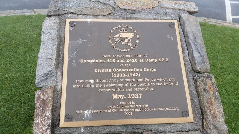
Here served members of Companies 413 and 2410 at Camp SP-2 of the Civilian Conservation Corps (1933-1942) that magnificent Army of Youth and Peace which put into action the awakening of the people to the facts of conservation and recreation. May, 1937
Erected 2003 by North Carolina Chapter 175, National Association of Civilian Conservation Corps Alumni (NACCCA).
Topics and series. This historical marker is listed in these topic lists: Charity & Public Work • Horticulture & Forestry. In addition, it is included in the Civilian Conservation Corps (CCC) series list.
Location. 35° 45.986′ N, 82° 15.91′ W. Marker is near Burnsville, North Carolina, in Yancey County. Marker can be reached from North Carolina 128, 4 miles north of Blue Ridge Parkway and Route 128. Located in the parking lot of Mount Mitchell. Next to the parking lot is a museum, two stores and the footpath to the summit of Mount Mitchell. Touch for map. Marker is at or near this postal address: 2388 NC-128, Burnsville NC 28714, United States of America. Touch for directions.
Other nearby markers. At least 8 other markers are within 9 miles of this marker, measured as the crow flies. Elisha Mitchell (within shouting distance of this marker); Rev. Elisha Mitchell, D.D. (about 600 feet away, measured in a direct line); The First U.S. Forest Service Tract (approx. 4.3 miles away); Andrews Geyser (approx. 8.1 miles away); Lake Susan (approx. 8˝ miles away); Boone Trail Highway (approx. 8˝ miles away); Montreat's Rich Heritage is a Place of Renewal (approx. 8˝ miles away); Beetles Bring Hope for Hemlock Survival (approx. 8.7 miles away). Touch for a list and map of all markers in Burnsville.
Credits. This page was last revised on February 10, 2021. It was originally submitted on September 23, 2017, by Frank Harder Sr. of Dumfries, Virginia. This page has been viewed 229 times since then and 32 times this year. Photo 1. submitted on September 23, 2017, by Frank Harder Sr. of Dumfries, Virginia. • Bill Pfingsten was the editor who published this page.
