Gaffney in Cherokee County, South Carolina — The American South (South Atlantic)
The Overmountain Victory National Historic Trail
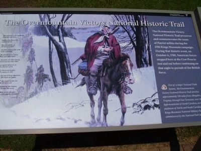
Photographed by Stanley and Terrie Howard, October 25, 2008
1. The Overmountain Victory National Historic Trail Marker
Part of a larger National Trails System, the Overmountain Victory National Historic Trail stretches approximately 330 miles from Abingdon, Virginia, through East Tennessee, over the high mountains of North Carolina, across the piedmont of North and South Carolina to Kings Mountain National Military Park administered by the National Park Service.
"We marched to the Cowpens,
Campbell was there,
Shelby, Cleveland, and
Colonel Sevier;
Men of renown, sir,
Like lions, so bold-
Like lions undaunted,
ne'er to be controlled.
We set out on our march
that very same night;
Sometimes we were wrong,
sometimes we were right;
Our hearts being run in
true liberty's mold,
We valued not hunger,
wet, weary, or cold.
On the top of Kings Mountain
the old rogue we found,
And, like brave heroes,
his camp did surround;
Like lightning, the flashes;
like
this page online
Our rifles struck the poor
Tories with sudden surprise."
Lossing, Vol. ll
Erected by Cowpens National Battlefield - National Park Service - U.S. Department of the Interior.
Topics. This historical marker is listed in this topic list: War, US Revolutionary. A significant historical month for this entry is October 1863.
Location. Marker has been reported missing. It was located near 35° 8.381′ N, 81° 49.071′ W. Marker was in Gaffney, South Carolina, in Cherokee County. It was on Chesnee Highway (Route 11). Located in Cowpense National Battlefield Park. Touch for map. Marker was at or near this postal address: 4001 Chesnee Highway, Gaffney SC 29341, United States of America. Touch for directions.

Regionally, this marker was in Upstate and in the Foothills. It was also in the American South, specifically in the Deep South, in Appalachia, and specifically in Southern Appalachia. Globally, it was in North America, the Western Hemisphere, the Western World, and the Anglosphere. Historically, it found itself in what was once the original Cherokee Nation, the territory of the Mississippian Culture, one of the original Thirteen Colonies, one of the Confederate States of America, and the Antebellum South.
Other nearby markers. At least 8 other markers are within walking distance of this location: Welcome to Cowpens National Battlefield (approx. 0.2 miles away); U.S. Memorial Monument (approx. 0.2 miles away); Battle of Cowpens Monument (approx. 0.2 miles away); The Battle of Cowpens: Prelude to Victory (approx. 0.2 miles away); Morgan's Flying Army (approx. 0.2 miles away); Spirit up the People (approx. ¼ mile away); a different marker also named Race to the Dan River (approx. 0.3 miles away); The Cavalry (Dragoons) at Cowpens (approx. 0.3 miles away). Touch for a list and map of all markers in Gaffney.
Other markers no longer nearby. Race to the Dan River (was approx. 0.2 miles away but has been confirmed missing); After Victory (was approx. ¼ mile away but has been confirmed missing).
Also see . . .
1. Overmountain Victory National Historic Trail. National Park Service site. (Submitted on October 27, 2008, by Craig Swain of Leesburg, Virginia.)
2. Cowpens National Battlefield, National Park Service. (Submitted on August 31, 2019.)
Credits. This page was last revised on November 14, 2020. It was originally submitted on October 27, 2008, by Stanley and Terrie Howard of Greer, South Carolina. This page has been viewed 1,359 times since then and 25 times this year. Last updated on September 25, 2017, by Shane Oliver of Richmond, Virginia. Photo 1. submitted on October 27, 2008, by Stanley and Terrie Howard of Greer, South Carolina. • Bill Pfingsten was the editor who published this page.
