Near Dayville in Grant County, Oregon — The American West (Northwest)
Mascall Overlook
John Day Fossil Beds National Monument
Photographed By Don Hann
1. Mascall Overlook Marker 1
Inscription.
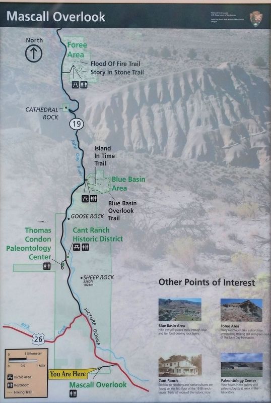
Mascall Overlook. John Day Fossil Beds National Monument. , Marker 1 , Shows an overview map of the National Monument with other points of interest.
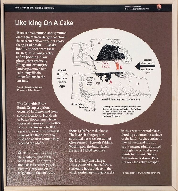
Marker 2 , Like Icing on a Cake. "Between 16.6 million and 15 million years ago, eastern Oregon sat above the nascent Yellowstone hot spot's rising jet of basalt... basalts literally flooded from these 10-to 25-mile-long cracks, at first ponding in low places, then gradually filling and leveling the landscape, much like cake icing fills the imperfections in the surface." (From In Search of Ancient Oregon by Ellen Bishop). The Columbia River Basalt Group eruptions occurred in phases and from several locations. Hundreds of basalt floods issued from scores of fissures in the Earth's crust, covering over 62,000 square miles of the northwest. Some of the floods were so fluid and of such volume that they reached the ocean. A. This is your location on the southern edge of the basalt flows. The layers of basalt flows before you, in Picture Gorge and on the ridge to the north, are about 1,000 feet in thickness. The layers in the gorge are now tilted but were horizontal when formed. Beneath Yakima, Washington, the basalt layers are bout 15,000 feet thick. B- It is likely that a large rising plume of magma, from a stationary hot spot deep in the Earth, pushed up through cracks in the crust in several places, flooding out onto the surface of the land. As the continent moved westward the hot spot's magma plume burned through the crust as several points to the east. Today, Yellowstone National Park lies over the active hot spot.
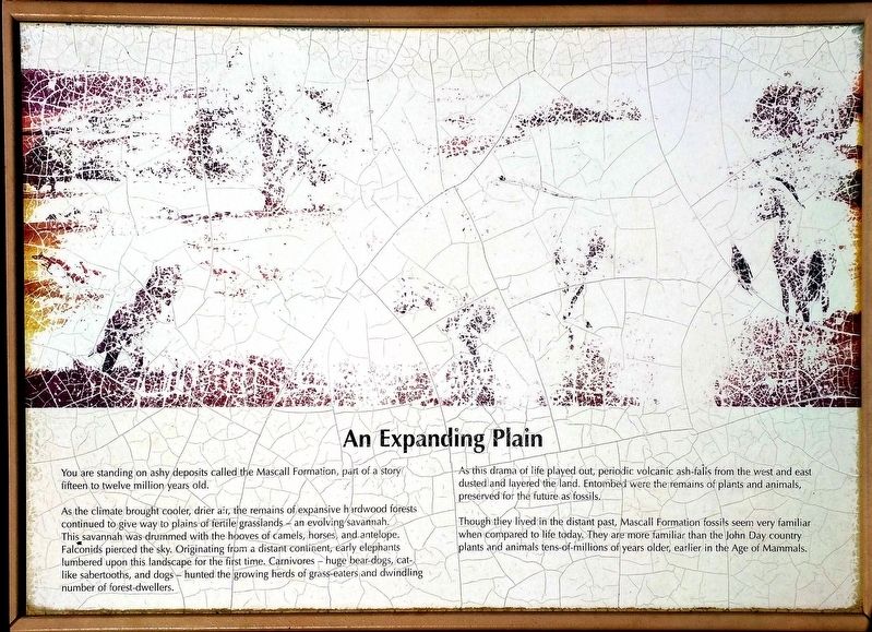
Marker 3 , An Expanding Plain. You are standing on ashy deposits called the Mascall Formation, part of a story fifteen to twelve million years old. As the climate brought cooler, drier air, the remains of expansive hardwood forests continued to give way to plains of fertile grassland- and evolving savanna. This savanna was drummed with the hooves of camels, horses and antelope. Falcons pierced the sky. Originating from a distant continent, early elephants lumbered upon this landscape for the first time. Carnivores- huge bear-dogs, cat-like sabertooths, and dogs- hunted the growing herds of grass-eaters and dwindling numbers of forest dwellers. As this drama of life played out, periodic volcanic ash falls from the west and east dusted and layered the land. Entombed were the remains of plants and animals, preserved for the future as fossils. Though they lived in the distant past, Mascall Formation fossils seem very familiar when compared to life today. They are more familiar than the John Day country plants and animals tens-of-millions of years older, from earlier in the age of mammals.
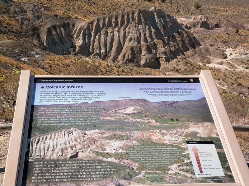
Marker 4 , A Volcanic Inferno. Imagine standing at the bottom of a long mountain valley, here, over seven million years ago. A lush blanket of grass covers the length of the valley swaying wave-like in a dry, light breeze. A few trees are visible. Nearby, four-tusked elephants graze playfully, ignoring a passing hyena hunting prey. The sound of munching grass comes from a wary heard of horses. Suddenly, a distant thundering explosion shakes the land. Birds burst from the grasses into the sky. Soon, the inhabitants settle down, as you wonder about the source of the explosion. Less than an hour latter the valley to the east quickly fills with a glowing tidal wave of fiery volcanic ash, gasses and debris. This onrushing cloud of death flows down the valley towards you at high speed, engulfing and incinerating all life. It is well you were not there. Successive ash falls from the volcanic eruption, over 80 miles to the south, covered the region. A fiery deposit, an ignimbrite, settled into that ancient valley bottom, welded, and cooled into a thick layer- the rim rock you see atop the mesas. Just under that layer is the ancient valley bottom. The mountains and hills that held that valley have since eroded down, leaving the hard, resistant ignimbrite layer, and valley bottom, high in the sky. Named after a nearby creek, the Rattlesnake Group spans several hundred feet of deposits. These deposits, above and below the ignimbrite layer and made up of fanglomerates, contain fossils from 8 to 6 million years in age. They reveal a dry landscape dominated by grasses, with many types of grazers, some unfamiliar to North America today, including camels, elephants, and rhinos. Named after the nearby ranch, these tilted, buff-colored layers are part of the Mascall Formation. The deposits of volcanic ashfalls came from multiple directions about 15 to 12 million years ago, covering and fossilizing plant and animal remains. The fossil record here reveals a savanna-like landscape. There was enough rainfall and fertile soil to foster the growth of lush, nutritious grasslands and mixed hardwood forests, much like those found today from Illinois to Ohio.
Marker 1 Shows an overview map of the National Monument with other points of interest.
Marker 2 Like Icing on a Cake. "Between 16.6 million and 15 million years ago, eastern Oregon sat above the nascent Yellowstone hot spot's rising jet of basalt... basalts literally flooded from these 10-to 25-mile-long cracks, at first ponding in low places, then gradually filling and leveling the landscape, much like cake icing fills the imperfections in the surface." (From In Search of Ancient Oregon by Ellen Bishop). The Columbia River Basalt Group eruptions occurred in phases and from several locations. Hundreds of basalt floods issued from scores of fissures in the Earth's crust, covering over 62,000 square miles of the northwest. Some of the floods were so fluid and of such volume that they reached the ocean. A. This is your location on the southern edge of the basalt flows. The layers of basalt flows before you, in Picture Gorge and on the ridge to the north, are about 1,000 feet in thickness. The layers in the gorge are now tilted but were horizontal when formed. Beneath Yakima, Washington, the basalt layers are bout 15,000 feet thick. B- It is likely that a large rising plume of magma, from a stationary hot spot deep in the Earth, pushed up through cracks in the crust in several places, flooding out onto the surface
Click or scan to see this page online
of the land. As the continent moved westward the hot spot's magma plume burned through the crust as several points to the east. Today, Yellowstone National Park lies over the active hot spot.
Marker 3 An Expanding Plain. You are standing on ashy deposits called the Mascall Formation, part of a story fifteen to twelve million years old. As the climate brought cooler, drier air, the remains of expansive hardwood forests continued to give way to plains of fertile grassland- and evolving savanna. This savanna was drummed with the hooves of camels, horses and antelope. Falcons pierced the sky. Originating from a distant continent, early elephants lumbered upon this landscape for the first time. Carnivores- huge bear-dogs, cat-like sabertooths, and dogs- hunted the growing herds of grass-eaters and dwindling numbers of forest dwellers. As this drama of life played out, periodic volcanic ash falls from the west and east dusted and layered the land. Entombed were the remains of plants and animals, preserved for the future as fossils. Though they lived in the distant past, Mascall Formation fossils seem very familiar when compared to life today. They are more familiar than the John Day country plants and animals tens-of-millions of years older, from earlier in the age of mammals.
Marker 4 A Volcanic Inferno. Imagine standing at the bottom of a long mountain
Photographed By Don Hann
2. Mascall Overlook Marker 2
valley, here, over seven million years ago. A lush blanket of grass covers the length of the valley swaying wave-like in a dry, light breeze. A few trees are visible. Nearby, four-tusked elephants graze playfully, ignoring a passing hyena hunting prey. The sound of munching grass comes from a wary heard of horses. Suddenly, a distant thundering explosion shakes the land. Birds burst from the grasses into the sky. Soon, the inhabitants settle down, as you wonder about the source of the explosion. Less than an hour latter the valley to the east quickly fills with a glowing tidal wave of fiery volcanic ash, gasses and debris. This onrushing cloud of death flows down the valley towards you at high speed, engulfing and incinerating all life. It is well you were not there. Successive ash falls from the volcanic eruption, over 80 miles to the south, covered the region. A fiery deposit, an ignimbrite, settled into that ancient valley bottom, welded, and cooled into a thick layer- the rim rock you see atop the mesas. Just under that layer is the ancient valley bottom. The mountains and hills that held that valley have since eroded down, leaving the hard, resistant ignimbrite layer, and valley bottom, high in the sky. Named after a nearby creek, the Rattlesnake Group spans several hundred feet of deposits. These deposits, above and below the ignimbrite layer and made up of fanglomerates,
Photographed By Don Hann
3. Mascall Overlook Marker 3
contain fossils from 8 to 6 million years in age. They reveal a dry landscape dominated by grasses, with many types of grazers, some unfamiliar to North America today, including camels, elephants, and rhinos. Named after the nearby ranch, these tilted, buff-colored layers are part of the Mascall Formation. The deposits of volcanic ashfalls came from multiple directions about 15 to 12 million years ago, covering and fossilizing plant and animal remains. The fossil record here reveals a savanna-like landscape. There was enough rainfall and fertile soil to foster the growth of lush, nutritious grasslands and mixed hardwood forests, much like those found today from Illinois to Ohio.
Location. 44° 30.014′ N, 119° 37.321′ W. Marker is near Dayville, Oregon, in Grant County. Marker can be reached from County Road 40 (County Route 40). Road to the Mascall Overlook is well marked on Highway 26 about 4 1/2 miles west of Dayville, Oregon. Touch for map. Marker is in this post office area: Dayville OR 97825, United States of America. Touch for directions.
Credits. This page was last revised on October 1, 2017. It was originally submitted on September 26, 2017, by Don Hann of Canyon City, Oregon. This page has been viewed 327 times since then and 36 times this year. Photos:1, 2, 3, 4, 5, 6. submitted on September 26, 2017, by Don Hann of Canyon City, Oregon. • Bill Pfingsten was the editor who published this page.