West Montrose in Waterloo Region, Ontario — Central Canada (North America)
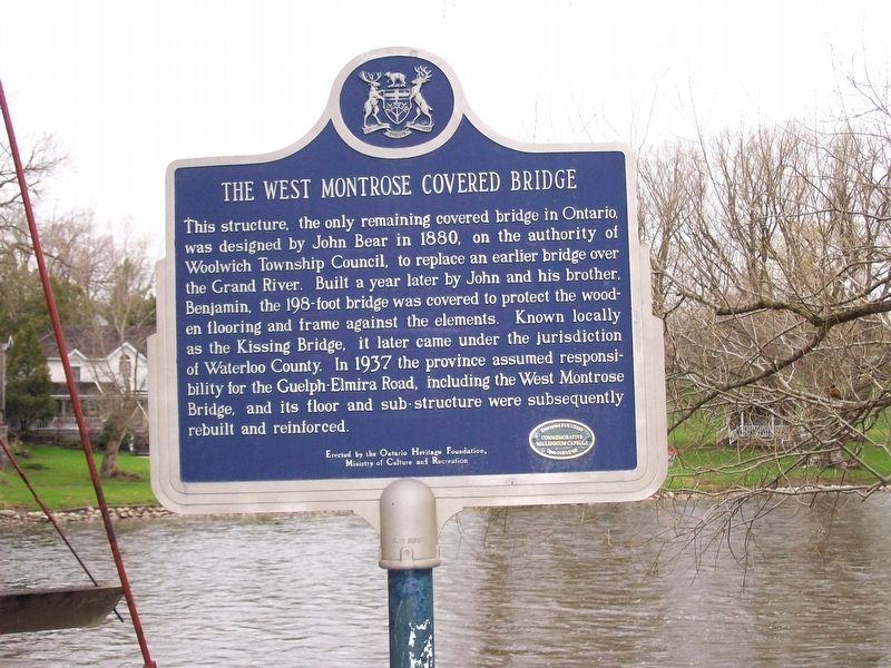
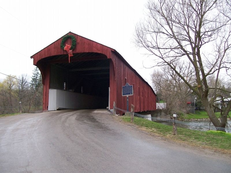
The West Montrose Covered Bridge
Photographed by Yugoboy, May 3, 2014
1. The West Monrose Covered Bridge Marker
Erected by the Ontario Heritage Foundation, Ministry of Culture and Recreation
Encrypted 01/01/2000 Commemorative Millenium Capsule Open 01/01/2100
Erected 2000 by Ontario Heritage Foundation, Ministry of Culture and Recreation.
Topics and series. This historical marker is listed in this topic list: Bridges & Viaducts. In addition, it is included in the Canada, Ontario Heritage Trust, and the Covered Bridges series lists.
Location. 43° 35.118′ N, 80° 28.868′ W.
this page online

Regionally, this marker is in the Huron-Perth-Waterloo-Wellington Area and in Southwestern Ontario. It is also in Central Canada. Globally, it is in North America, the Western Hemisphere, the Western World, and the Anglosphere. Historically, it finds itself in what was once a British colony, the Viceroyalty of New France, the Haudenosaunee (Iroquois) Confederacy, and Rupert’s Land.
Other nearby markers. At least 8 other markers are within 13 kilometers of this marker, measured as the crow flies: Kitchener-Waterloo Municipal Airport (approx. 10.3 kilometers away); Elora Drill Shed / Le Manège Militaire D’Elora (approx. 11.3 kilometers away); Former Victoria Street Bridge (approx. 11.4 kilometers away); Crossing the Grand (approx. 11.4 kilometers away); Lover’s Leap (approx. 11.4 kilometers away);
Photographed by Yugoboy, May 3, 2014
2. The West Monrose Covered Bridge and Marker
Credits. This page was last revised on January 24, 2022. It was originally submitted on September 27, 2017, by Yugoboy of Rochester, New York. This page has been viewed 406 times since then and 31 times this year. Photos: 1, 2. submitted on September 27, 2017, by Yugoboy of Rochester, New York. • Andrew Ruppenstein was the editor who published this page.
