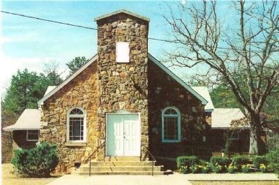
Near Mauldin in Greenville County, South Carolina — The American South (South Atlantic)
Laurel Creek Church
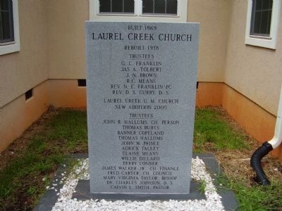
Laurel Creek Church
Rebuilt 1938
Trustees
G.C. Franklin
Jas A. Tolbert
J.N. Brown
R.C. Means
Rev. N.E. Franklin-PC
Rev. D.S. Curry D.S.
Laurel Creek U. M. Church
New Addition 2005
Trustees
John B. Hallums, CH Person
Thomas Burts
Banner Copeland
Thomas Hallums
John W. Prince
Adrick Talley
Elaine Means
Willie Dillard
Terry Conner
James Walker Jr. CH Finance
Fred Carter CH Council
Mary Virginia Taylor, Bishop
Dr. Charles Johnson D.S.
Calvin L. Smith. Pastor
Topics. This historical marker is listed in this topic list: Churches & Religion. A significant historical year for this entry is 1869.
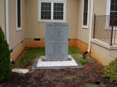
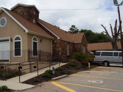
Location. 34° 48.12′ N, 82° 19.182′ W. Marker is near Mauldin, South Carolina, in Greenville County. Marker is on Laurens Road (U.S. 276), on the right when traveling south. Marker is located on the east (front) side of the church. Touch for map. Marker is at or near this postal address: 3598 Laurens Road, Greenville SC 29607, United States of America. Touch for directions.
Other nearby markers. At least 10 other markers are within 4 miles of this marker, measured as the crow flies. The History of the Gosnell Cabin (approx. 1.7 miles away); Mauldin (approx. 1.7 miles away); Mauldin United Methodist Church (approx. 1.7 miles away); Deputy Marcus L. Whitfield (approx. 2.4 miles away); Lake Conestee in Transition (approx. 2.7 miles away); Beaver at Lake Conestee (approx. 2.7 miles away); Fred W. Symmes Hall of Science (approx. 2.7 miles away); Reedy River Factory (approx. 2.7 miles away); McBee Chapel (approx. 3.1 miles away); Bethel Community Training Ground (approx. 3.1 miles away). Touch for a list and map of all markers in Mauldin.
Credits. This page was last revised on November 18, 2020. It was originally submitted on August 30, 2008, by Stanley and Terrie Howard of Greer, South Carolina. This page has been viewed 1,422 times since then and 25 times this year. Photos: 1, 2, 3, 4. submitted on August 30, 2008, by Stanley and Terrie Howard of Greer, South Carolina. 5. submitted on May 25, 2009, by James Walker Jr of Greenville, South Carolina. • Kevin W. was the editor who published this page.
