
Thoroughgood in Virginia Beach, Virginia — The American South (Mid-Atlantic)
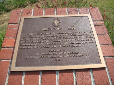
Church Point
1639
Photographed by Laura Troy, September 16, 2007
1. Church Point-1639 Marker
Erected 1995.
Topics. This historical marker is listed in this topic list: Religion & Religious Structures. A significant historical year for this entry is 1639.
Location. 36° 53.657′ N, 76° 6.819′ W. Marker is in Virginia Beach, Virginia. It is in Thoroughgood. It is on Spring House Trail. Touch for map. Marker is at or near this postal address: 1636 Parish Rd, Virginia Beach VA 23455, United States of America. Touch for directions.

Regionally, this marker is in Virginia’s Hampton Roads, specifically in Coastal Virginia, and in the Hampton Roads Metropolitan Area. It is also in the American South, specifically in the Upper South, in the Tidewater, and on the Eastern Seaboard. Globally, it is in the North Atlantic Region, North America, the Western Hemisphere, the Western World, and the Anglosphere. Historically,
this page online
Other nearby markers. At least 8 other markers are within 2 miles of this marker, measured as the crow flies: Thorowgoods in the Revolution (a few steps from this marker); Adam Thoroughgood House (within shouting distance of this marker); Thoroughgood House (within shouting distance of this marker); Adam Thorowgood (approx. 0.9 miles away); Colonizing “Carolana” (approx. 0.9 miles away); Protecting Our Waterways and Wildlife (approx. 0.9 miles away); The Oyster Barge (approx. 1.2 miles away); Fisheries / Blue Crab (approx. 1.2 miles away). Touch for a list and map of all markers in Virginia Beach.
Photographed by Peggy Carnes, September 2017
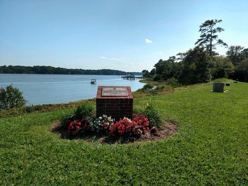
2. Church Point Marker
Credits. This page was last revised on February 1, 2023. It was originally submitted on September 16, 2007, by Laura Troy of Burke, Virginia. This page has been viewed 2,405 times since then and 111 times this year. Last updated on October 10, 2017, by Peggy Carnes of Virginia Beach, Virginia. Photos: 1. submitted on September 16, 2007, by Laura Troy of Burke, Virginia. 2. submitted on October 10, 2017, by Peggy Carnes of Virginia Beach, Virginia. • Bernard Fisher was the editor who published this page.
