The 2011 Lake Champlain Bridge
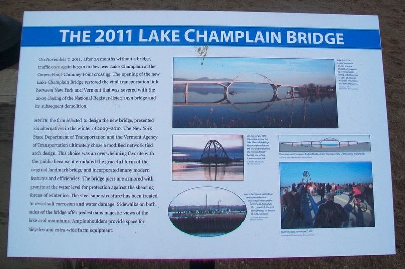
On November 7, 2011, after 25 months without a bridge, traffic once again began to flow over Lake Champlain at the Crown Point-Chimney Point crossing. The opening of the new Lake Champlain Bridge restored the vital transportation link between New York and Vermont that was severed with the 2009 closing of the National Register-listed 1929 bridge and its subsequent demolition.
HNTB, the firm selected to design the new bridge, presented six alternatives in the winter of 2009-2010. The New York Department of Transportation and the Vermont Agency of Transportation ultimately chose a modified network tied arch design. This choice was an overwhelming favorite with the public because it emulated the graceful form of the original landmark bridge and incorporated many modern features and efficiencies. The bridge piers are armored with granite at the water level for protection against the shearing forces of winter ice. The steel superstructure has been treated to resist salt corrosion and water damage. Sidewalks on both sides of the bridge offer pedestrians majestic views of the lake and mountains. Ample shoulders provide space for bicycles and extra-wide farm equipment.
[Photo captions, from top to bottom, read]
• Like the 1929 Lake Champlain Bridge, the new bridge both responds to its remarkable setting and offers views
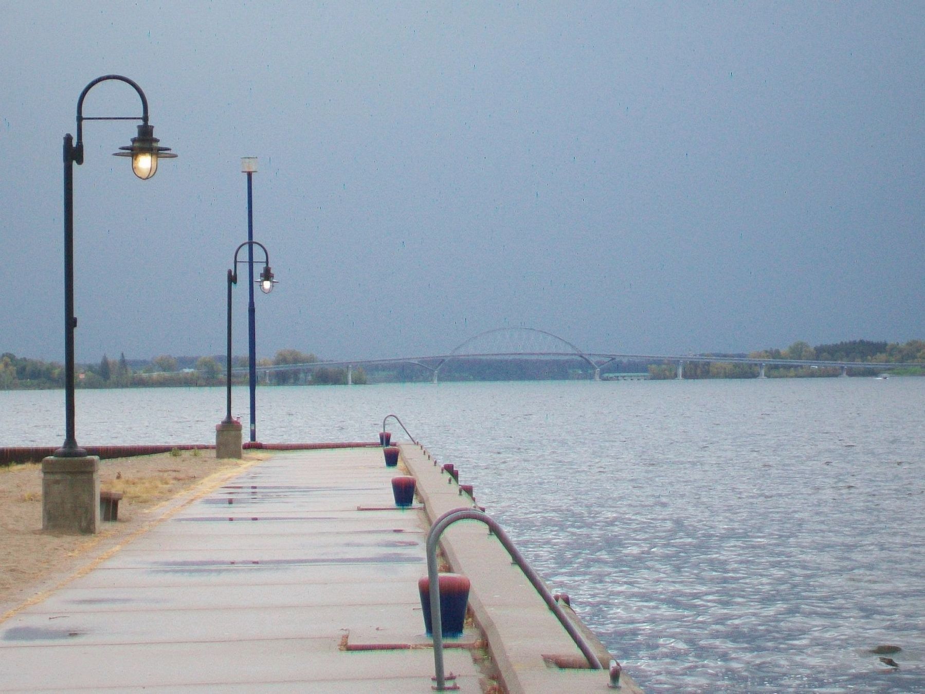
• On August 26, 2011, the central arch of the Lake Champlain Bridge was transported across the lake on barges from the marina directly behind you, where it was constructed.
• The new Lake Champlain Bridge (black) echoes the elegant arc of the historic bridge (red).
• An excited crowd assembled on the waterfront at Powerhouse Park on the morning of August 26, 2011, to watch the arch being floated on barges to the bridge site.
• Opening day, November 7, 2011.
[Found on the adjacent 1929 Lake Champlain Bridge marker]
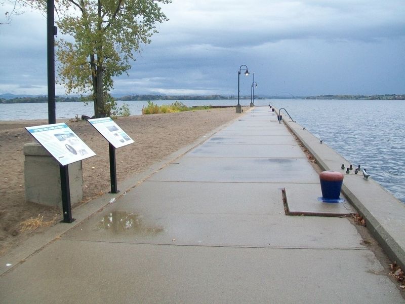
These two signs were prepared as part of a larger program of commemoration to mitigate the loss of the 1929 Lake Champlain Bridge. It was developed in response to Section 106 of the National Historic Preservation Act and was funded jointly by the New York State Department of Transportation, the Vermont Agency of Transportation, and the Federal Highway Administration.
Erected by NY State Dept of Trans, VT Agency of Trans, and Federal Hwy Admin.
Topics. This historical marker is listed in these topic lists: Bridges & Viaducts • Industry & Commerce • Waterways & Vessels. A significant historical date for this entry is November 7, 2011.
Location. 44° 3.049′ N, 73° 27.09′ W. Marker is in Port Henry, New York, in Essex County. Marker is in Powerhouse Park, along the Lake Champlain pier. Touch for map. Marker is in this post office area: Port Henry NY 12974, United States of America. Touch for directions.
Other nearby markers. At least 8 other markers are within walking distance of this marker. The 1929 Lake Champlain Bridge (here, next to this marker); Daisy Godfrey (within shouting distance of this marker); Powerhouse Park (about 400 feet away, measured in a direct line); Teamsters, Dock Wallopers and Child Captains (about 500 feet away); Shore Line (approx. 0.3 miles away); Champlain Academy (approx. 0.3 miles away); Site of Porter's and Lewis's Mills (approx. 0.3 miles away); Site of First Blast Furnace (approx. 0.3 miles away). Touch for a list and map of all markers in Port Henry.
Also see . . . Lake Champlain(Crown Point) Bridge. National Steel Bridge Alliance (Submitted on May 2, 2023, by Larry Gertner of New York, New York.)
Credits. This page was last revised on May 2, 2023. It was originally submitted on October 14, 2017, by William Fischer, Jr. of Scranton, Pennsylvania. This page has been viewed 211 times since then and 9 times this year. Photos: 1, 2. submitted on October 14, 2017, by William Fischer, Jr. of Scranton, Pennsylvania. 3. submitted on October 15, 2017, by William Fischer, Jr. of Scranton, Pennsylvania.


