16th Street Heights in Northwest Washington in Washington, District of Columbia — The American Northeast (Mid-Atlantic)
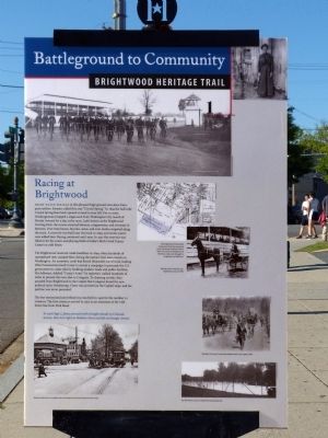
Racing at Brightwood
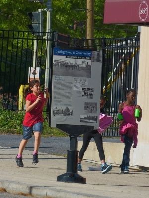
Battleground to Community
— Brightwood Heritage Trail —
Fresh Water Springs in this pleasant high ground once drew European settlers. Farmers called the area "Crystal Spring." In 1859 the half-mile Crystal Spring Racetrack opened on land to your left. For 75 cents, Washingtonians hopped a stagecoach from Washington City (south of Florida Avenue) for a day at the races. Later known as the Brightwood Trotting Park, the course attracted laborers, congressmen, and everyone in between. Over time horses, bicycles, autos, and even mules competed along the track. A reservoir was built just South of the track in 1899, and tennis courts were added later. Racing continued until 1909. In 1936 the reservoir was filled in for the courts and playing fields known as the Brightwood Recreation Area of Rock Creek Park on 16th Street.
The Brightwood racetrack made headlines in 1894, when hundreds of unemployed men camped there during the nation's first mass march on Washington. An economic crash had forced thousands out of work, leading Ohio businessman Jacob Coxey to mount a campaign to persuade the U.S. government to create jobs by building modern roads and public facilities. His followers, dubbed "Coxey's Army" by reporters, walked hundreds of miles to present this new idea to Congress. To cheering crowds, they paraded from Brightwood to the Capital. But Congress found the new political tactic threatening. Coxey was arrested on the Capitol steps, and his petition was never presented.
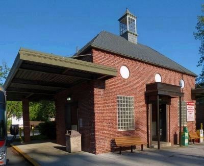
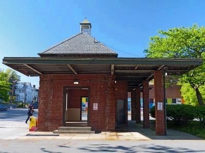
The bus turnaround just behind you was built in 1936 for the number 52 streetcar. The first streetcar arrived in 1907 as an extension of the 14th Street line from Park Road.
Erected 2008 by Cultural Tourism DC. (Marker Number 1.)
Topics and series. This historical marker is listed in these topic lists: Entertainment • Industry & Commerce • Labor Unions. In addition, it is included in the Brightwood Heritage Trail series list. A significant historical year for this entry is 1859.
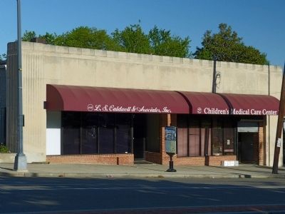
Location. 38° 57.354′ N, 77° 1.997′ W. Marker is in Northwest Washington in Washington, District of Columbia. It is in 16th Street Heights. Marker is at the intersection of 16th Street Northwest and Colorado Avenue Northwest, on the right when traveling north on 16th Street Northwest. Touch for map. Marker is at or near this postal address: 5427 14th Street Northwest, Washington DC 20011, United States of America. Touch for directions.
Other nearby markers. At least 8 other markers are within walking distance of this marker. Fellowship Baptist Church (about 700 feet away, measured in a direct line); New St. Paul Baptist Church (approx. ¼ mile away); St. Paul African Methodist Episcopal Church (approx. 0.4 miles away); School Days (approx. 0.4 miles away); Military Road School (approx. 0.4 miles away); Crossroads Create Community (approx. 0.4 miles away); Build It And They Will Come (approx. half a mile away); An African American Enclave (approx. half a mile away). Touch for a list and map of all markers in Northwest Washington.
Credits. This page was last revised on January 30, 2023. It was originally submitted on October 3, 2013, by Allen C. Browne of Silver Spring, Maryland. This page has been viewed 1,390 times since then and 39 times this year. Last updated on October 27, 2017, by Devry Becker Jones of Washington, District of Columbia. Photos: 1, 2, 3, 4, 5, 6, 7, 8, 9, 10, 11. submitted on October 3, 2013, by Allen C. Browne of Silver Spring, Maryland. • Bill Pfingsten was the editor who published this page.
Editor’s want-list for this marker. A photo of the reverse of the marker. • Can you help?
