Amsterdam-Centrum , North Holland, Netherlands — Northwestern Europe
Municipal Morgue
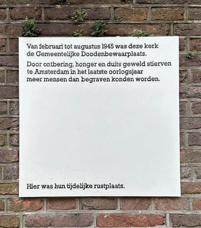
Door ontbering, honger en duits geweld stierven te Amsterdam in het laatste oorlogsjaar meer mensen dan begraven konden worden.
Hier was hun tijdelijke rustplaats.
From February to August 1945 this church was the Municipal Morgue.
Through deprivation, hunger and German violence, more people died in Amsterdam in the last year of war than could be buried.
This was their temporary resting place.
Topics. This historical marker is listed in this topic list: War, World II. A significant historical year for this entry is 1945.
Location. 52° 22.221′ N, 4° 54.005′ E. Marker is in Amsterdam, Noord-Holland (North Holland). It is in Amsterdam-Centrum. Marker is on Zuiderkerkhof just east of Zanddwarsstraat. Touch for map. Marker is at or near this postal address: Zuiderkerkhof 72, Amsterdam, Noord-Holland 1011 JH, Netherlands. Touch for directions.
Other nearby markers. At least 8 other markers are within walking distance of this marker. Huis De Pinto (within shouting distance of this marker); Waterlooplein / Huis de Pinto (about 210 meters away, measured in a direct line); Boas Diamantfabriek (Diamond Factory) (about 240 meters away); De Herschepping Synagogue (approx. 0.2 kilometers away); Hendrick de Keyser (approx. 0.3 kilometers away); Anthoniespoort / St. Anthony's Gate (approx. 0.3 kilometers away); Jacobus Henricus van 't Hoff (approx. 0.3 kilometers away); Benedictus de Spinoza (approx. 0.3 kilometers away). Touch for a list and map of all markers in Amsterdam.
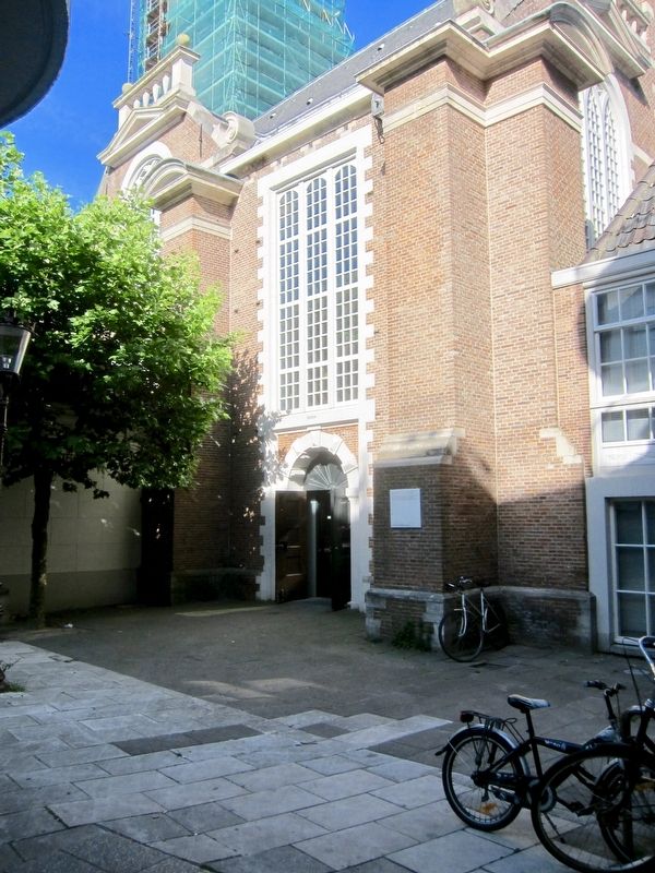
More about this marker. The marker is located to the right of the Zuiderkerk (church) entrance.
Also see . . . Dutch famine of 1944–45 (Wikipedia). "The Dutch famine of 1944–45, known as the Hongerwinter ("Hunger winter") in Dutch, was a famine that took place in the German-occupied part of the Netherlands, especially in the densely populated western provinces north of the great rivers, during the winter of 1944–45, near the end of World War II. A German blockade cut off food and fuel shipments from farm areas. Some 4.5 million were affected and survived because of soup kitchens. As many as 22,000 may have died because of the famine..." (Submitted on November 2, 2017.)
Credits. This page was last revised on February 10, 2024. It was originally submitted on November 2, 2017, by Andrew Ruppenstein of Lamorinda, California. This page has been viewed 217 times since then and 23 times this year. Photos: 1. submitted on February 10, 2024, by Andrew Ruppenstein of Lamorinda, California. 2. submitted on November 2, 2017, by Andrew Ruppenstein of Lamorinda, California.

