North Fork in Lemhi County, Idaho — The American West (Mountains)
Salmon River Encounter
Downriver Reconnaissance
Photographed by Barry Swackhamer, June 24, 2017
1. Salmon River Encounter Panel
Panel on the left.
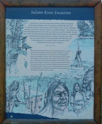
Clark; August 22, 1805
The Main Stem Salmon River and the North Fork met in a series of rapids where salmon entered the smaller tributary to spawn. This was the perfect place to catch them as they attempted to swim
this page online
Photographed by Barry Swackhamer, June 24, 2017
2. North Fork Area Lewis and Clark Opportunities panel, center
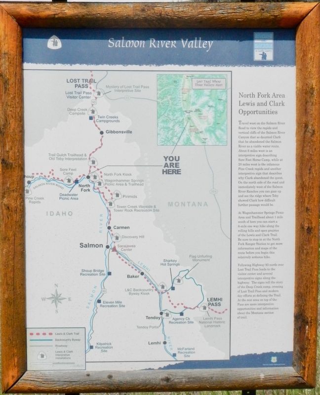
Travel west on the Salmon River Road to view the rapids and vertical cliffs of the Salmon River Canyon that so daunted Clark that he abandoned the Salmon River as a viable water route. About 6 miles west is an interpretive sign describing Sore Feet Horse Camp, while at 20 miles west is the Infamous Pine Creek rapids and another interpretive sign that describes why Clark abandoned the quest. On the north side of the road and immediately west of the Salmon River Ranches you can gaze up and see the ridge where Toby showed Clark how difficult further passage would be.
At Wagonhammer Springs Picnic Area and Trailhead about 1 mile south of here you can start a 6-mile one way hike along the rolling hills and open prairies of the Lewis and Clark Trail. Be sure to stop in at the North Fork Ranger Station to get more information and maps of the route before you begin this relatively arduous hike.
Following Highway 93 north over Lost Trail Pass leads to the visitors center and several interpretive signs along the highway. The signs tell the story of Deep Creek camp, crossing of Lost Trail Pass and modern day efforts at defining the Trail. At the rest area on top of the Pass are more interpretive opportunities and information about the Montana section of the trail.
At Wagonhammer Springs Picnic Area and Trailhead about 1 mile south of here you can start a 6-mile one way hike along the rolling hills and open prairies of the Lewis and Clark Trail. Be sure to stop in at the North Fork Ranger Station to get more information and maps of the route before you begin this relatively arduous hike.
Following Highway 93 north over Lost Trail Pass leads to the visitors center and several interpretive signs along the highway. The signs tell the story of Deep Creek camp, crossing of Lost Trail Pass and modern day efforts at defining the Trail. At the rest area on top of the Pass are more interpretive opportunities and information about the Montana section of the trail.
Erected by U.S. Forest Service.
Topics and series. This historical marker is listed in this topic list: Exploration. In addition, it is included in the Lewis & Clark Expedition series list. A significant historical date for this entry is August 22, 1805.
Location. 45° 24.428′ N, 113° 59.772′ W. Marker is in North Fork, Idaho, in Lemhi County. It is on Salmon River Road (Forest Road 30) near Casey Road (U.S. 93), on the right when traveling west. Touch for map. Marker is in this post office area: North Fork ID 83466, United States of America. Touch for directions.

Regionally, this marker is in Central Idaho — Sawtooth Range. It is also in the American Mountain West and in the Lewis & Clark Corridor. Globally, it is in North America, the Rocky Mountains, the Western Hemisphere, the Western World, and the Anglosphere.
Other nearby markers. At least 8 other markers are within 8 miles of this marker, measured as the crow flies:
Photographed by Barry Swackhamer, June 24, 2017
3. Downriver Reconnaissance Marker, right
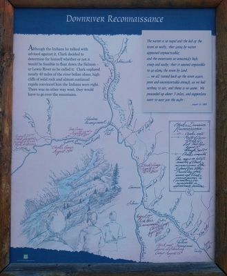
Click on the image to enlarge it and read the details of Clark's Reconnaissance and the Corp's route over Lost Trail Pass.
"This map is an artists rendition of Clark's reconnaissance of the Salmon River Valley. Present day pace names and Clark's journal names in parenthesis are represented in approximate locations."
"This map is an artists rendition of Clark's reconnaissance of the Salmon River Valley. Present day pace names and Clark's journal names in parenthesis are represented in approximate locations."
Photographed by Barry Swackhamer, June 24, 2017
4. Salmon River Encounter Marker
Credits. This page was last revised on September 22, 2018. It was originally submitted on November 5, 2017, by Barry Swackhamer of Brentwood, California. This page has been viewed 483 times since then and 41 times this year. Photos: 1, 2, 3, 4. submitted on November 5, 2017, by Barry Swackhamer of Brentwood, California.
