Near Sharpsburg in Washington County, Maryland — The American Northeast (Mid-Atlantic)
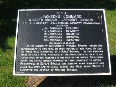
Jackson's Command
Winder's Brigade, Jackson's Division
Jackson's Command
Winder's Brigade, Jackson's Division
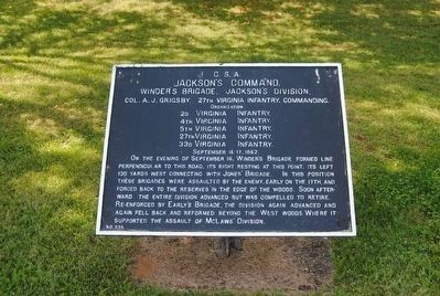
Col. A.J. Grigsby, 27th Virginia Infantry, Commanding.
Organization.
2d Virginia Infantry
4th Virginia Infantry
5th Virginia Infantry
27th Virginia Infantry
33d Virginia Infantry
September 16-17, 1862.
On the evening of September 16, Winder's Brigade formed line perpendicular to this road, its right resting at this point, its left 130 yards west connecting with Jones' Brigade. In this position these brigades were assaulted by the enemy, early on the 17th, and forced back to the reserves in the edge of the woods. Soon afterward, the entire division advanced but was compelled to retire. Re-enforced by Early's Brigade, the division again advanced and again fell back and reformed beyond the West Woods where it supported the assault of McLaws' Division.
Erected by Antietam Battlefield Board. (Marker Number 335.)
Topics. This historical marker is listed in this topic list: War, US Civil. A significant historical month for this entry is September 1988.
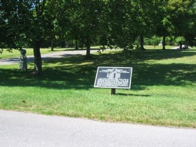
Location. 39° 28.719′ N, 77° 44.863′ W. Marker is near Sharpsburg, Maryland, in Washington County. Marker is on Dunker Church Road / Old Hagerstown Pike, on the right when traveling south. Located at stop five of the driving tour of Antietam Battlefield, near the Philadelphia Brigade monument. Touch for map. Marker is in this post office area: Sharpsburg MD 21782, United States of America. Touch for directions.
Other nearby markers. At least 8 other markers are within walking distance of this marker. A different marker also named Jackson's Command (within shouting distance of this marker); Brigadier General William E. Starke (about 300 feet away, measured in a direct line); The 19th Indiana Infantry (about 300 feet away); a different marker also named Jackson's Command (about 400 feet away); "We May Never Meet Again" (about 400 feet away); Philadelphia Brigade Park (about 400 feet away); Philadelphia Brigade Monument (about 400 feet away); "With Flags Flying" (about 500 feet away). Touch for a list and map of all markers in Sharpsburg.
Also see . . .
1. Antietam Battlefield. National Park Service site. (Submitted on September 1, 2008, by Craig Swain of Leesburg, Virginia.)
2. The Famous Stonewall Brigade. Also known as the Stonewall Brigade, the units arrived at Antietam a well traveled veteran formation, but low in numbers. (Submitted on September 1, 2008, by Craig Swain of Leesburg, Virginia.)
3. Col. Andrew Jackson Grigsby. The "Stonewall" Brigade was rather hard on commanders. Starting the year, Gen. Richard B. Garnett commanded the Brigade, but was relieved, by Gen. Jackson, for poor performance at the First Kernstown in March, 1862. Gen. Charles Winder led the Brigade through the Valley Campaign and into the Seven Days Battles, but fell mortally wounded at the battle of Cedar Mountain on August 9. His replacement, Col. William Baylor, was killed at Second Manassas, replaced by Col. Grigsby. However, at Antietam, Col. Grigsby ended up assuming command of the entire division when General Starke fell. Lt. Col. Robert D. Gardner assumed command of the Brigade at that point. (Submitted on September 1, 2008, by Craig Swain of Leesburg, Virginia.)
4. Andrew J. Grigsby. Andrew Jackson Grigsby (November 2, 1819 – December 23, 1895) was a Confederate States Army officer in the famed Stonewall Brigade during the American Civil War. Grigsby was also known as both "A.J. Grigsby" and "Arnold J. Grigsby". (Submitted on October 16, 2015, by Brian Scott of Anderson, South Carolina.)
Photographed By Craig Swain, March 29, 2008
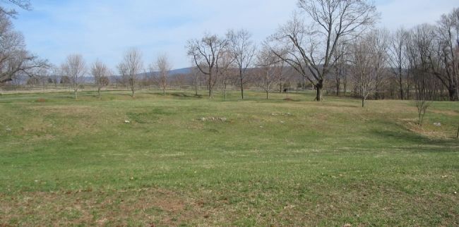
5. Stonewall Brigade's Position - Morning of the Battle
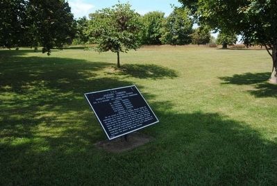
Looking from the Philadelphia Brigade monument toward the Dunker Church Road (running left to right in the distance). Winder's Brigade held the ground fronting Hagerstown Pike (now Dunker Church Road). When confronted by the Federal advance, the Brigade fell back to the West Woods to the right of this photo.
Credits. This page was last revised on October 25, 2017. It was originally submitted on September 1, 2008, by Craig Swain of Leesburg, Virginia. This page has been viewed 993 times since then and 22 times this year. Photos: 1. submitted on September 1, 2008, by Craig Swain of Leesburg, Virginia. 2. submitted on October 16, 2015, by Brian Scott of Anderson, South Carolina. 3. submitted on September 1, 2008, by Craig Swain of Leesburg, Virginia. 4. submitted on October 16, 2015, by Brian Scott of Anderson, South Carolina. 5. submitted on September 1, 2008, by Craig Swain of Leesburg, Virginia.
