
Southfield in Oakland County, Michigan — The American Midwest (Great Lakes)
Southfield Centre
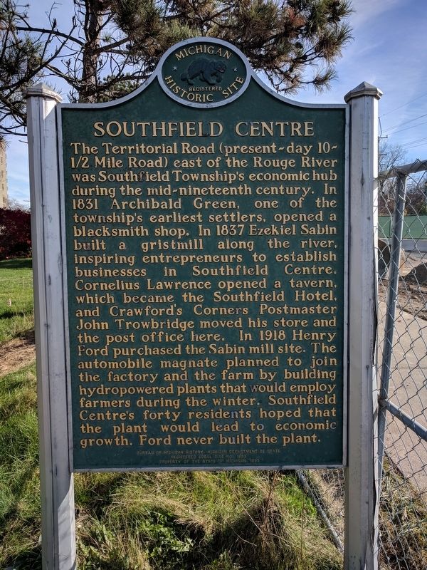
Photographed by Joel Seewald, November 11, 2017
1. Southfield Centre Marker
Erected 1993 by Bureau of Michigan History, Michigan Department of State. (Marker Number L1893.)
Topics and series. This historical marker is listed in these topic lists: Industry & Commerce • Settlements & Settlers. In addition, it is included in the Michigan Historical Commission
this page online
Location. 42° 28.75′ N, 83° 17.032′ W. Marker is in Southfield, Michigan, in Oakland County. It is on Civic Center Drive east of Telegraph Road (U.S. 24), on the right when traveling west. Touch for map. Marker is at or near this postal address: 24300 Civic Center Drive, Southfield MI 48033, United States of America. Touch for directions.

Regionally, this marker is in Southeast Michigan and in Greater Detroit. It is also in the American Midwest and on the Great Lakes. Globally, it is in North America, the Western Hemisphere, the Western World, and the Anglosphere. Historically, it finds itself in what was once the Northwest Territory.
Other nearby markers. At least 8 other markers are within walking distance of this marker: Southfield Town Hall (approx. ¼ mile away); Southfield Township Site (approx. ¼ mile away); Southfield Township Volunteer Fire Department (approx. ¼ mile away); Southfield Center (approx. ¼ mile away); Southfield Methodist Episcopal Church (approx. 0.3 miles away); Southfield Cemetery (approx. half a mile away); Historical Marker (approx. half
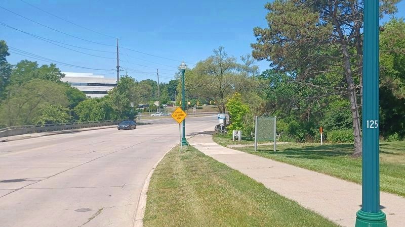
Photographed by Joel Seewald, June 24, 2022
2. Southfield Centre Marker
This view is looking west toward Telegraph Road.
Credits. This page was last revised on August 8, 2022. It was originally submitted on November 12, 2017, by Joel Seewald of Madison Heights, Michigan. This page has been viewed 409 times since then and 16 times this year. Photos: 1. submitted on November 12, 2017, by Joel Seewald of Madison Heights, Michigan. 2. submitted on August 8, 2022, by Joel Seewald of Madison Heights, Michigan.
