Near Kailua-Kona in Hawaii County, Hawaii — Hawaiian Island Archipelago (Pacific Ocean)
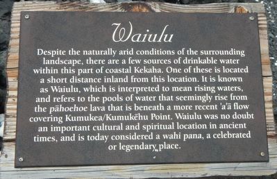
Waiulu Kīpuka
Photographed by Barry Swackhamer, August 29, 2017
1. Waiulu Kīpuka Marker
Topics. This historical marker is listed in this topic list: Settlements & Settlers.
Location. 19° 49.437′ N, 155° 59.829′ W. Marker is near Kailua-Kona, Hawaii, in Hawaii County. It can be reached from Kaupulehu Drive near Aina Kaha Place, on the left when traveling north. Touch for map. Marker is at or near this postal address: 72, Kailua Kona HI 96740, United States of America. Touch for directions.

Regionally, this marker is on the Kona Coast and in the Volcanic Hawaii. Globally,
this page online
Other nearby markers. At least 8 other markers are within walking distance of this marker: A different marker also named Waiulu Kīpuka (here, next to this marker); Habitation Site (within shouting distance of this marker); Ala Loa (about 600 feet away, measured in a direct line); Hawaiian Trail (approx. 0.2 miles away); Offshore Ko'a Moi (approx. 0.2 miles away); Kupe'e Concentration (approx. 0.2 miles away); Kumukea/Kumukēhu Point (approx. 0.2 miles away); Imu Fishing Area (approx. 0.2 miles away). Touch for a list and map of all markers in Kailua-Kona.
More about this marker. This marker is located on along a public access coastal path in front Four Season Resort Hualalai. The path may be accessed via an unnamed road located on the south side of the resort. Stop at the gate and ask for a pass and instructions Kukio Beach.
The address given above is for the Four Season Resort.
Photographed by Barry Swackhamer, August 29, 2017
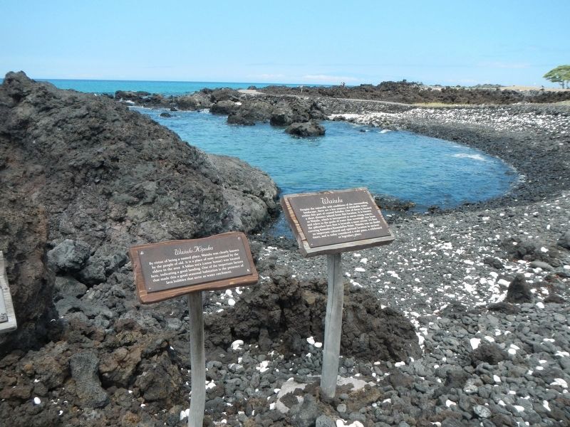
2. Waiulu Kīpuka Marker
The marker is on the right.
Photographed by Barry Swackhamer, August 29, 2017
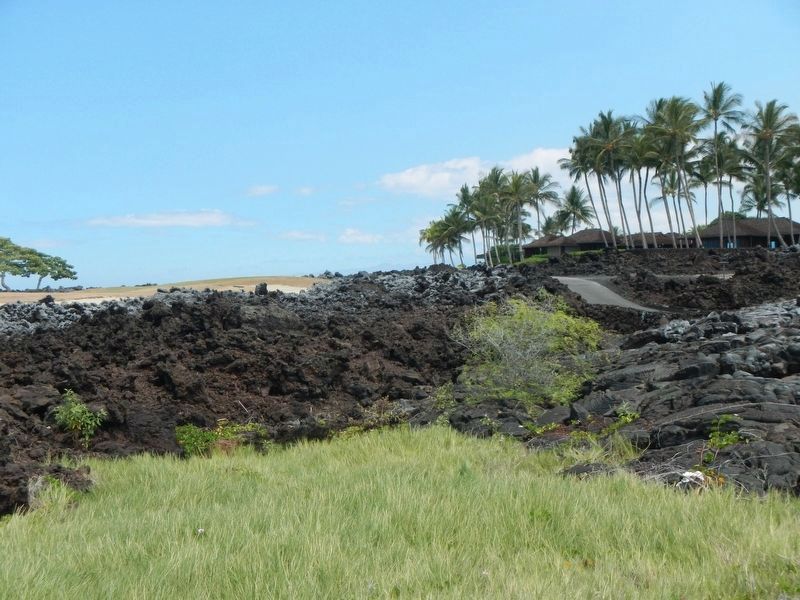
3. Waiulu Kīpuka water source in the lava beds. Note the green areas.
Credits. This page was last revised on November 23, 2017. It was originally submitted on November 23, 2017, by Barry Swackhamer of Brentwood, California. This page has been viewed 335 times since then and 23 times this year. Photos: 1, 2, 3. submitted on November 23, 2017, by Barry Swackhamer of Brentwood, California.
