Near Pāhoa in Hawaii County, Hawaii — Hawaiian Island Archipelago (Pacific Ocean)
The islands of Hawai'i begin here

Photographed By Barry Swackhamer, September 4, 2017
1. The islands of Hawai'i begin here Marker
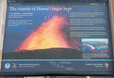
Caption: (lower left) You stand at the edge of one of the world's longest chains of islands, a vast archipelago that stretches far beyond Kaua'i to Kure Atoll, over 1600 miles (2,575 km) across the Pacific.
In the unfathomable darkness, dark blue, and bottomless...
Kumulipo, a Hawaiian creating chant, tells of the fiery beginnings of the earth that began in the primordial darkness of Pō.
Just offshore, magna pushes through the ocean floor and new volcanos come to live. Fueled by a hot spot, colossal volcanos gradually build from the ocean's dark depths.
At the horizon, about 28 miles (45 km) in the distance, lies the submerged summit of the newest volcano - Lō'ihi (also known as Kama'ehu in Hawaiian chants). At 3,180 feet (969 m) below sea level, the sun's rays never reach its summit.
These young volcanos emerge to form the next new islands. Given time, some will grow into the world's largest mountains.
Riding the oceanic plate to the northwest, the great volcanoes drift away from the hot spot, becoming extinct, and erode into the ocean from which they were born.
Erected by National Park Service, Hawai'i Volcanoes National Park and Papahānaumokuākea Marine National Monument.
Topics. This historical marker is listed in this topic list: Natural Features.
Location. 19° 17.718′ N, 155° 5.868′ W. Marker is near Pāhoa , Hawaii, in Hawaii County. Marker can be reached from Chain of Craters Road near Hilina Pali Road. Touch for map. Marker is in this post office area: Pahoa HI 96778, United States of America. Touch for directions.
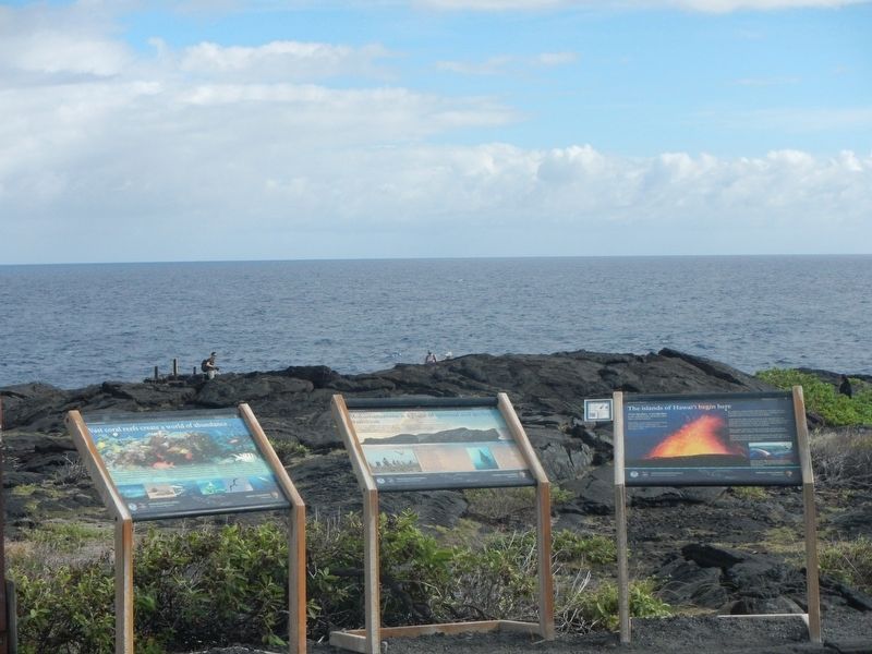
Other nearby markers. At least 8 other markers are within 7 miles of this marker, measured as the crow flies. Mokumanamana is a place of spiritual and geologic transition (a few steps from this marker); Vast coral reefs create a world of abundance (a few steps from this marker); Nature's Untamed Forces Unite to Sculpt Sea Arches (within shouting distance of this marker); These simple impressions embody the essence of Pu'uloa (approx. 1.6 miles away); The spirit of Pu'uloa now surrounds you (approx. 1.6 miles away); Hawaiians learned to survive on this harsh volcanic land (approx. 1.8 miles away); Preserved within Pu'uloa are the stories and memories of the Native Hawaiian people (approx. 2.1 miles away); Mauna Ulu (approx. 6.6 miles away). Touch for a list and map of all markers in Pāhoa.
More about this marker. This marker is located at the ocean end of Chain of Craters Road.
Credits. This page was last revised on December 4, 2017. It was originally submitted on December 4, 2017, by Barry Swackhamer of Brentwood, California. This page has been viewed 158 times since then and 18 times this year. Photos: 1, 2. submitted on December 4, 2017, by Barry Swackhamer of Brentwood, California.
