Near Volcano in Hawaii County, Hawaii — Hawaiian Island Archipelago (Pacific Ocean)
Mauna Loa

Photographed By Barry Swackhamer, September 4, 2017
1. Mauna Loa Marker
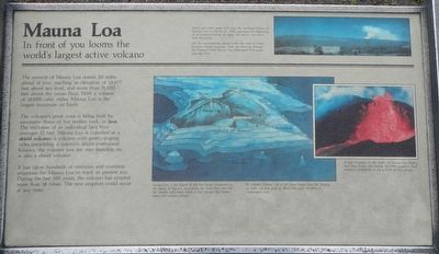
Captions: (top right) Steam and other gases boil from the northeast slopes of Mauna Loa on March 25, 1984, signaling the beginning of an eruption lasting 21 days. The photo was taken near this point.; (center) Mauna Loa is the largest of the five major volcanoes on the island of Hawai'i, accounting for more than one-half the islands's land mass. Most of the volcano lies hidden below the ocean's surface. By volume, Mauna Loa is 100 times larger than Mt. Rainier, an older volcanic peak of about the same elevation in Washington state.; (center right) A fiery fountain on the flank's of Mauna Loa feeds a lava flow (lower left) during the 1984 eruption. Each eruption contributes to the growth of the volcano.
The summit of Mauna Loa stands 20 miles ahead of you, reaching an elevation of 13,677 feet above sea level and more that 31,000 feet above the ocean floor. With a volume of 10,000 cubic miles, Mauna Loa is the largest mountain on Earth.
The volcano's great mass is being built by successive flows of hot molten rock, or lava. The thickness of an individual lava flow averages 12 feet. Mauna Loa is classified as a shield volcano, a volcano with gently-sloping sides resembling a warriors's shield overturned. Kilauea, the volcano you are now standing on, is also a shield volcano.
It has taken hundreds of centuries and countless eruptions for Mauna Loa to reach its present size. During the last 100 years , the volcano has erupted more than 18 times, The next eruption could occur at any time.
Erected by National Park Service, Hawai'i Volcanoes National Park.
Topics. This historical marker is listed in this topic list: Natural Features.
Location. 19° 25.188′ N, 155° 17.292′ W. Marker is near Volcano, Hawaii, in Hawaii County. Marker can be reached from Crater Rim Drive near Mauna Loa Road, on the left when traveling west . Touch for map. Marker is in this post office area: Volcano HI 96785, United States of America. Touch for directions.
Other nearby markers. At least 8 other markers are within 3 miles of this marker, measured as the crow flies. Explosive eruptions rock Kīlauea volcano (approx. 0.4 miles away); The "Firepit" of Halema'uma'u (approx. 1.3 miles away); Site of Hawaiian Volcano Observatory (approx. 2.1 miles away); The Volcano House reigns as one of America's great lodges (approx. 2.1 miles away); The 'Ōhi'a Wing will soon be home to the park's collection of artwork and artifacts (approx. 2.1 miles away); Kilauea (approx. 2.1 miles away); Countless are the Accomplishments of Roosevelt's Trusty "Tree Army" (approx. 2.1 miles away); Stephen Tyng Mather (approx. 2.1 miles away). Touch for a list and map of all markers in Volcano.
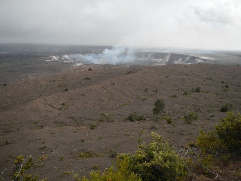
More about this marker. This marker is located at the Jaggar Museum and Hawaiian Volcano Observatory.
Credits. This page was last revised on December 4, 2017. It was originally submitted on December 4, 2017, by Barry Swackhamer of Brentwood, California. This page has been viewed 201 times since then and 15 times this year. Photos: 1, 2. submitted on December 4, 2017, by Barry Swackhamer of Brentwood, California.
Editor’s want-list for this marker. A view of Mauna Loa that includes the marker • Can you help?
