Yorktown in York County, Virginia — The American South (Mid-Atlantic)
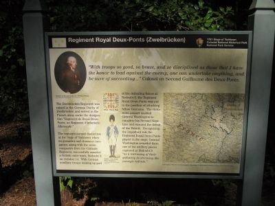
Regiment Royal Deux-Ponts (Zweibrücken)
1781 Siege of Yorktown
— Colonial National Historical Park —
“With troops so good, so brave, and so disciplined as those that I have the honor to lead against the enemy, one can undertake anything, and be sure of succeeding … ”
Colonel en Second Guillaume des Deux-Ponts.
The Zweibrücken Regiment was raised in the German Duchy of Zweibrücken and served in the French army under the designation “Regiment de Royal Deux-Ponts, un Regiment d’Infanterie Allemande.”
The regiment earned distinction at the Siege of Yorktown when its grenadier and chasseur companies from the Gâtinais Regiment, successfully assailed a British outer work, Redoubt 9, on October 14. With German auxiliary troops making up part of the defending forces at Redoubt 9, the Regiment Royal Deux-Ponts was put in the position of attacking fellow Germans. The victorious assaults enabled General Washington to complete his Second Siege Line end ensured the defeat of the British. Recognizing the important role the Regiment Royal Deux-Ponts played in the siege, General Washington awarded them one of the artillery pieces captured at Redoubt 9 “as a testimony of their gallantry in storming the enemy’s redoubt.”
Erected by Colonial National Historical Park, National Park Service.
Topics and series. This historical marker is listed in this topic list: War, US Revolutionary. In addition, it is included in the Former U.S. Presidents: #01 George Washington series list. A significant day of the year for for this entry is October 14.
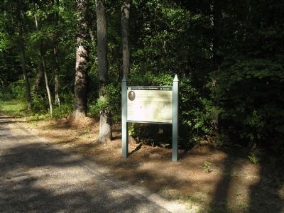
Location. 37° 13.621′ N, 76° 32.183′ W. Marker is in Yorktown, Virginia, in York County. Marker is located on the Yorktown Battlefield in Colonial National Historical Park, at stop K on the Allied Encampment Tour. Touch for map. Marker is in this post office area: Yorktown VA 23690, United States of America. Touch for directions.
Other nearby markers. At least 8 other markers are within 2 miles of this marker, measured as the crow flies. Bourbonnois Brigade Encampment (about 700 feet away, measured in a direct line); Soissonois Regiment (approx. 0.2 miles away); Saintonge Regiment (approx. 0.2 miles away); St. Simon’s Headquarters (approx. 0.4 miles away); Agenois Encampment (approx. half a mile away); A Changed Scene (approx. 0.9 miles away); Baron De Viomenil (approx. 1.1 miles away); Washington-Rochambeau Route (approx. 1.1 miles away). Touch for a list and map of all markers in Yorktown.
More about this marker. A portrait of “Colonel en Second Guillaume des Deux-Ponts, Courtesy of the City Museum of Zweibrücken” appears on the upper left of the marker.
The right side of the marker contains a “Contemporary Map showing the geographic relationship of Zweibrücken to France, Courtesy of the Library of Congress.”
Also on the marker are pictures of the Deux-Ponts Flag and of a “Soldier of the Deux-Ponts Regiment, Courtesy of the Don Troiani Collection.”
Also see . . .
1. Yorktown Battlefield. National Park Service. (Submitted on September 6, 2008, by Bill Coughlin of Woodland Park, New Jersey.)
2. The Battle of Yorktown 1781. A British perspective of the Battle of Yorktown from BritishBattles.com. (Submitted on September 6, 2008, by Bill Coughlin of Woodland Park, New Jersey.)
Credits. This page was last revised on December 27, 2019. It was originally submitted on September 6, 2008, by Bill Coughlin of Woodland Park, New Jersey. This page has been viewed 2,737 times since then and 41 times this year. Photos: 1, 2. submitted on September 6, 2008, by Bill Coughlin of Woodland Park, New Jersey.

