Hilo in Hawaii County, Hawaii — Hawaiian Island Archipelago (Pacific Ocean)
Mo'oheau Park and Bandstand
Hilo's Historic Gathering Place
Photographed by Barry Swackhamer, September 5, 2017
1. Mo'oheau Park and Bandstand Marker
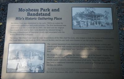
Captions: (top right) Ladies in kimonos and men in straw hats. The original bandstand has two stories and was a prominent place to gather for the ethnically diverse Hilo community of the early 1900's.; (bottom left) Members of the Hawai'i County Band later on the steps of the old bandstand in 1909. The band has been entertaining island residents since 1883.
The name "Mo'oheau" was used by male descendants of the Hilo chief Ho'olulu, who helped to hide the bones of Kamehameha the Great following his death in 1819, Admiral Beckley and his son were known to use the name Mo'oheau.
The current bandstand was destroyed several times by tsunami activity and rebuilt each time with similar roof and floor plans. Prior designs were two story and had "lady resting rooms" and "sport team facilities,' or restrooms on the floor
Mo'oheau Bandstand became the traditional home of the Hawai'i County Band which began in 1883. The bandstand has been the site of countless public events, music concerts, and celebrations of all sorts. Since the 1950's, the site has been a traditional statewide location for political gatherings and Democratic election
this page online
Erected by EnVision Downtown Hilo 2025 and Hilo Downtown Improvement Association.
Topics. This historical marker is listed in this topic list: Entertainment. A significant historical year for this entry is 1905.
Location. 19° 43.44′ N, 155° 5.052′ W. Marker is in Hilo, Hawaii, in Hawaii County. It is on Kamehameha Avenue near Mamo Street, on the left when traveling east. Touch for map. Marker is at or near this postal address: 400 Kamehameha Avenue, Hilo HI 96720, United States of America. Touch for directions.

Regionally, this marker is on Hilo and East Hawaii and in the Volcanic Hawaii. Globally, it is in North America, in Polynesia, in the Pacific Ocean, in North Pacific, on the Pacific Rim, in the Western Hemisphere, in the Western World, and in the Anglosphere.
Other nearby markers. At least 8 other markers are within 6 miles of this marker, measured as the crow flies: Hilo Town Plantation Bell Tower (within shouting distance of this marker); The Spiritual Power of Stones (approx. 0.4 miles away); Lyman House Memorial (approx. half a mile away); Kamehameha at Hilo Bay (approx. half a mile away); Hilo Bay: In the days of Kamehameha
Photographed by Barry Swackhamer, September 5, 2017
2. Mo'oheau Park and Bandstand and Marker
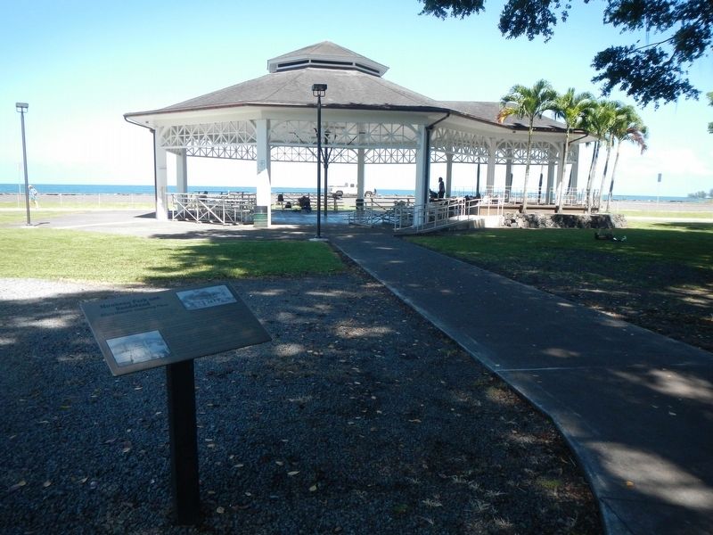
More about this marker. The Bandstand is in the park located between Kamehameha Avenue and the Bayfront Highway.
Credits. This page was last revised on December 9, 2017. It was originally submitted on December 9, 2017, by Barry Swackhamer of Brentwood, California. This page has been viewed 2,106 times since then and 131 times this year. Photos: 1, 2. submitted on December 9, 2017, by Barry Swackhamer of Brentwood, California.
