Hilo in Hawaii County, Hawaii — Hawaiian Island Archipelago (Pacific Ocean)
Kamehameha at Hilo Bay
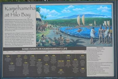
Kamehameha was a frequent visitor and resident of Hilo. While in his mid 40s, he oversaw the construction of his great Peleleu Fleet from the shores of Hilo Bay. The fleet consisted of over 1,000 canoes and included massive war canoes capable if carrying over 100 warriors each. Many of the great peleleu canoes were hewn from koa trees harvested from the forests of Mauna Kea. The fleet was provisioned from the rich natural resources of the Hilo area.
(Timeline across the bottom:)
1740s - 1759 - Rule of Chief Alap'i
1750s (est.) Kamehameha born at Kokoiki, Kohala
1759 (est.) Kamehameha's father Keōua Kupuapāikalanu dies here at Pi'opi'o, Hilo.
1759 - 1782 - Rule of Chief Kalani'ōpu'u
1773 (est.) Kamehameha proves strength and right to rule by lifting the Naha Stone at Pinao Heiau in Pi'ihonua.
1779 First Western Contact Kamehameha boards Capt. Cook's boat prior to its arrival on Hawai'i Island. Cant. Cook dies at Kealakekua several months later.
1782 - 1790 - Control of Hawai'i Island Contested
1782 Kalani'ōpu'u dies. Contest for dominance begins. Kamehameha inherits war god from Kalani'ōpu'u.
1784 (est.) Kamehameha beaten by fishermen on Puna shoreline. Inspired Kānāwai Māmalahoe Law of the Splintered Paddle.
1790 - 1810 - Period of Conquest & Unification
1790 Kamehameha conquers Maui in the Battle of Kapaniwai
1791 Kamehameha unites his rule of Hawai'i Island when Keōua killed at Pu'ukoholā Heiau.
1794 Kamehameha in Hilo for the Makahiki. Departs for Kona with Capt. Vancouver. 1794 Conquers O'ahu in Battle of Nu'uanu. 1796-1801 Kamehameha in Hilo overseeing construction of peleleu war fleet.
1801 Peleleu fleet departs Hilo of Maui.
1803 Conquest of Kaua'i fails.
1810 Kaua'i ali'i agree to unite under Kamehameha's rule.
1810 -1820 Kamehameha's Rule
1812 Kamehameha moves capitol to Kona. Son Kamehameah II (Liholiho) takes responsibility for annual dedication of heiau.
1819 Kamehameha dies in Kona; Liholiho breaks kapu (traditional religious system).
1820 First Western missionaries arrive.
(Chant:)
'O Kamehameha lani, ka'eu ke ano kapu
Ka haku manawa kapu ali'i kena
He ali'i no ka mu'o lani kapu no Lono
Nona ke kapu, ka wela
Ka hahana i holo i luna o ka wekiu
Lu ke ola'i naue ka honua
'Oni ke kai, naueue ka moku
'Ike ka lepa loa a ka lani
'Anapu wela ma ka honua mea
He inoa no Kamehameha
Kamehameha is chief, to him belongs the profound kapu
A lord indeed, a sacred chief is he,
A chief from the highest and sacred heaven of Lono
He is the kapu, the fiery kapu
The burning kapu that reaches the very heavens,
The earthquake, it is set a-tremble
The sea is disturbed, the land is moved.
These are the signs of a mighty warrior.
A flash of bright light over the sacred land is he
We praise his name.
Topics. This historical marker is listed in these topic lists: Government & Politics • Waterways & Vessels.
Location. 19° 43.254′ N, 155° 4.608′ W. Marker is in Hilo, Hawaii, in Hawaii County. Marker is on Mamalahoa Highway (Hawaii Route 19) near Pauahi Street, on the right when traveling east. Touch for map. Marker is in this post office area: Hilo HI 96720, United States of America. Touch for directions.
Other nearby markers. At least 8 other markers are within 7 miles of this marker, measured as the crow flies. Hilo Bay: In the days of Kamehameha (a few steps from this marker); Mo'oheau Park and Bandstand (approx. half a mile away); Hilo Town Plantation Bell Tower (approx. 0.6 miles away); Waiakea Social Settlement Clock (approx. 0.6 miles away); Waiakea Town (Yashijima) (approx. 0.6 miles away); Lyman House Memorial (approx. 0.9 miles away); The Spiritual Power of Stones (approx. 0.9 miles away); Onomea Bay (approx. 6.1 miles away). Touch for a list and map of all markers in Hilo.
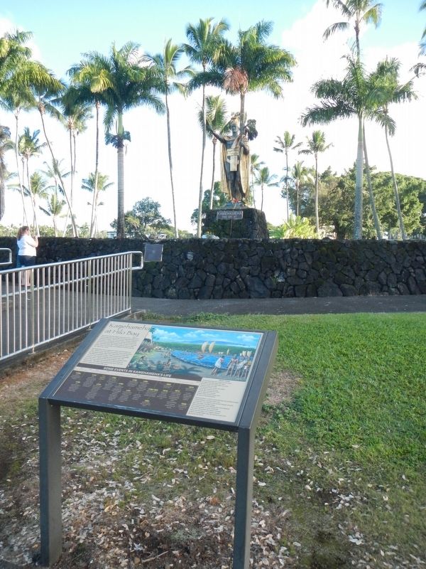
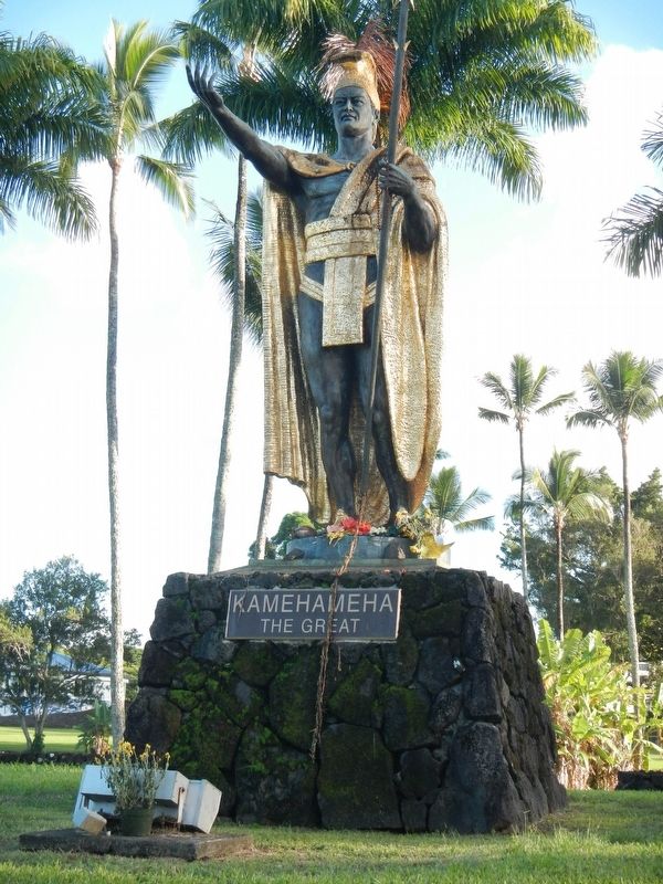
More about this marker. The statue of Kamehameha the Great is located at Wailoa River State Park.
Credits. This page was last revised on November 17, 2019. It was originally submitted on December 9, 2017, by Barry Swackhamer of Brentwood, California. This page has been viewed 461 times since then and 31 times this year. Photos: 1, 2, 3. submitted on December 9, 2017, by Barry Swackhamer of Brentwood, California.


