Mobile in Mobile County, Alabama — The American South (East South Central)
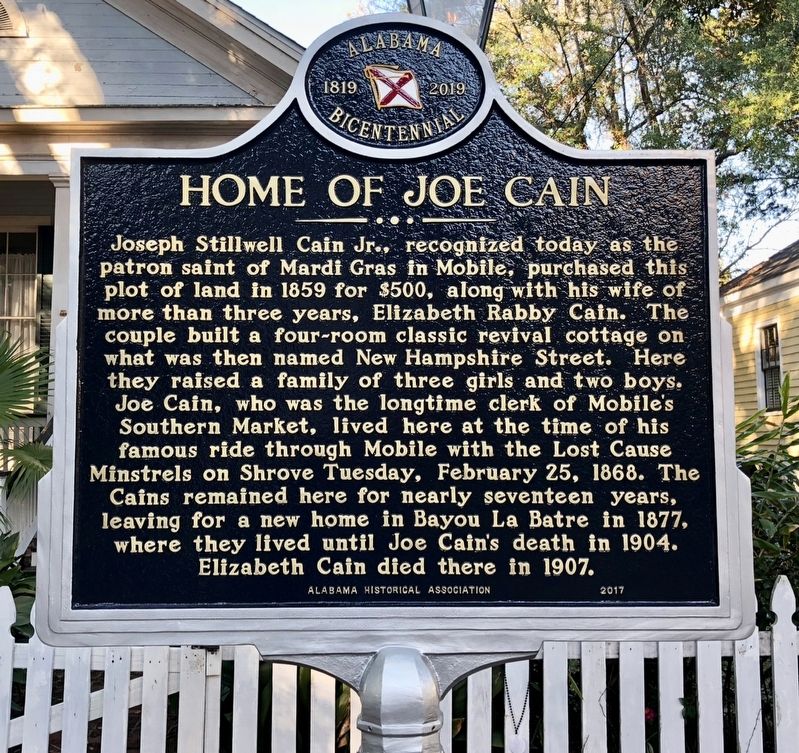
Home of Joe Cain
Alabama Bicentennial 1819-2019
Photographed by Mark Hilton, December 10, 2017
1. Home of Joe Cain Marker
Joseph Stillwell Cain Jr., recognized today as the patron saint of Mardi Gras in Mobile, purchased this plot of land in 1859 for $500, along with his wife of more than three years, Elizabeth Rabby Cain. The couple built a four-room classic revival cottage on what was then named New Hampshire Street. Here they raised a family of three girls and two boys. Joe Cain, who was the longtime clerk of Mobile's Southern Market, lived here at the time of his famous ride through Mobile with the Lost Cause Minstrels on Shrove Tuesday, February 25, 1868. The Cains remained here for nearly seventeen years, leaving for a new home in Bayou La Batre in 1877, where they lived until Joe Cain's death in 1904. Elizabeth Cain died there in 1907.
Erected 2017 by Alabama Historical Association.
Topics and series. This historical marker is listed in these topic lists: Architecture • Entertainment • Industry & Commerce • Settlements & Settlers. In addition, it is included in the Alabama Historical Association series list. A significant historical date for this entry is February 25, 1868.
Location. 30° 40.892′ N, 88° 3.247′ W. Marker is in
this page online

Regionally, this marker is on the Gulf Coast and in the Mobile Bay area. It is also in the American South, specifically in the Deep South, and on the Gulf Coast. Globally, it is in North America, a Gulf of Mexico state, the Western Hemisphere, the Western World, and the Anglosphere. Historically, it finds itself in what was once New Spain, the Viceroyalty of New France, the territory of the Mississippian Culture, one of the Confederate States of America, and the Antebellum South.
Other nearby markers. At least 8 other markers are within walking distance of this marker: Emerson Institute (approx. ¼ mile away); The Bee Hive (approx. 0.3 miles away); Big Zion African Methodist Episcopal Zion Church (approx. 0.3 miles away); Oakleigh (approx. 0.3 miles away); James W. Roper (approx. 0.4 miles away); Eugenie Marx (approx. 0.4 miles away); Home of Raphael Semmes
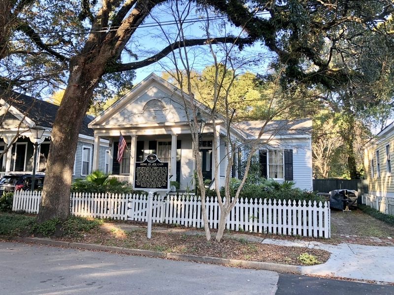
Photographed by Mark Hilton, December 10, 2017
2. Former home of Joe Cain.
Also see . . . Wikipedia article on Joe Cain. (Submitted on December 10, 2017, by Mark Hilton of Montgomery, Alabama.)
Additional keywords. minstrelsy
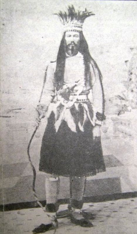
Public domain
3. Joseph Stillwell Cain, Jr.as "Slacabamorinico"
Credits. This page was last revised on March 16, 2026. It was originally submitted on December 10, 2017, by Mark Hilton of Montgomery, Alabama. This page has been viewed 4,547 times since then and 471 times this year. Photos: 1, 2, 3. submitted on December 10, 2017, by Mark Hilton of Montgomery, Alabama.
