Centro Histórico in Ciudad de México, Mexico — The Valley of Mexico (The Central Highlands)
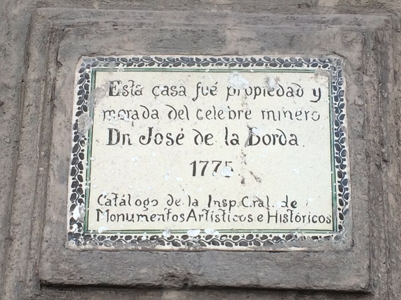
José de la Borda
morada del celebre minero
Dn José de la Borda.
1775.
Catálogo de la Insp. Gral. de Monumentos Artísticos e Históricos
José de la Borda.
1775.
Catalogue of the Inspector General of Artistic and Historic Monuments
Erected by Catálogo de la Inspección General de Monumentos Artísticos e Históricos.
Topics. This historical marker is listed in these topic lists: Colonial Era • Industry & Commerce. A significant historical year for this entry is 1775.
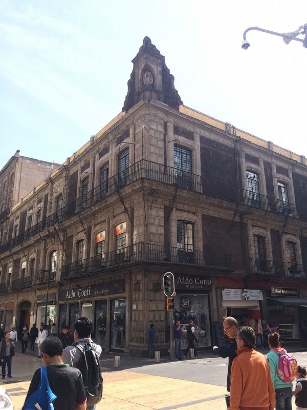
Location. 19° 26.022′ N, 99° 8.295′ W. Marker is in Ciudad de México. It is in Centro Histórico. Marker is at the intersection of Avenida Francisco I. Madero and Calle Bolívar, on the right when traveling east on Avenida Francisco I. Madero. Touch for map. Marker is in this post office area: Ciudad de México 06000, Mexico. Touch for directions.
Other nearby markers. At least 8 other markers are within walking distance of this marker. House of José de la Borda (within shouting distance of this marker); House of José de Borda (within shouting distance of this marker); Sebastián Lerdo de Tejada (within shouting distance of this marker); Museum and Cultural Center “El Borceguí” (within shouting distance of this marker); Teatro Santa Anna (within shouting distance of this marker); The House of the Count of San Mateo Valparaiso (within shouting distance of this marker); The Residence of Agustín Iturbide (about 90 meters away, measured in a direct line); High Water Mark of 1629 (about 90 meters away). Touch for a list and map of all markers in Ciudad de México.
Regarding José de la Borda. José de la Borda (Joseph de Laborde in French; c. 1700 – May 30, 1778) was a French/Spaniard who migrated to New Spain in the 18th century, amassing a great fortune in mines in Taxco and Zacatecas in Mexico. At one point, he was the richest man in Mexico. He is best remembered today through several architectural works that he sponsored, the most monumental being the Santa Prisca Church in Taxco. (from Wikipedia)
Credits. This page was last revised on April 17, 2020. It was originally submitted on December 12, 2017, by J. Makali Bruton of Accra, Ghana. This page has been viewed 144 times since then and 14 times this year. Photos: 1, 2. submitted on December 12, 2017, by J. Makali Bruton of Accra, Ghana.

