Golden in Jefferson County, Colorado — The American Mountains (Southwest)
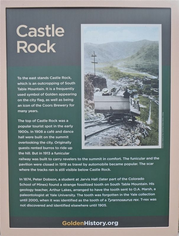
Castle Rock
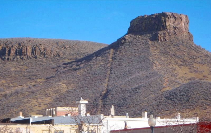
To the east stands Castle Rock, which is an outcropping of South Table Mountain. It is a frequently used symbol of Golden appearing on the city flag, as well as being an icon of the Coors Brewery for many years.
The top of Castle Rock was a popular tourist spot in the early 1900s. In 1908 a cafe and dance hall were built on the summit overlooking the city. Originally guests rented burros to ride up the hill. But in 1913 a funicular railway was built to carry revelers to the summit in comfort. The funicular and the pavilion were closed in 1919 as travel by automobile became popular. The scar where the tracks ran is still visible below Castle Rock.
In 1874, Peter Dobson, a student at Jarvis Hall (later part of the Colorado School of Mines) found a strange fossilized tooth on South Table Mountain. His geology teacher, Arthur Lakes, arranged to have the tooth sent to O. A. Marsh, a paleontologist at Yale University. The tooth was forgotten in the Yale collection until 2000, when it was identified as the tooth of a Tyrannosaurus rex. T-rex was not discovered and identified elsewhere until 1905.
Topics. This historical marker is listed in these topic lists: Environment • Notable Places. A significant historical year for this entry is 1908.
Location. 39° 45.35′ N, 105° 13.42′ W. Marker is in Golden, Colorado, in Jefferson County. The marker is located in the center of Golden, on the Clear Creek Trail, 50 yards southwest from the crossing of Washington Avenue. Touch for map. Marker is in this post office area: Golden CO 80401, United States of America. Touch for directions.
Other nearby markers. At least 8 other markers are within walking distance of this marker. Colorado National Guard Armory (here, next to this marker); Rock Flour Millstone (within shouting distance of this marker); Down by the Old Mill Stream (about 300 feet away, measured in a direct line); First Resident/Agriculturalist (about 300 feet away); Early History of Clear Creek (about 400 feet away); Settlement of Clear Creek Valley (about 400 feet away); Gold in Clear Creek (about 400 feet away); Farming (about 400 feet away). Touch for a list and map of all markers in Golden.
Also see . . .
1. Golden History. (Submitted on December 12, 2017, by Alan M. Perrie of Unionville, Connecticut.)
2. South Table Mountain. (Submitted on December 12, 2017, by Alan M. Perrie of Unionville, Connecticut.)
Credits. This page was last revised on December 16, 2017. It was originally submitted on December 12, 2017, by Alan M. Perrie of Unionville, Connecticut. This page has been viewed 542 times since then and 137 times this year. Photos: 1, 2. submitted on December 12, 2017, by Alan M. Perrie of Unionville, Connecticut. • Syd Whittle was the editor who published this page.
Editor’s want-list for this marker. Wide area view of the marker and its surroundings. • • Can you help?

