The National Mall in Southwest Washington in Washington, District of Columbia — The American Northeast (Mid-Atlantic)
Venus
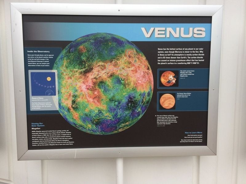
Venus has the hottest surface of any planet in our solar system, even though Mercury is closer to the Sun. Why is Venus so hot? Its atmosphere is mostly carbon dioxide and is 93 times denser than Earth's. The carbon dioxide has caused an intense greenhouse effect that has heated the planet's surface to a sweltering 860°F (460°C).
Captions:
Inside the Observatory
Venus goes through phases, and its apparent size varies, as the planet's position relative to the Sun and Earth changes. If the Cook Memorial Telescope is pointed toward Venus, you can compare your observations to those of past visitors.
Phases of Venus
September 2013 to January 2014
The Public Observatory captured these images of Venus, which goes through phases, over the course of five months.
Viewing Our Solar System:
Magellan
NASA's Magellan spacecraft studied Venus's geology, gravity, and topography. Released by the crew of Space Shuttle Atlantis, Magellan arrived at Venus in 1990. Over the next four years, it mapped most of Venus's surface using radar. It charted the planet's tectonic features, lava plains, craters, and dune fields. Magellan's final task was to gather aerodynamic data by intentionally falling into Venus's atmosphere. Scientists, including those at the Museum's Center for Earth and Planetary Studies, still use the wealth of Magellan data to learn more about Venus.
This artist's concept shows Magellan with a radar map of Venus created from Magellan data.
NASA/JPL
The Pioneer Venus Orbiter obtained this view of the planet's cloud cover.
NASA
←This view of Venus's surface was created using radar data from Magellan. Gaps are filled in with data from the Arecibo Observatory radio telescope. Blue represents low elevation; orange represents high elevation.
NASA/JPL/USGS
How to Learn More:
http://solarsystem.nasa.gov/
http://www.jpl.nasa.gov/magellan/
Also check inside the observatory during operating hours for Venus's current phase.
Erected by National Air and Space Museum.
Topics. This historical marker is listed in this topic list: Air & Space. A significant historical year for this entry is 1990.
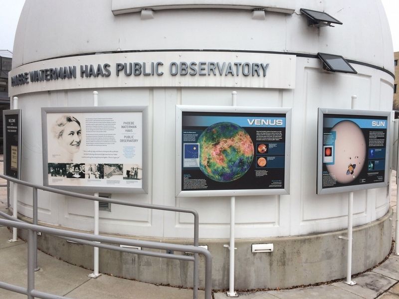
Location. 38° 53.273′ N, 77° 1.113′ W. Marker is in Southwest Washington in Washington, District of Columbia. It is in The National Mall. Marker can be reached from Independence Avenue Southwest west of 4th Street Southwest, on the right when traveling west. On the grounds of the National Air and Space Museum on the side of the Phoebe Waterman Haas
Other nearby markers. At least 8 other markers are within walking distance of this marker. Phoebe Waterman Haas (here, next to this marker); Moon (here, next to this marker); Saturn (here, next to this marker); Sun (here, next to this marker); Jupiter (here, next to this marker); Cook Telescope (here, next to this marker); Binary Stars (here, next to this marker); Star Nurseries (here, next to this marker). Touch for a list and map of all markers in Southwest Washington.
Credits. This page was last revised on January 30, 2023. It was originally submitted on December 12, 2017, by Devry Becker Jones of Washington, District of Columbia. This page has been viewed 170 times since then and 11 times this year. Photos: 1, 2. submitted on December 12, 2017, by Devry Becker Jones of Washington, District of Columbia. • Bill Pfingsten was the editor who published this page.

