Yorktown in York County, Virginia — The American South (Mid-Atlantic)
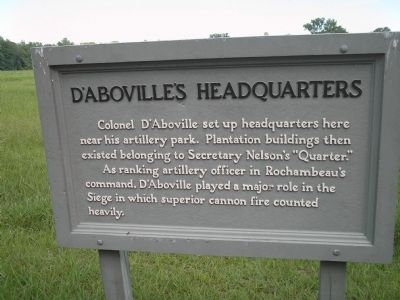
D’Aboville’s Headquarters
As ranking artillery officer in Rochambeau’s command, D’Aboville played a major role in the Siege in which superior cannon fire counted heavily.
Erected by National Park Service, U.S. Department of the Interior.
Topics. This historical marker is listed in this topic list: War, US Revolutionary.
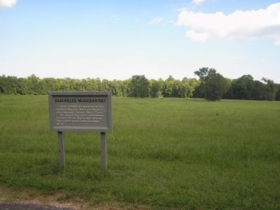
Location. 37° 12.696′ N, 76° 31.474′ W. Marker is in Yorktown, Virginia, in York County. Marker is on Historical Tour Road, on the right when traveling north. Marker is located on the Yorktown Battlefield in Colonial National Historical Park, on the Allied Encampment Tour. Touch for map. Marker is in this post office area: Yorktown VA 23690, United States of America. Touch for directions.
Other nearby markers. At least 8 other markers are within walking distance of this marker. Baron De Viomenil (approx. 0.2 miles away); French Artillery Park (approx. 0.3 miles away); French Artillery Park (approx. 0.3 miles away); A Changed Scene (approx. 0.3 miles away); French Cemetery (approx. 0.4 miles away); The Adjutant General (approx. 0.6 miles away); Comte de Rochambeau (approx. 0.6 miles away); Beaver Dam Creek (approx. 0.7 miles away). Touch for a list and map of all markers in Yorktown.
Also see . . .
1. Yorktown Battlefield. National Park Service. (Submitted on September 6, 2008, by Bill Coughlin of Woodland Park, New Jersey.)
2. The Battle of Yorktown 1781. A British perspective of the Battle of Yorktown from BritishBattles.com. (Submitted on September 6, 2008, by Bill Coughlin of Woodland Park, New Jersey.)
Credits. This page was last revised on December 27, 2019. It was originally submitted on September 6, 2008, by Bill Coughlin of Woodland Park, New Jersey. This page has been viewed 890 times since then and 27 times this year. Photos: 1, 2. submitted on September 6, 2008, by Bill Coughlin of Woodland Park, New Jersey.

