Downtown in Sacramento in Sacramento County, California — The American West (Pacific Coastal)
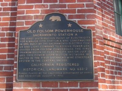
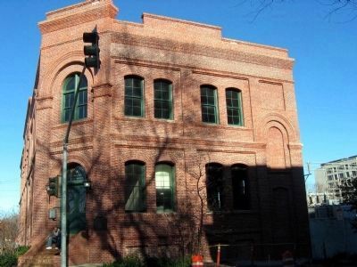
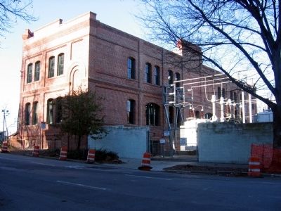
Old Folsom Powerhouse
Sacramento Station A
Photographed by Syd Whittle, January 15, 2006
1. Old Folsom Powerhouse Marker
Erected 1970 by California Department of Parks and Recreation (August 4, 1970). (Marker Number 633-2.)
Topics and series. This historical marker is listed in these topic lists: Industry & Commerce • Railroads & Streetcars. In addition, it is included in the California Historical Landmarks series list. A significant historical month for this entry is July 1828.
Location. 38° 35.038′ N, 121° 29.86′ W. Marker is in Sacramento, California, in Sacramento County. It is in Downtown. It is at the intersection of H Street and 6th Street, on the left when traveling east on H Street. Touch for map. Marker is in this post office area: Sacramento CA 95814, United States of America. Touch for directions.

Regionally, this marker is in the Sacramento Valley and specifically
this page online
Other nearby markers. At least 8 other markers are within walking distance of this marker: Site of First African Methodist Episcopal Church on the Pacific Coast (about 500 feet away, measured in a direct line); Site of First and Second State Capitols at Sacramento (about 500 feet away); United States Post Office, Courthouse, & Federal Building (approx. 0.2 miles away); Travelers' Hotel (approx. 0.2 miles away); Central Pacific’s Other Big Four (approx. 0.2 miles away); Pioneer Hall (approx. 0.2 miles away); Sacramento Pioneers Society (approx. 0.2 miles away); St. George Hotel (approx. ¼ mile away). Touch for a list and map of all markers in Sacramento.
Regarding Old Folsom Powerhouse. This is a California Registered Historical Landmark(No. 633-2).
Related marker. Click here for another marker that is related
Photographed by Syd Whittle, January 15, 2006
2. Old Folsom Powerhouse - Station A
Photographed by Syd Whittle, January 15, 2006
3. Old Folsom Powerhouse - Station A
Credits. This page was last revised on February 7, 2023. It was originally submitted on September 7, 2008, by Syd Whittle of Mesa, Arizona. This page has been viewed 2,047 times since then and 58 times this year. Photos: 1, 2, 3. submitted on September 7, 2008, by Syd Whittle of Mesa, Arizona. • Kevin W. was the editor who published this page.
