Echo in Umatilla County, Oregon — The American West (Northwest)
The Blockhouse
Photographed by Barry Swackhamer, July 1, 2017
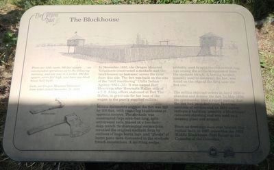
1. The Blockhouse Marker
Captions: (bottom left) Splitting wedge; Hewing hatchet.
In November 1855, the Oregon Mounted Volunteers constructed a stockade and two blockhouses (or bastions) across the river from this site. The fort was built on the site of the "still smoldering" Utilla (sic) Indian Agency (1851-1855). It was named Fort Henrietta after Henrietta Haller, wife of a U.S. Army officer stationed at Fort The Dalles, in gratitude for her loan of the wagon to poorly supplied militia.
Militia documents suggest the fort was 100 feet by 100 feet, with round-log blockhouses at opposite corners. The stockade was constructed from nine-foot-long, split-cottonwood rails, placed in a two-foot deep trench. Archaeological excavations revealed the original stockade form by outlines of huge burnt logs, and "ghosts" of burnt posts were discovered in the stockade trench excavations. A splitting wedge, probably used to split the cottonwood logs
this page online
The militia received orders in April 1856 to abandon and destroy the fort. In May 1856, the commander filed a report stating that the fort had been destroyed. However, accounts of settlers and an 1859 survey indicate a building (possibly a blockhouse) remained standing and was used as a meeting place and arsenal.
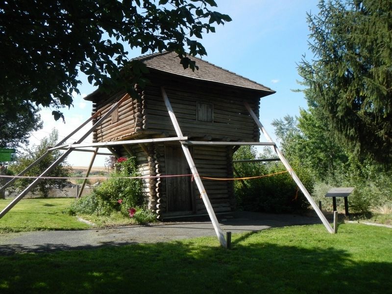
Since no drawings were ever located, the replica built in 1985 resembles the 1855 Middle Blockhouse (Fort Rains) at the Cascades of the Columbia.
Erected by City of Echo.
Topics. This historical marker is listed in these topic lists: Forts and Castles • Wars, US Indian.
Location. 45° 44.504′ N, 119° 11.898′ W. Marker is in Echo, Oregon, in Umatilla County. It can be reached from West Main Street near Water Street, on the left when traveling west. Touch for map. Marker is at or near this postal address: 10 West Main Street, Echo OR 97826, United States of America. Touch for directions.

Regionally,
Photographed by Barry Swackhamer, July 1, 2017
2. The Fort Henrietta Blockhouse (replica) and Marker
The marker is on the right.
Other nearby markers. At least 8 other markers are within walking distance of this marker: The Lower Crossing (a few steps from this marker); Umatilla County Jail (within shouting distance of this marker); Covered Wagon Museum (within shouting distance of this marker); Jack Dempsey (within shouting distance of this marker); Umatilla Masonic Lodge #40 (about 500 feet away, measured in a direct line); Echo Mercantile Building/Post Offices (about 500 feet away); Arlington Hotel (about 500 feet away); Echo Methodist-Episcopal Church (approx. 0.2 miles away). Touch for a list and map of all markers in Echo.
More about this marker. The Blockhouse is located in Fort Henrietta Park.
Credits. This page was last revised on December 26, 2017. It was originally submitted on December 26, 2017, by Barry Swackhamer of Brentwood, California. This page has been viewed 421 times since then and 31 times this year. Photos: 1, 2. submitted on December 26, 2017, by Barry Swackhamer of Brentwood, California.
