North Newport News , Virginia — The American South (Mid-Atlantic)
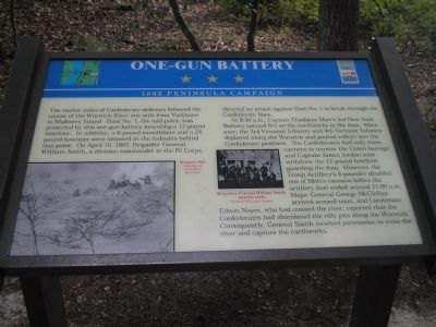
One-Gun Battery
1862 Peninsula Campaign
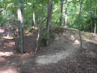
At 8:30 a.m., Captain Thaddeus Mott’s 3rd New York Battery opened fire on the earthworks at the dam. Moreover, the 3rd Vermont Infantry and the 4th Vermont Infantry deployed along the Warwick and poured volleys into the Confederate positions. The Confederates had only three cannons to counter the Union barrage, and Captain James Jordan soon withdrew the 12-pound howitzer guarding the dam. However, the Troup Artillery’s 6-pounder disabled one of Mott’s cannons before the artillery duel ended around 11:00 a.m. Major General George McClellan arrived around noon, and Lieutenant Edwin Noyes, who had crossed the river, reported that the Confederates had abandoned the rifle pits along the Warwick. Consequently, General Smith received permission to cross the river and capture the earthworks.
(captions)
Wynne’s Mill. Courtesy of John Moran Quarstein.
Brigadier General William Smith and his staff. Vermont Historical Society
Erected by Virginia Civil War Trails.
Topics and series. This historical marker is listed in this topic list: War, US Civil. In addition, it is included in the Virginia Civil War Trails series list. A significant historical date for this entry is April 16, 1862.
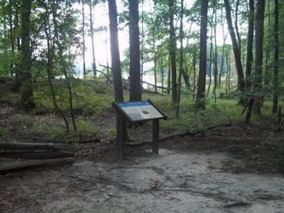
Location. 37° 11.099′ N, 76° 32.265′ W. Marker is in Newport News, Virginia. It is in North Newport News. Marker can be reached from Constitution Way, on the left when traveling east. Marker is located in Newport News Park, on the Twin Forts Walking Trail on the north side of Lee Hall Reservoir. Touch for map. Marker is in this post office area: Newport News VA 23603, United States of America. Touch for directions.
Other nearby markers. At least 8 other markers are within walking distance of this marker. “Their Conduct was Worthy of Veterans” (about 500 feet away, measured in a direct line); “Every Kind of Obstruction was Skillfully Used” (about 700 feet away); “The Bullets Would Whistle Around my Head” (approx. 0.2 miles away); Third Regiment Vermont Volunteer Infantry (approx. 0.2 miles away); Battle of Lee’s Mill (Dam Number 1) (approx. 0.2 miles away); “Just Like Sap – Boiling, in the Stream” (approx. 0.2 miles away); Battle of Dam No. 1
(approx. 0.2 miles away); Ten Pound Parrott Rifle and Limber (approx. 0.2 miles away). Touch for a list and map of all markers in Newport News.
Related markers. Click here for a list of markers that are related to this marker. Markers on the Twin Forts Walking Trail in Newport News Park.
Also see . . . Civil War Yorktown. Colonial National Historical Park/Yorktown Battlefield, National Park Service (Submitted on September 7, 2008, by Bill Coughlin of Woodland Park, New Jersey.)
Credits. This page was last revised on February 1, 2023. It was originally submitted on September 7, 2008, by Bill Coughlin of Woodland Park, New Jersey. This page has been viewed 1,795 times since then and 31 times this year. Last updated on June 15, 2022, by James Dean of Chesterfield, Virginia. Photos: 1, 2, 3. submitted on September 7, 2008, by Bill Coughlin of Woodland Park, New Jersey. • Bernard Fisher was the editor who published this page.


