Sutter Creek in Amador County, California — The American West (Pacific Coastal)
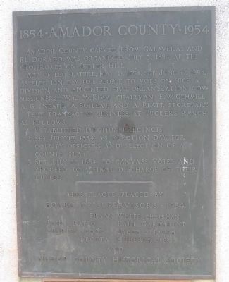
1854 · Amador County · 1954
Act of Legislature, May 11, 1854, set June 17, 1854, as election date for people to vote on such a division, and appointed five organization commissioners: W.L. McKimm, Chairman; E.W. Gemmill; A.J. Sneath; A.Boileau; and A. Platt, Secretary.
They transacted business at Tucker’s Ranch as follows:
1. Established election precincts;
2. Set July 17, 1854, as election day for county officers and selection of a County Seat;
3. Set July 22, 1854, to canvass votes and proceed to final discharge of their duties.
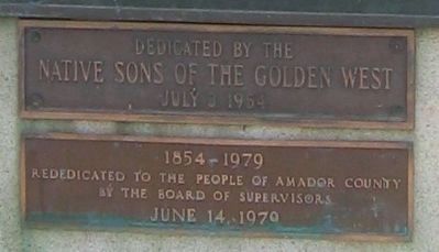
Erected 1954 by the Native Sons of the Golden West. Rededicated 1979 by the Amador County Board of Supervisors.
Topics and series. This historical marker is listed in these topic lists: Government & Politics • Notable Events • Notable Places • Political Subdivisions • Settlements & Settlers. In addition, it is included in the Native Sons/Daughters of the Golden West series list. A significant historical date for this entry is May 11, 1945.
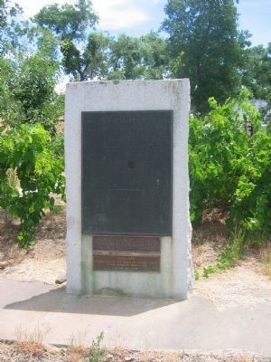
Location. 38° 22.897′ N, 120° 47.991′ W. Marker is in Sutter Creek, California, in Amador County. Marker is at the intersection of Sutter Hill Road and Eureka Road, on the right when traveling west on Sutter Hill Road. Touch for map. Marker is in this post office area: Sutter Creek CA 95685, United States of America. Touch for directions.
Other nearby markers. At least 8 other markers are within walking distance of this marker. Botto Saloon (about 400 feet away, measured in a direct line); Central Eureka Mine (about 400 feet away); In Memory of the Heros of Amador County (approx. half a mile away); Old Eureka Mine (approx. half a mile away); a different marker also named Old Eureka Mine (approx. half a mile away); Knight Scarifier – “The Scarifier that will scarify” (approx. half a mile away); Miners' Bend Park (approx. half a mile away); Hydroelectric Power in Amador County (approx. half a mile away). Touch for a list and map of all markers in Sutter Creek.
Regarding 1854 · Amador County · 1954. In the 1850's, just after gold was discovered at Coloma in nearby El Dorado County, Andrew Kennedy discovered the claim that was to become world famous as the Kennedy Mine in the area that is now the city of Jackson. It would turn out to be one of the richest in the Mother Lode. With its extremely deep mine shafts (the deepest plunged down 5,912 feet), it was to be productive for 50 years.
Amador County was established in 1854. Almost incorporated into neighboring Calaveras County, the new county narrowly missed being named "Washington" by the state legislature, but the name "Amador" was substituted in the State Assembly. The name paid homage to ranchero Jose Maria Amador, after whom Amador City is named, and as a translation from Spanish for "love of gold."
As the county developed, towns rose up around early mining settlements and homes and buildings reflecting the architectural styles popular in that time were built. Many still stand. Mining continued until 1942, when Presidential edict closed mines on behalf of the war effort. However, in recent years, shaft mining activity has been resumed between the towns of Amador City and Sutter Creek, and gold panning continues to thrill hobbyists and professional gold miners, alike.
Source: Amador County - History
Credits. This page was last revised on June 16, 2016. It was originally submitted on September 8, 2008, by Syd Whittle of Mesa, Arizona. This page has been viewed 3,053 times since then and 47 times this year. Photos: 1, 2, 3. submitted on September 8, 2008, by Syd Whittle of Mesa, Arizona. • Kevin W. was the editor who published this page.


