Hayfork in Trinity County, California — The American West (Pacific Coastal)
Japanese Bomb Balloon
Photographed by Barry Swackhamer, June 1, 2012
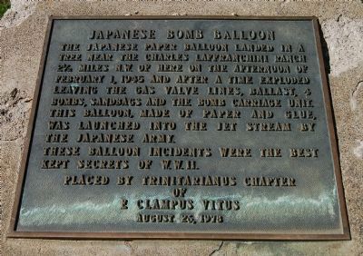
1. Japanese Bomb Balloon Marker
These balloon incidents were the best kept secrets of W.W. II.
Erected 1978 by E Clampus Vitus, Trinitarianus Chapter 62.
Topics and series. This historical marker is listed in this topic list: War, World II. In addition, it is included in the E Clampus Vitus series list. A significant historical date for this entry is February 1, 1848.
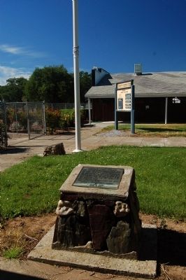
Location. 40° 32.662′ N, 123° 11.41′ W. Marker is in Hayfork, California, in Trinity County. It can be reached from the intersection of California Route 3 and Morgan Hill Road. This marker is on the Trinity County Fairgrounds in front of the Fair Office. Touch for map. Marker is in this post office area: Hayfork CA 96041, United States of America. Touch for directions.

Regionally, this marker is in the Shasta Cascade, on the Coast Ranges, and in the Klamath
this page online
Other nearby markers. At least 7 other markers are within 17 miles of this marker, measured as the crow flies: Jedediah Strong Smith (approx. 0.6 miles away); Kellogg Cemetery (approx. 0.8 miles away); Salt Creek School (approx. 5 miles away); Big Flat – Big Bar (approx. 13.7 miles away); Junction City Centennial (approx. 14.7 miles away); The La Grange Mine (approx. 16.9 miles away); Moving Mountains... (approx. 16.9 miles away).
Related markers. Click here for a list of markers that are related to this marker. To better understand the relationship, study each marker in the order shown.
Also see . . .
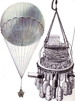
1. Japanese Balloon Bombs. In 1944, during World War II, Japan launched a top secret project, nearly two years in the making, to send thousands of "balloon bombs" (called Fu-Go
Photographed by Barry Swackhamer, June 1, 2012
2. Japanese Bomb Balloon Marker
2. 1945 Japanese Balloon Bombs to North America - YouTube. This is a video on the Japanese Balloon Bombs. (Submitted on June 5, 2012, by Barry Swackhamer of Brentwood, California.)
from Military Images.net
3. Fu-Go, the Japanese Bomb Balloon
Credits. This page was last revised on August 15, 2026. It was originally submitted on June 5, 2012, by Barry Swackhamer of Brentwood, California. This page has been viewed 2,334 times since then and 115 times this year. Last updated on January 13, 2018, by Douglass Halvorsen of Klamath Falls, Oregon. Photos: 1, 2, 3. submitted on June 5, 2012, by Barry Swackhamer of Brentwood, California.
