
Near Oakes in Dickey County, North Dakota — The American Midwest (Upper Plains)
Stagecoach Relay Station
Photographed by Ruth VanSteenwyk, May 2, 2017
1. Stagecoach Relay Station Marker
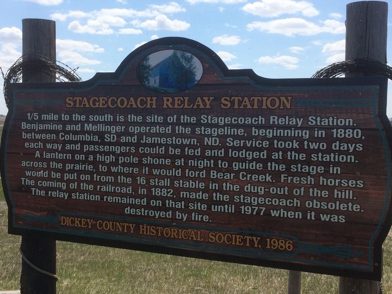
1/5 mile to the south is the site of the Stagecoach Relay Station. Benjamine and Mellinger operated the stage line, beginning in 1880, between Columbia, SD and Jamestown, ND. Service took two days each way and passengers could be fed and lodged at the station.
A lantern on a high pole shone at night to guide the stage in across the prairie, to where it would ford Bear Creek. Fresh horses would be put on from the 16 stall stable in the dug-out of the hill. The coming of the railroad, in 1882, made the stagecoach obsolete. The relay station remained on that site until 1977 when it was destroyed by fire.
Erected 1986 by Dickey County Historical Society.
Topics. This historical marker is listed in these topic lists: Railroads & Streetcars • Settlements & Settlers. A significant historical year for this entry is 1880.
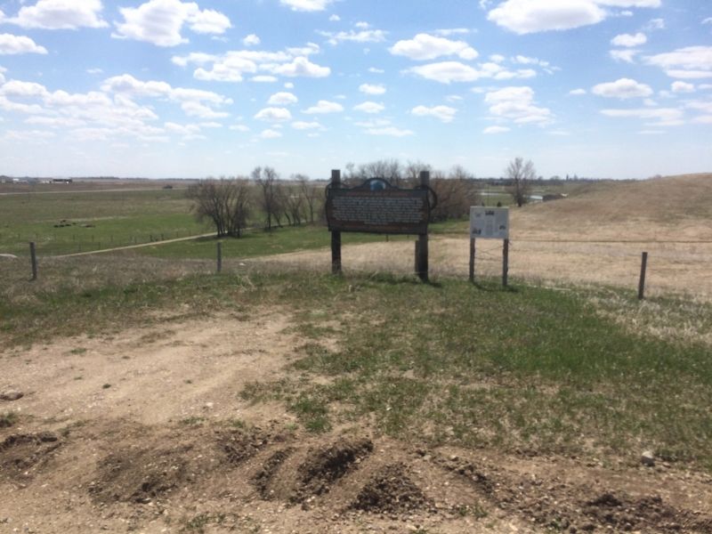
Location. 46° 10.937′ N, 98° 5.768′ W. Marker is near Oakes, North Dakota, in Dickey County. It can be reached from 85th Street Southeast 0.3 miles west of 110th Ave SE, on the left when traveling west. Touch for map. Marker is in this post office area: Oakes ND 58474, United States of America.
this page online

Regionally, this marker is in North Dakota’s Drift Prairie. It is also in the American Lewis & Clark Corridor, on the prairies, and on the Northern Plains. Globally, it is in North America, the Western Hemisphere, the Western World, and the Anglosphere. Historically, it finds itself in what was once Rupert’s Land and also the Louisiana Purchase.
Other nearby markers. At least 8 other markers are within 16 miles of this marker, measured as the crow flies: 1891 Church - Oakes Historical Park (approx. 3.4 miles away); Hudson Townsite (approx. 6.2 miles away); St. Ansgar Lutheran Church (approx. 10.7 miles away); Early Settlers of the Valley (approx. 11½ miles away); 1916 Block (approx. 12.6 miles away); Steamboats on the River (approx. 15.4 miles away); Honorable Milton R. Young (approx. 15.4 miles away); Symbol of Freedom (approx. 15.4 miles away). Touch for a list and map of all markers in Oakes.
Photographed by Ruth VanSteenwyk, May 2, 2017
2. Stagecoach Relay Station Marker
Credits. This page was last revised on January 16, 2018. It was originally submitted on January 13, 2018, by Ruth VanSteenwyk of Aberdeen, South Dakota. This page has been viewed 1,024 times since then and 44 times this year. Photos: 1, 2. submitted on January 13, 2018, by Ruth VanSteenwyk of Aberdeen, South Dakota. • Bill Pfingsten was the editor who published this page.
