Rogue River in Jackson County, Oregon — The American West (Northwest)
A Bridge for a New Century

Photographed By Barry Swackhamer, September 21, 2017
1. A Bridge for a New Century Marker
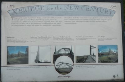
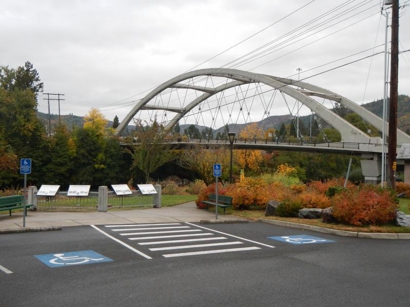
Captions: (center, far left) Old Bridge: The Depot Street Bridge was built for yesterday, It has two 13-foot-wide lanes for traffic and lacked a shoulder. The bridge was no longer able to carry the weight of the increasing traffic.; (center, near left) Safety and Travel Considerations: The new bridge design allows for bike lanes, wide sidewalks, and increased lighting for night travel.; (middle) Increased Traffic Capacity: The new bridge is wider that the old Depot Street Bridge and includes a center turn lane and two travel lanes for traffic. It meets the level load limits to accommodate today's traffic demands.; (center, near right) Pedestrian Accommodations: The new bridge has seating available for enjoying a view of the Rogue River.; (center, far right) The design, a tied-arch span, was selected for its strength, beauty, and environmental appropriateness.; (bottom) Arched Bridges: At the center, this new bridge is six feet above the 100-year floodplain - six feet higher than the old Depot Street Bridge. The single-pier structure minimizes the bridge's "footprint" and its impact on the riparian zone - the habitat around the Rogue River.
Throughout the bridge replacement project, Jackson County worked with local citizens to identify and suggest aesthetic qualities desirable for this community bridge.
Erected by City of Rogue River.
Topics. This historical marker is listed in this topic list: Bridges & Viaducts.
Location. 42° 25.862′ N, 123° 10.313′ W. Marker is in Rogue River, Oregon, in Jackson County. Marker is on Rogue River Highway (Oregon Route 99) near North Star Lane when traveling west. Touch for map. Marker is at or near this postal address: 8898 Rogue River Highway, Rogue River OR 97537, United States of America. Touch for directions.
Other nearby markers. At least 8 other markers are within 4 miles of this marker, measured as the crow flies. Rising above the Rogue (here, next to this marker); Crossing the Rogue (here, next to this marker); The City of Rogue River (here, next to this marker); Evan's Ferry (a few steps from this marker); Applegate Trail - Fort Birdseye (approx. 2 miles away); Fort Birdseye (approx. 2 miles away); Valley of the Rogue Applegate Trail Kiosk (approx. 2.6 miles away); Rock Point, Oregon (approx. 4.1 miles away). Touch for a list and map of all markers in Rogue River.
More about this marker. The marker is located next to the Rogue River Chamber of Commerce.
Credits. This page was last revised on January 26, 2018. It was originally submitted on January 15, 2018, by Barry Swackhamer of Brentwood, California. This page has been viewed 205 times since then and 22 times this year. Photos: 1, 2. submitted on January 15, 2018, by Barry Swackhamer of Brentwood, California.
