Grants Pass in Josephine County, Oregon — The American West (Northwest)
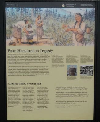
From Homeland to Tragedy
Inscription.
The Rogue Valley has been the traditional homelands of three distinct language- based tribal groups since ancient times: Takelma, Dakubetede/Taltushtuntude, and Shasta. Tribes shared similar cultural and societal practices, subsistence patterns, house styles, and belief systems. Each group had multiple villages, each with recognized territorial boundaries. Prior to 1849, the tribes in the region had mostly limited, fleeting, but sometimes violent interactions with American, French Canadian, and British traders and trappers.
That changed in the early 1850s when miners and settlers poured into the valley. The majority of overland emigrants were farmers accustomed to owning land and plowing, logging, and grazing it to provide for their families. Native people lived with the land, encouraging and utilizing its abundant, natural seasonal resources. Although the tribes of the Pacific Northwest were territorial, European-style land ownership was an alien concept. This difference in perspective, at first a curiosity and frustration to both sides, set the stage for tragedy.
From about 1850 to 1856, tribal and American cultures fought for their lifeways in what became known as the Rogue River Wars. Skirmishes, ambushes, and murder perpetuated by both sides led to a cease re in August 1853 and the Table Rock Treaty meetings. Some 700 Indians from many tribes showed up as did the military, settlers, and miners.
Under the terms of the treaty, the tribes ceded the entire Rogue Valley. In payment, tribes would receive $60,000 in blankets, clothing, and agricultural implements, and be subject to deductions by settlers who might file depredation claims for loss of property during the war. The Table Rock Reservation was temporarily established until a permanent reservation could be selected by the President of the United States.
Over the years, eight treaties were signed in attempts to save western Oregon tribes from the slaughter being carried out by some emigrants. In the fall of 1855 the act of one man ignited the last stage of the Rogue River Wars. Local politician James Lupton of Jacksonville, Oregon, called a meeting at a local saloon and encouraged “extermination as a solution to the Indian problem.”
You might ask me, ‘What did the land mean to your people?’ I could answer, ‘The very meaning of our life.’
I might ask you, ‘What is the most important thing that the white man’s god has given you?’ The Indians’ belief is that the most meaningful thing the Great Spirit gave to us was our land.
The removal of the Indians from this land was like the removal of the spirit from
the body.
Billie Buschmann, Chair, Cow Creek Band of Umpqua Tribe of Indians, Congressional Testimony, June 14, 1979
Caring for the Land
The Rogue Valley tribes cared for the land through low intensity burning at appropriate times. This regimen reduced forest diseases and wildfires, led to diverse plant communities, and provided nutritious browse for deer and elk.
Tribal husbandry kept the region in peak production, with a wide variety of foods, materials, and medicines for their people.
Art and Function
Tribal practices combined the making of everyday items with artistic expression and decoration. Highly prized baskets, ceremonial regalia, and woodworking were designed with more than utility in mind.
Similar Systems
Traditional systems of trade, marriage practices, and long- standing means of dispute resolution promoted healthy tribal society—one that allowed political groups to reside next to each other in relative peace.
Erected by National Park Service, Hugo Neighborhood Association, Confederated Tribes of Siletz Indians, Confederated Tribes of the Grand Ronde and Cow Creek Band of Umpqua Tribe of Indians.
Topics. This historical marker is listed in this topic list: Native Americans.
Location. 42° 31.008′ N, 123° 21.792′ W. Marker is in Grants Pass, Oregon, in Josephine County. Marker can be reached from Interstate 5 at milepost 62 near Merlin Road, on the right when traveling south. Touch for map. Marker is in this post office area: Grants Pass OR 97526, United States of America. Touch for directions.
Other nearby markers. At least 8 other markers are within 7 miles of this marker, measured as the crow flies. The 1846 Applegate Trail (a few steps from this marker); No Land is Free (a few steps from this marker); Burrell M. Baucom (within shouting distance of this marker); Rogue River Wars (approx. 2.9 miles away); The Oregon Cavemen (approx. 4.3 miles away); The First Brick Building in Grants Pass (approx. 5.7 miles away); The Perkinsville Ferry (approx. 6.1 miles away); Fort Vannoy (approx. 6.2 miles away). Touch for a list and map of all markers in Grants Pass.
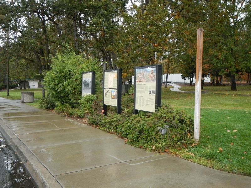
More about this marker. The marker is at the Manzanita Rest Area, Northbound, located about a mile north of the Grants Pass/Merlin Road exit #61.
Credits. This page was last revised on January 16, 2018. It was originally submitted on January 16, 2018, by Barry Swackhamer of Brentwood, California. This page has been viewed 243 times since then and 15 times this year. Photos: 1, 2. submitted on January 16, 2018, by Barry Swackhamer of Brentwood, California.

