Lowell in Lane County, Oregon — The American West (Northwest)
Lowell Prospers
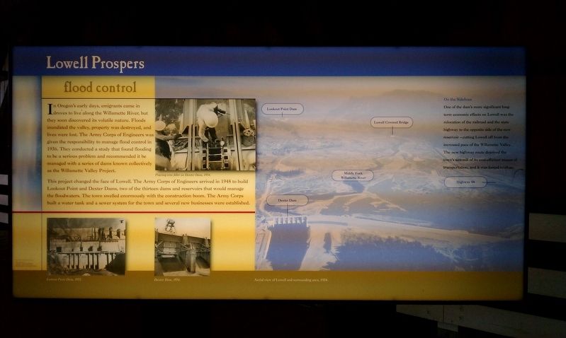
Flood Control
Photographed by Douglass Halvorsen, October 21, 2012
1. Lowell Prospers Marker
This project changed the face of Lowell. The Army Corps of Engineers arrived in 1948 to build Lookout Point and Dexter Dams, two of the thirteen dams and reservoirs that would manage the floodwaters. The town swelled enormously with the construction boom. The Army Corps built a water tank and a sewer system for the town and several new businesses were established.
On the Sidelines
One of the dam's more significant long-term economic effects on Lowell was the relocation of the railroad and the state highway to the opposite side of the new reservoir – cutting Lowell off from the increased pace of the Willamette Valley. The new highway route deprived the
this page online
Topics. This historical marker is listed in these topic lists: Industry & Commerce • Waterways & Vessels. A significant historical year for this entry is 1936.
Location. 43° 54.538′ N, 122° 46.767′ W. Marker is in Lowell, Oregon, in Lane County. It can be reached from S Pioneer St. Touch for map. Marker is in this post office area: Lowell OR 97452, United States of America. Touch for directions.

Regionally, this marker is in Oregon’s Willamette Valley. It is also on the American Pacific Coast, in the Pacific Northwest, and in the Lewis & Clark Corridor. Globally, it is in North America, in the Cascade Range, on the Ring of Fire, in the Pacific Rim, in the Western Hemisphere, in the Western World, and in the Anglosphere.
Other nearby markers. At least 8 other markers are within 9 miles of this marker, measured as the crow flies: A different marker also named Lowell Prospers (here, next to this marker); Frontier Life (here, next to this marker); a different marker also named Frontier Life (a few steps from this marker); Building a Bridge
Photographed by Douglass Halvorsen, October 21, 2012
2. Lowell Prospers Marker
Credits. This page was last revised on January 20, 2018. It was originally submitted on January 18, 2018, by Douglass Halvorsen of Klamath Falls, Oregon. This page has been viewed 321 times since then and 27 times this year. Photos: 1, 2. submitted on January 18, 2018, by Douglass Halvorsen of Klamath Falls, Oregon. • Bill Pfingsten was the editor who published this page.
