Millhaven in Screven County, Georgia — The American South (South Atlantic)
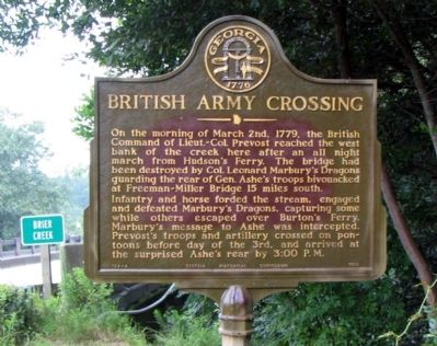
British Army Crossing
Photographed by David Seibert, August 16, 2005
1. British Army Crossing Marker
Infantry and horse forded the stream, engaged and defeated Marbury's Dragons, capturing some while others escaped over Burton's Ferry. Marbury's message to Ashe was intercepted. Prevost's troops and artillery crossed on pontoons before day of the 3rd, and arrived at the surprised Ashe's rear by 3:00 P.M.
Erected 1953 by Georgia Historical Commission. (Marker Number 124-4.)
Topics and series. This historical marker is listed in this topic list: War, US Revolutionary. In addition, it is included in the Georgia Historical Society series list. A significant historical date for this entry is March 2, 1785.
Location. 32° 56.014′ N, 81° 39.005′ W. Marker is in Millhaven, Georgia, in Screven County. It is at the intersection of Millhaven Road and Gin House Road, on the right when traveling south on Millhaven Road. Touch for map.
this page online

Regionally, this marker is on Georgia’s Coastal Plain. It is also in the American South and specifically in the Deep South. Globally, it is in North America, the Western Hemisphere, the Western World, and the Anglosphere. Historically, it finds itself in what was once the territory of the Mississippian Culture, one of the original Thirteen Colonies, one of the Confederate States of America, and the Antebellum South.
Other nearby markers. At least 8 other markers are within 8 miles of this marker, measured as the crow flies: Paris' Mill (here, next to this marker); Old Quaker Road (approx. 4.2 miles away); First McCanaan Baptist Church (approx. 4.6 miles away); Bethel United Methodist Church (approx. 6.6 miles away); Brick (Bethel) Church (approx. 6.6 miles away); Sardis Baptist Church (approx. 6.8 miles away); Jacksonborough (approx. 7½ miles away); Jacksonboro (approx. 7½ miles away).
Also see . . . Battle of Brier Creek. The crossing was part of a campaign which culminated in the battle of Brier Creek
Photographed by Craig Swain
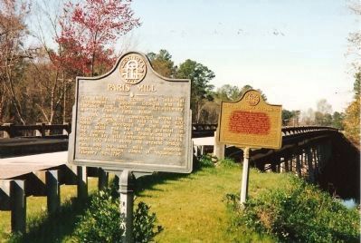
2. Paris' Mill and British Army Crossing Markers
This photo, taken in the 1990s shows an older, weathered version of the British Army Crossing marker.
Credits. This page was last revised on June 16, 2016. It was originally submitted on September 9, 2008, by David Seibert of Sandy Springs, Georgia. This page has been viewed 1,982 times since then and 30 times this year. Photos: 1. submitted on September 9, 2008, by David Seibert of Sandy Springs, Georgia. 2. submitted on September 4, 2008, by Craig Swain of Leesburg, Virginia. • Craig Swain was the editor who published this page.
