Indio in Riverside County, California — The American West (Pacific Coastal)
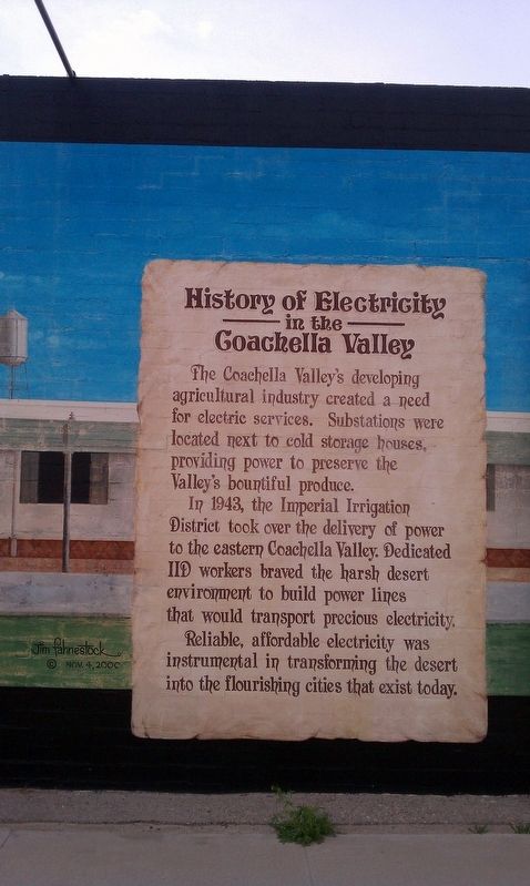
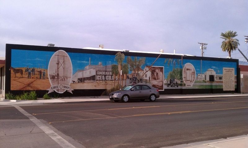
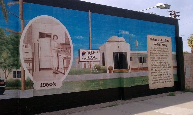
History of Electricity in the Coachella Valley
Inscription.
The Coachella Valley's developing agricultural industry created a need for electric services. Substation were located next to cold storage houses, providing power to preserve the Valley's bountiful produce. In 1943, the Imperial Irrigation District took over the delivery of power to the eastern Coachella Valley. Dedicated IID workers braved the harsh desert environment to build power lines that would transport precious electricity. Reliable, affordable electricity was instrumental in transforming the desert into the flourishing cities that exist today.
Erected by Indio Chamber of Commerce Historical Mural Project.
Topics. This historical marker is listed in this topic list: Industry & Commerce. A significant historical year for this entry is 1943.
Location. 33° 43.112′ N, 116° 13.048′ W. Marker is in Indio, California, in Riverside County. Marker is at the intersection of Civic Center Mall and Fargo St, on the right when traveling east on Civic Center Mall. Touch for map. Marker is in this post office area: Indio CA 92201, United States of America. Touch for directions.
Other nearby markers. At least 8 other markers are within 6 miles of this marker, measured as the crow flies. Dr. June Robertson McCarroll (approx. 0.2 miles away); Smiley Place (approx. 0.4 miles away); USS Liberty Tree - USN Captain William L. McGonagle (approx. 0.4 miles away); Jimmy Swaggart's "Date" (approx. one mile away); Veterans Remembrance Memorial (approx. 3.4 miles away); Water Trough (approx. 3.6 miles away); The Bradshaw Trail / Point Happy (approx. 4˝ miles away); Carl G. Bray, Smoke Tree Painter (approx. 5.3 miles away). Touch for a list and map of all markers in Indio.
Credits. This page was last revised on January 23, 2018. It was originally submitted on January 20, 2018, by Douglass Halvorsen of Klamath Falls, Oregon. This page has been viewed 377 times since then and 41 times this year. Photos: 1, 2, 3, 4, 5. submitted on January 20, 2018, by Douglass Halvorsen of Klamath Falls, Oregon. • Andrew Ruppenstein was the editor who published this page.


