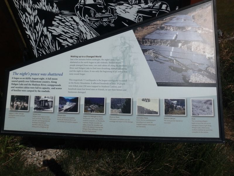
The Night’s Peace Was Shattered
Waking up to a Changed World
Just a few minutes before midnight, the night’s peace was shattered as the earth began to jolt violently. Shaken awake, people began to emerge from tents, cars and cabins all along the Madison River and Hebgen Lake to find trees thrashing, dust clouds rising, and the night in chaos. It was only the beginning of an ordeal that none would forget.
This magnitude 7.5 earthquake is the largest earthquake recorded in the Rocky Mountains. It affected hundreds of lives: 28 people were killed, over 250 were trapped in Madison Canyon, and hundreds more lost loved ones or friends, or saw their homes and businesses damaged.
(captions)
August 17, 1959 11:37pm
Earthquake strikes and fault scarps form.
Minutes later
Hebgen Lake begins to slosh back and forth. Waves overtop the dam and damage lakeside buildings. Destabilized shorelines slide into the lake taking parts of Highway 287.
Minutes later
An 80-million-ton landslide blocks the Madison River and cuts off the exit road for campers.
August
18, Midnight to Dawn
Earthquake Lake, rises rapidly, swallows campsites, as aftershocks continue. People scramble for safety, rescue the stranded, and tend to the injured. Fearing that Hebgen Dam will break, many head for high ground.
Dawn to Noon
Helicopters and planes scan the wreckage and report on the damage.
Just before Noon
Forest Service Smokejumpers parachute in to assist the trapped campers and prepare an evacuation.
Noon to 3:00pm
The most gravely injured are evacuated.
Dusk
The remaining refugees begin to leave the area on an emergency bypass road along Hebgen Lake, while rescue workers continue to search the campsites in the canyon.
Topics. This historical marker is listed in this topic list: Disasters. A significant historical date for this entry is August 17, 1959.
Location. 44° 48.239′ N, 111° 11.287′ W. Marker is in West Yellowstone, Montana, in Gallatin County. Marker is on U.S. 287, on the right when traveling west. 4.4 miles west of junction with 191. Touch for map. Marker is in this post office area: West Yellowstone MT 59758, United States of America. Touch for directions.
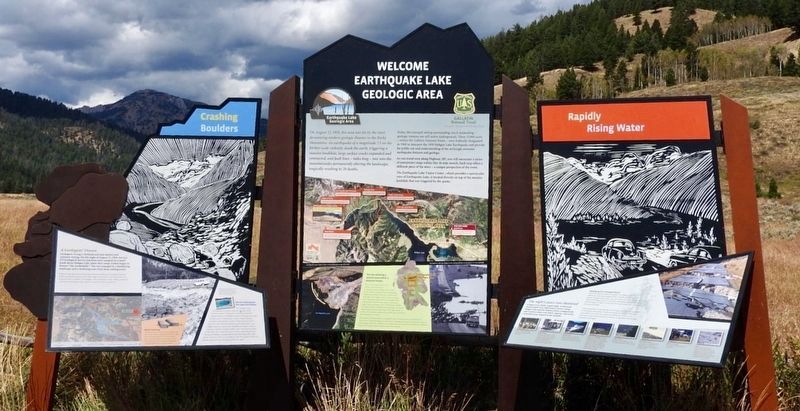
Other nearby markers. At least 8 other markers are within 9 miles of this marker, measured as the crow flies. Earthquake Lake Geologic Area (here, next to this marker); Geologists' Dream (here, next to this marker); Hebgen Lake and Quake Lake (approx. one mile away); Sleep Interrupted
Additional keywords. Hebgen Earthquake
Credits. This page was last revised on May 29, 2018. It was originally submitted on February 1, 2018, by Martin Schrattenholzer of Renton, Washington. This page has been viewed 312 times since then and 16 times this year. Photos: 1. submitted on February 1, 2018, by Martin Schrattenholzer of Renton, Washington. 2. submitted on May 29, 2018, by Craig Baker of Sylmar, California. • Andrew Ruppenstein was the editor who published this page.

