Near Paradise in Butte County, California — The American West (Pacific Coastal)
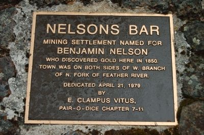
Nelsons Bar
Benjamin Nelson
who discovered gold here in 1850.
Town was on both sides of W. Branch
of N. Fork of Feather River.
Erected 1979 by E Clampus Vitus, Pair-o-Dice Chapter No. 7-11.
Topics and series. This historical marker is listed in this topic list: Settlements & Settlers. In addition, it is included in the E Clampus Vitus series list. A significant historical year for this entry is 1850.
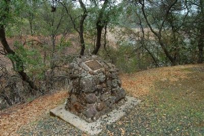
Location. 39° 41.678′ N, 121° 34.165′ W. Marker is near Paradise, California, in Butte County. Marker can be reached from Nelson Bar Boat Ramp Road. This marker is located in the Nelson Bar Day Use Facility just off of Lime Saddle Road. Touch for map. Marker is in this post office area: Paradise CA 95969, United States of America. Touch for directions.
Other nearby markers. At least 8 other markers are within 5 miles of this marker, measured as the crow flies. Yankee Hill (approx. 2˝ miles away); 1879 Site of Messilla Valley School (approx. 2.8 miles away); Cherokee (approx. 3.7 miles away); Paradise Pioneers (approx. 4.7 miles away); Old Paradise (approx. 4.9 miles away); Town of Paradise Memorial Trailway (approx. 4.9 miles away); Paradise Veterans Memorial (approx. 4.9 miles away); PFC. Steven J. Walberg-Riotto (approx. 5 miles away). Touch for a list and map of all markers in Paradise.
Click on the ad for more information.
Please report objectionable advertising to the Editor.
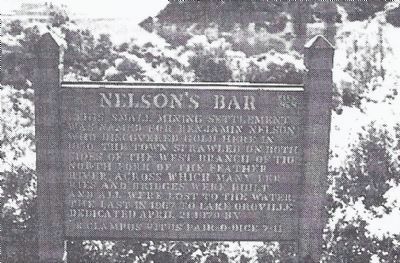
sectionhead>More about this marker. An earlier Nelson's Bar marker erected on Nelson's Bar Road by the Pair-O-Dice Chapter, No. 7-11 of E Clampus Vitus is no longer in place. It has been replaced by this marker.
Please report objectionable advertising to the Editor.

Photographed By E Clampus Vitus Plaques Book 1930-1995, n/a
4. An earlier Nelson's Bar marker erected by the E Clampus Vitus Pair-O-Dice Chapter
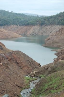
"This small mining settlement was named for Bejamin Nelson who discovered gold here in 1850. The town sprawled on both sides of the West Branch of the North Fork of the Feather River, across which many ferries and bridges were built and all were lost to the water, the last in 1967, to Lake Oroville.
Dedicated April 21, 1979 by E Clampus Vitus, Pair-O-Dice 7-11."
Dedicated April 21, 1979 by E Clampus Vitus, Pair-O-Dice 7-11."
Credits. This page was last revised on February 9, 2018. It was originally submitted on December 9, 2012, by Barry Swackhamer of Brentwood, California. This page has been viewed 1,010 times since then and 38 times this year. Last updated on February 9, 2018, by Douglass Halvorsen of Klamath Falls, Oregon. Photos: 1, 2, 3, 4. submitted on December 9, 2012, by Barry Swackhamer of Brentwood, California.


