Midtown - Downtown in Columbia in Richland County, South Carolina — The American South (South Atlantic)
Congaree Vista
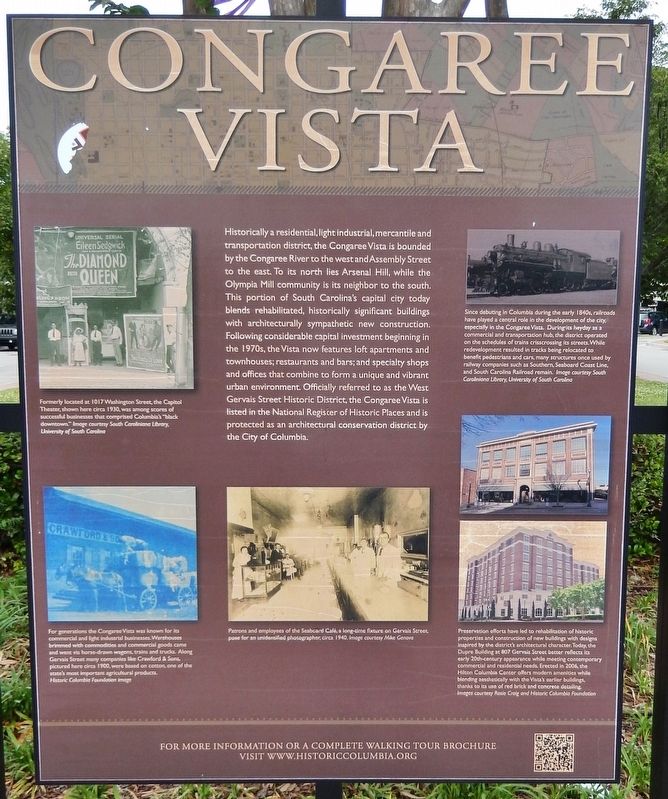
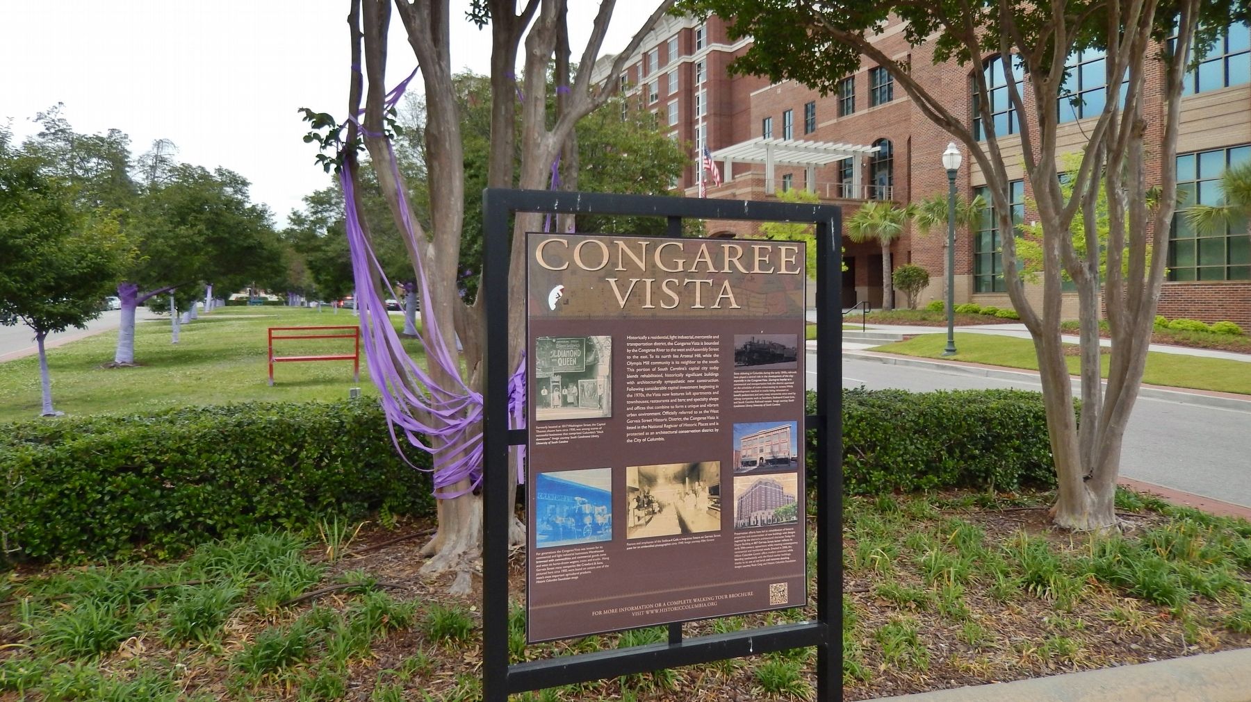
Historically a residential, light industrial, mercantile and transportation district, the Congaree Vista is bounded by the Congaree River to the west and Assembly Street to the east. To its north lies Arsenal Hill, while the Olympia Mill community is its neighbor to the south. This portion of South Carolina’s capital city today blends rehabilitated, historically significant buildings with architecturally sympathetic new construction. Following considerable capital investment beginning in the 1970s, the Vista now features loft apartments and townhouses; restaurants and bars; and specialty shops and offices that combine to form a unique and vibrant urban environments. Officially referred to as the West Gervais Street Historic District, the Congaree Vista is listed in the National Register of Historic Places and is protected as an architectural conservation district by the City of Columbia.
Topics. This historical marker is listed in these topic lists: Architecture • Industry & Commerce • Notable Places • Railroads & Streetcars.
Location. 33° 59.906′ N, 81° 2.261′ W. Marker is in Columbia, South Carolina, in Richland County. It is in Midtown - Downtown. Marker is at the intersection of Senate Street and Lincoln Street , in the median on Senate Street. Touch for map. Marker is in this post office area: Columbia SC 29201, United States of America. Touch for directions.
Other nearby markers. At least 8 other markers are within walking distance of this marker. 9 -11 / First Responders (within shouting distance of this marker); Generations (about 400 feet away, measured in a direct line); Lincoln Street (about 500 feet away); Seaboard Air-Line Railway Station #1 (about 600 feet away); 1001 Gervais Street (about 700 feet away); Seaboard Air-Line Railway Station #2 (about 700 feet away); Gadsden Street (approx. 0.2 miles away); Site of Wayside Hospital (approx. 0.2 miles away). Touch for a list and map of all markers in Columbia.
Also see . . .
1. Congaree Vista. Wikipedia entry:
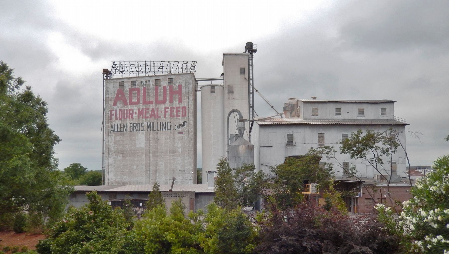
Congaree Vista is a cosmopolitan section of Columbia, South Carolina, near the banks of the Congaree River, which was revitalized during the late 1990s and early 2000s. "The Vista," as it is known by locals, is centered on one of the city's old train stations along Gervais Street. Also in this area is the historic Adluh Flour Mill, one of the few productive remnants of the district's industrial past. (Submitted on February 11, 2018, by Cosmos Mariner of Cape Canaveral, Florida.)
2. The Vista. Historic Columbia Foundation Walking Tours website entry (Submitted on February 12, 2018.)
3. Adluh Flour Mill. Website entry:
Adluh Flour Mills began in Columbia, SC around 1900. It was
Photographed By Cosmos Mariner, May 13, 2017
2. Marker detail: Capitol Theater, circa 1930
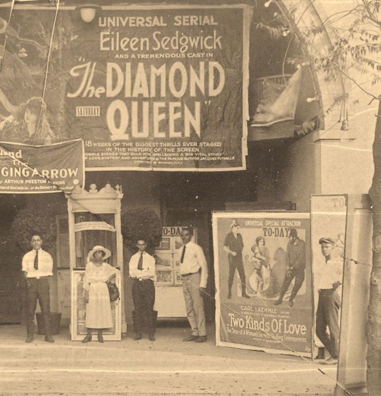
Formerly located at 1017 Washington Street, the Capitol Theater, shown here circa 1930, was among scores of successful businesses that comprised Columbia’s “black downtown.” Image courtesy South Caroliniana Library, University of South Carolina
Photographed By Cosmos Mariner, May 13, 2017
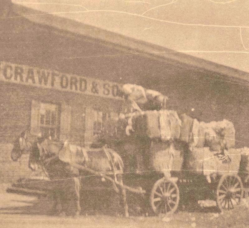
3. Marker detail: Crawford & Sons, circa 1900
For generations the Congaree Vista was known for its commercial and light industrial businesses. Warehouses brimmed with commodities and commercial goods came and went via horse-drawn wagons, trains and trucks. Along Gervais Street many companies like Crawford & Sons, pictured here circa 1900, were based on cotton, one of the state’s most important agricultural products. Historic Columba Foundation image
Photographed By Cosmos Mariner, May 13, 2017
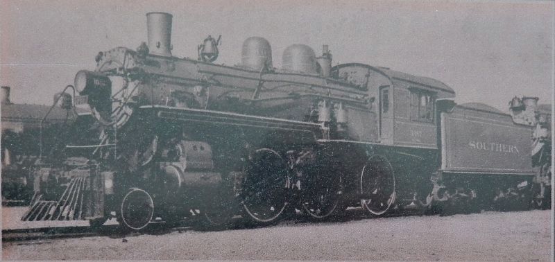
4. Marker detail: Railroads
Since debuting in Columbia during the early 1840s, railroads have played a central role in the development of the city, especially in the Congaree Vista.
During its heyday as a commercial and transportation hub, the district operated on the schedules of trains crisscrossing its streets.
While redevelopment resulted in tracks being relocated to benefit pedestrians and cars, many structures once used by railway companies such as Southern, Seaboard Coast Line, and South Carolina Railroad remain. Image courtesy South Caroliniana Library, University of South Carolina
Photographed By Cosmos Mariner, May 13, 2017
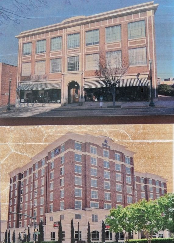
5. Marker detail: Architectural Preservation
Preservation efforts have led to rehabilitation of historic properties and construction of new buildings with designs inspired by the district’s architectural character.Today, the Dupre Building at 807 Gervais Street better reflects its early 20th-century appearance while meeting contemporary commercial and residential needs. Erected in 2006, the Hilton Columbia Center offers modern amenities while blending aesthetically with the Vista’s earlier buildings, thanks to its use of red brick and concrete detailing. Images courtesy of Rosie Craig and Historic Columbia Foundation
Credits. This page was last revised on July 18, 2023. It was originally submitted on February 11, 2018, by Cosmos Mariner of Cape Canaveral, Florida. This page has been viewed 309 times since then and 37 times this year. Photos: 1, 2, 3, 4, 5, 6. submitted on February 11, 2018, by Cosmos Mariner of Cape Canaveral, Florida. 7. submitted on February 12, 2018, by Cosmos Mariner of Cape Canaveral, Florida. • Bernard Fisher was the editor who published this page.
