Navy Yard in Southeast Washington in Washington, District of Columbia — The American Northeast (Mid-Atlantic)
Historic Pumping Station
Water Is Life
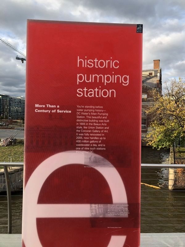
More Than a Century of Service
You're standing before water pumping history— DC Water's Main Pumping Station. This beautiful and distinctive building was built in 1905 in the Beaux Arts style, like Union Station and the Corcoran Gallery of Art. It was fully renovated in 2005, now handles up to 400 million gallons of wastewater a day, and is one of nine such stations throughout DC.
Giving Gravity a Boost
DC's sewer system works mainly through gravity, sending wastewater downhill to the Blue Plains Treatment Plant. But when things have to go uphill, pumping stations do the job gravity can't.
Topics. This historical marker is listed in these topic lists: Arts, Letters, Music • Charity & Public Work. A significant historical year for this entry is 1905.
Location. 38° 52.362′ N, 77° 0.185′ W. Marker is in Southeast Washington in Washington, District of Columbia. It is in Navy Yard. It is on Anacostia Riverwalk Trail east of 1st Street Southeast, on the right when traveling west. Touch for map. Marker is in this post office area: Washington DC 20003, United States of America. Touch for directions.

Regionally,
this page online
Other nearby markers. At least 6 other markers are within walking distance of this marker: Clean Rivers Project (a few steps from this marker); Play (a few steps from this marker); Restore and Connect (a few steps from this marker); Foundry (about 300 feet away, measured in a direct line); Lumber Shed - Form and Function (about 500 feet away); Radio Towers (about 600 feet away). Touch for a list and map of all markers in Southeast Washington.
Other markers no longer nearby. The Lumber Shed (was about 400 feet away but has been replaced with another marker now near it); Twelve12 (was about 400 feet away but has been replaced with another marker now near it); The Bixby (was about 400 feet away but has been replaced with another marker now near it); USDOT (was about 400 feet away but has been replaced with another marker now near it);
Credits. This page was last revised on January 30, 2023. It was originally submitted on February 15, 2018, by Devry Becker Jones of Washington, District of Columbia. This page has been viewed 647 times since then and 44 times this year. Photos: 1, 2. submitted on October 28, 2021, by Devry Becker Jones of Washington, District of Columbia. • Bill Pfingsten was the editor who published this page.
