Coos Bay in Coos County, Oregon — The American West (Northwest)
Bay View Brewery
⎯⎯⎯
Guildesheim's 2nd Hand Hide & Junk Store
ca. 1891-1922
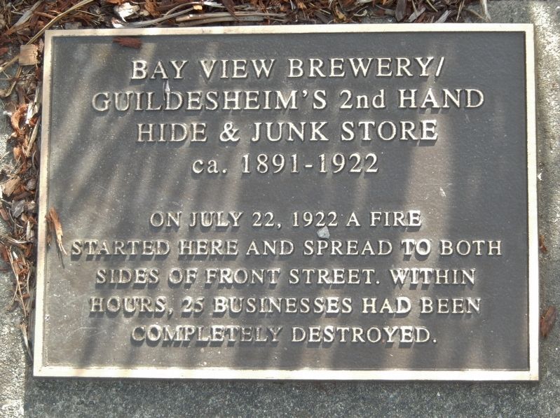
Photographed by Cosmos Mariner, June 24, 2015
1. Bay View Brewery / Guildesheim's 2nd Hand Hide & Junk Store Marker
Topics. This historical marker is listed in this topic list: Disasters. A significant historical date for this entry is July 22, 1922.
Location. 43° 22.219′ N, 124° 12.713′ W. Marker is in Coos Bay, Oregon, in Coos County. It is on Oregon Coast Highway (U.S. 101) north of East Market Avenue, on the right when traveling north. Marker is a metal tablet mounted near the sidewalk in front of a kiosk exhibiting a 340 year old tree trunk cross-section. Touch for map. Marker is at or near this postal address: 390 North Front Street, Coos Bay OR 97420, United States of America. Touch for directions.

Regionally, this marker is in Southern Oregon and specifically on the Oregon Coast. It is also on the American Pacific Coast, in the Pacific Northwest, and in the Lewis & Clark Corridor. Globally, it is in North America, on the Ring of Fire, on the Pacific Rim, in the Western Hemisphere, in the Western World, and in the Anglosphere.
Other nearby markers. At least 8 other markers are within walking
this page online
Credits. This page was last revised on June 12, 2024. It was originally submitted on February 18, 2018, by Cosmos Mariner of Cape Canaveral, Florida. This page has been viewed 391 times since then and 28 times this year. Photo 1. submitted on February 18, 2018, by Cosmos Mariner of Cape Canaveral, Florida. • Bill Pfingsten was the editor who published this page.
Editor’s want-list for this marker. Photos of the marker in situ and the area • Can you help?
