Near Oregon City in Clackamas County, Oregon — The American West (Northwest)
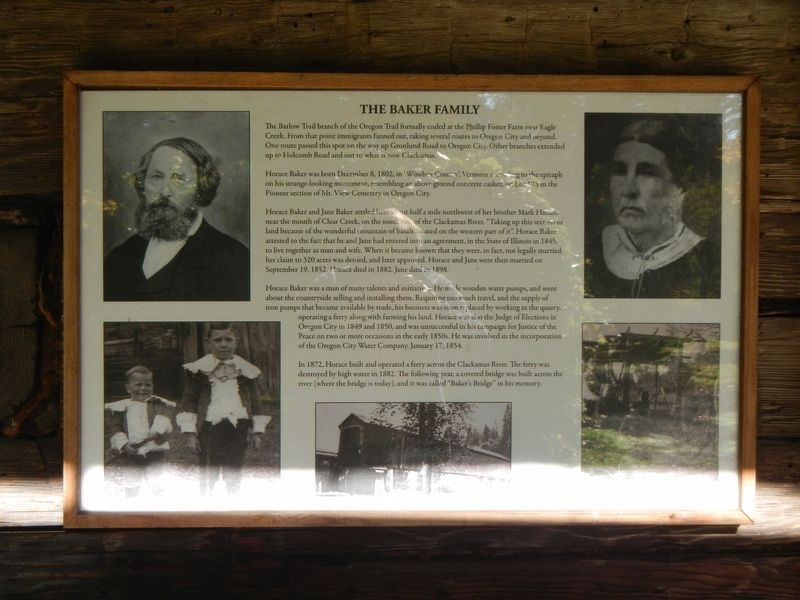
The Baker Family
Horace Baker was born December 8, 1802, in 'Windsor County,' Vermont according to the epitaph on his strange-looking monument, resembling an above ground concerte casket, on Lot 175 in the Pioneer section of Mt. View Cemetery in Oregon City.
Horace Baker and Jane Baker settled here about half a mile northwest of her brother Mark Hattan, near the mouth of Clear Creek, on the south side of the Clackamas River. "Taking up this section of land because of the wonderful mountain of basalt located on the western part of it." Horace Baker attested to the fact that he and Jane had entered into an arrangement, in the State of Illinois in 1845 to live together as man and wife. When it became known that they were, in fact, not legally married her claim to 320 acres was denied, and later approved. Horace and Jane were then married on September 19, 1852. Horace died in 1882. Jane died in 1898.
Horace Baker was a man of many talents and initiatives. He made wooden water pumps, and went about the countryside selling and installing them. Requiring too much travel, and the supply of iron pumps that became available by trade, his business was soon replaced by working in the quarry, operating a ferry along with farming his land. Horace was also the Judge of Elections in Oregon City in 1849 and 1850, and was unsuccessful in his campaign for Justice of the Peace on two or more occasions in the early 1850s. He was involved in the incorporation of the Oregon City Water Company, January 17, 1854.
In 1872, Horace built an operated a ferry across the Clackamas River. The ferry was destroyed by high water in 1882. The following year, a covered bridge was built across the river (where the bridge is today), and it was called "Baker's Bridge" in his memory.
Erected by The Old Timers' Association of Carver, Oregon.
Topics. This historical marker is listed in this topic list: Settlements & Settlers.
Location. 45° 23.405′ N, 122° 29.802′ W. Marker is near Oregon City, Oregon, in Clackamas County. Marker can be reached from South Gronlund Road near Carver Road, on the right when traveling west. Touch for map. Marker is at or near this postal address: 1800 South Gronlund Road, Oregon City OR 97045, United States of America. Touch for directions.
Other nearby markers. At least 8 other markers are within 5 miles of this marker, measured as the crow flies. The Baker Cabin Overview (here, next to this marker);
Area Commerce (a few steps from this marker); Grinding Rock (within shouting distance of this marker); The Baker Cabin (within shouting distance of this marker); Baker Site (within shouting distance of this marker); Baker Cabin Pioneer Church (about 400 feet away, measured in a direct line); Baker Cabin Historical Society (about 500 feet away); Willamette Falls, circa 1880 (approx. 5 miles away). Touch for a list and map of all markers in Oregon City.
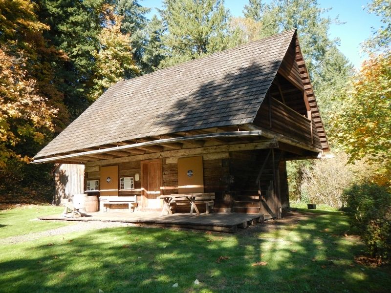
More about this marker. This marker is located on the side of Baker Cabin on the grounds of Baker Cabin Historical Site.
Credits. This page was last revised on February 19, 2018. It was originally submitted on February 19, 2018, by Barry Swackhamer of Brentwood, California. This page has been viewed 430 times since then and 38 times this year. Photos: 1, 2. submitted on February 19, 2018, by Barry Swackhamer of Brentwood, California.

