Near Aurora in Marion County, Oregon — The American West (Northwest)
Boone's Ferry
Photographed by Barry Swackhamer, September 25, 2017
1. Boone's Ferry Marker
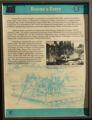
Caption: (center right) From an oar-drawn raft to a modern cable-drawn ferry, travelers relied upon the Boone's Ferry to safely cross the Willamette River for more than 100 years.
Alphonso Boone, grandson of the frontiersman Daniel Boone, emigrated to Oregon with 10 children in 1846. The family established homesteads on the Willamette River between present-day Oregon City and Butteville. By 1847, the Boones established a ferry crossing on the Willamette near this marker. and eldest son Jesse began clearing a path through Marion, Washington, Clackamas, and Multnomah Counties known today as Boones Ferry Road.
Jesse Boone operated the ferry until his death in 1872. The ferry continued in private hands for several years until Clackamas County, and finally, the State of Oregon assumed control in the early 1900s. Boones Ferry crossed the
this page online
Erected by Oregon Department of Transportation.
Topics and series. This historical marker is listed in these topic lists: Bridges & Viaducts • Waterways & Vessels. In addition, it is included in the Oregon Beaver Boards series list.
Location. 45° 16.265′ N, 122° 46.522′ W. Marker is near Aurora, Oregon, in Marion County. It can be reached from Interstate 5 at milepost 281, one mile south of Miley Road, on the right when traveling north. Touch for map. Marker is in this post office area: Aurora OR 97002, United States of America. Touch for directions.

Regionally, this marker is in Oregon Wine Country and in the Willamette Valley. It is also on the American Pacific Coast, in the Pacific Northwest, and in the Lewis & Clark Corridor. Globally, it is in North America, in
Photographed by Barry Swackhamer, September 25, 2017
2. Boone's Ferry Marker
Other nearby markers. At least 8 other markers are within 2 miles of this marker, measured as the crow flies: Grove of the States (approx. ¼ mile away); Tauchman House (approx. 1.6 miles away); Boone’s Landing (approx. 1.6 miles away); Site of Bill Flynn’s Saloon (approx. 1.7 miles away); The Cottage Hotel (approx. 1.9 miles away); Norris Young Machine Shop (approx. 1.9 miles away); Drug Store and Lodge Hall (approx. 1.9 miles away); Site of the Train Depot (approx. 1.9 miles away).
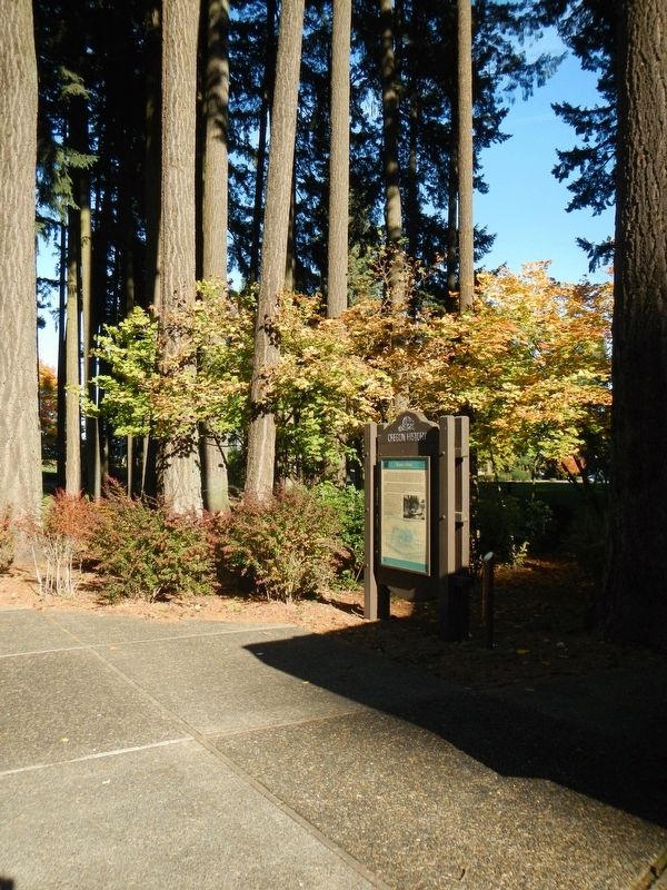
More about this marker. This marker is located at the French Prairie Rest Area - Northbound.
Also see . . .
1. Boones Ferry - Wikipedia. The family cleared a path and laid a split log roadway north to Portland and south toward Salem. The ferry was propelled by oarsmen from the nearby Tuality Indian tribe.... Alphonso was adamant about operating the ferry 24 hours a day, which might have been related to a widespread illicit moonshine industry along the new road. (Submitted on February 22, 2018, by Barry Swackhamer of Brentwood, California.)
2. Oregon Travel Experience - Audio Tour Stop. The official Oregon 'Beaver Board' website which promotes over 100 Oregon State Historical Markers. (Submitted on February 22, 2018, by Douglass Halvorsen of Klamath Falls, Oregon.)
Credits. This page was last revised on February 24, 2018. It was originally submitted on February 22, 2018, by Barry Swackhamer of Brentwood, California. This page has been viewed 617 times since then and 70 times this year. Photos: 1, 2. submitted on February 22, 2018, by Barry Swackhamer of Brentwood, California.
