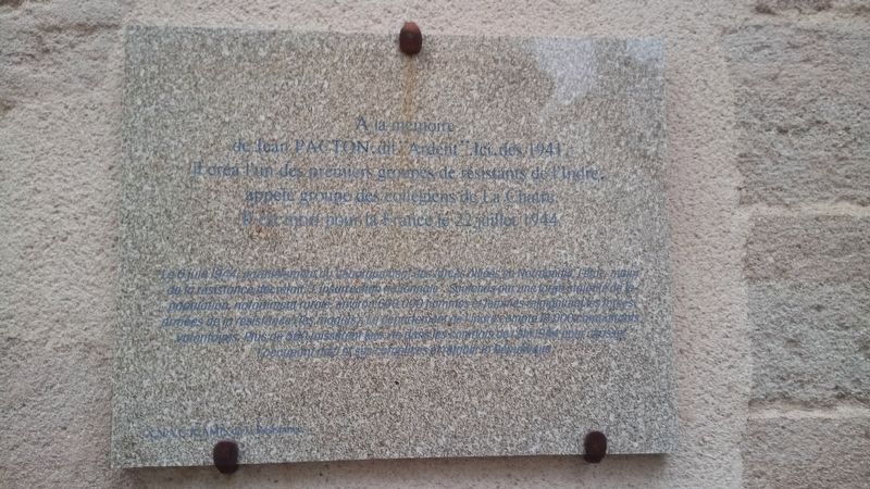
Plaque Commémorative de Jean Pacton
de Jean PACTON, dit "Ardent". Ici dès 1941,
il créa l'un des premiers groupes de résistants de l'Indre,
appelé groupe des collégiens de La Châtre.
Il est mort pour la France le 22 Juillet 1944.
Le 6 Juin 1944, parallèlement au débarquement des forces alliées en Normandie l'état-major de la résistance décrétait : "L'insurrection nationnale". Soutenus par une large majorité de la population, notamment rurale, environ 600 000 hommes et femmes rejoignirent les forces armées de la résistance (les maquis). Le département de l'Indre compta 18 000 combattants volontaires. Plus de 560 laissèrent leur vie dans les combats de l'été 1944 pour chasser l'occupant nazi et ses complices et rétablir la République.
To the memory of Jean Pacton, codenamed "Ardent". Here in 1941 he put together one of the most noted resistance groups of the Indre, composed of the college students of La Châtre. He died for France on July 22, 1944.
On June 6, 1944, parallel to the landing of the Allied forces in Normandy, the staff of the resistance
Erected by Amis de la Resistance.
Topics. This memorial is listed in this topic list: War, World II. A significant historical date for this entry is July 22, 1944.
Location. 46° 34.869′ N, 1° 59.191′ E. Marker is in La Châtre, Centre-Val de Loire, in Indre. Memorial is on Rue Nationale just north of Rue du Marché, on the left when traveling north. Touch for map. Marker is at or near this postal address: 134 Rue Nationale, La Châtre, Centre-Val de Loire 36400, France. Touch for directions.
Other nearby markers. At least 8 other markers are within walking distance of this marker. Hôtel de Villaines (here, next to this marker); Place du Marché / Market Square (within shouting distance of this marker); La maison du Chevalier d'Ars (about 120 meters away, measured in a direct line); Place du Docteur Vergne (about 150 meters away); Maison rue des Pavillons (approx. 0.3 kilometers away); La Bataille de Bir Hakeim / The Battle of Bir Hakeim (approx. 0.3 kilometers
away); Fontaine Sainte-Radegonde (approx. 0.3 kilometers away); Pont des Cabignats (approx. 0.4 kilometers away). Touch for a list and map of all markers in La Châtre.
Credits. This page was last revised on September 9, 2018. It was originally submitted on February 24, 2018, by Corentin Buisson of Saint-Août, France. This page has been viewed 191 times since then and 6 times this year. Photo 1. submitted on February 24, 2018, by Corentin Buisson of Saint-Août, France. • Andrew Ruppenstein was the editor who published this page.
