Upper Sandusky in Wyandot County, Ohio — The American Midwest (Great Lakes)
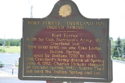
Fort Ferree - Overland Inn - Indian Spring
Photographed by Dale K. Benington, August 6, 2008
1. Fort Ferree - Overland Inn - Indian Spring Marker
built by Gen. Harrison's Army, 1812.
Overland Inn
1814 until 1846, on site Elks Lodge.
Indian Spring
used by Indians 1730 to 1843.
Erected 1956 by Wyandot County Historical Society and B.P.O.E. No. 83.
Topics and series. This historical marker is listed in these topic lists: Forts and Castles • Military • War of 1812. In addition, it is included in the Former U.S. Presidents: #09 William Henry Harrison series list. A significant historical date for this entry is June 4, 1745.
Location. 40° 49.655′ N, 83° 16.659′ W. Marker is in Upper Sandusky, Ohio, in Wyandot County. It is on E. Wyandot Avenue (U.S. 30) close to 4th Street, on the left when traveling east. This historical marker is located directly in front of the local Elk Lodge (B.P.O.E. No. 83). Touch for map. Marker is at or near this postal address: 340 E Wyandot Ave, Upper Sandusky OH 43351, United States of America. Touch for directions.

Regionally, this marker is in the Till Plains. It
this page online
Other nearby markers. At least 8 other markers are within walking distance of this marker: Old Indian Burial Grounds (about 400 feet away, measured in a direct line); Tschanen Elm (about 500 feet away); The William Walker Jr. House (about 500 feet away); Wyandot Indian Council House (about 700 feet away); Wyandot County War of 1812 Veterans Memorial Flagpole (approx. 0.2 miles away); Wyandot County Veterans Memorial (approx. 0.2 miles away); Col. William Crawford (approx. 0.2 miles away); 1000 feet east - site of Fort Ferree (approx. 0.2 miles away). Touch for a list and map of all markers in Upper Sandusky.
More about this marker. This marker was missing for some time, but it has been reported refurbished and reinstalled. We are awaiting fresh photographs.
There is an additional
Photographed by Dale K. Benington, August 6, 2008
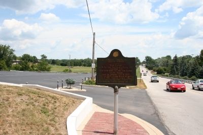
2. Fort Ferree - Overland Inn - Indian Spring Marker
View of historical marker looking east along US 30, the old Lincoln Highway. The historic Sandusky River is just beyond the treeline, directly behind the marker.
Regarding Fort Ferree - Overland Inn - Indian Spring. With regards to this marker's subject material that is related to the topic of the War of 1812: As part of his preparations to recapture Detroit and invade Canada, General William Henry Harrison built a chain of forts northward, along both the Sandusky River Valley and the Sandusky-Scioto Trail, from what is now Upper Sandusky, Ohio (Fort Ferree), to what is now Tiffin, Ohio (Fort Ball), to what is now Old Fort, Ohio (Fort Seneca), all the way to what is now Fremont, Ohio (Fort Stephenson). These forts were intended to protect the American lines of supply and communication as General Harrison attempted to both position and build up his forces while he was seeking the opportunity for an invasion of British controlled Canada.
Related markers. Click here for a list of markers that are related to this marker. To better understand the relationship, study
Photographed by Dale K. Benington, August 6, 2008
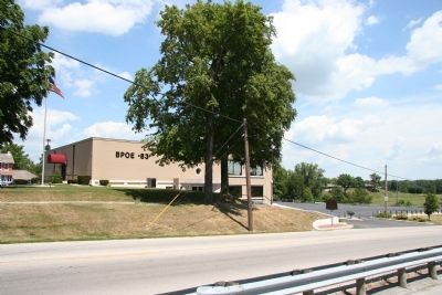
3. Fort Ferree - Overland Inn - Indian Spring Marker
View of the historical marker, as seen in front of the local Elk Lodge, B.P.O.E. No 83.
Photographed by Dale K. Benington, August 6, 2008
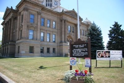
4. Fort Ferree - Overland Inn - Indian Spring Marker
View of a related Fort Ferree historical marker, located 1,000 feet to the west, in front of the Wyandot County Courthouse.
Photographed by Dale K. Benington, August 6, 2008
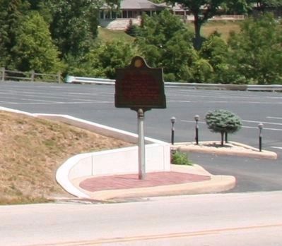
5. Fort Ferree - Overland Inn - Indian Spring Marker
A closer view, enlarged from an August 6, 2008 photo, showing the marker located on a brick paved insert adjacent to the curbside and the property's driveway entrance.
Photographed by Dale K. Benington, April 16, 2016
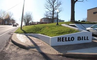
6. Fort Ferree - Overland Inn - Indian Spring Marker
View of the missing marker's former location, on the brick paved curbside insert, looking west along East Wyandot Avenue.
Photographed by Dale K. Benington, April 16, 2016
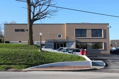
7. Fort Ferree - Overland Inn - Indian Spring Marker
View of the former site of the now missing historical marker (on the brick paved, curbside insert), as seen in front of the local Elk Lodge, B.P.O.E. No 83.
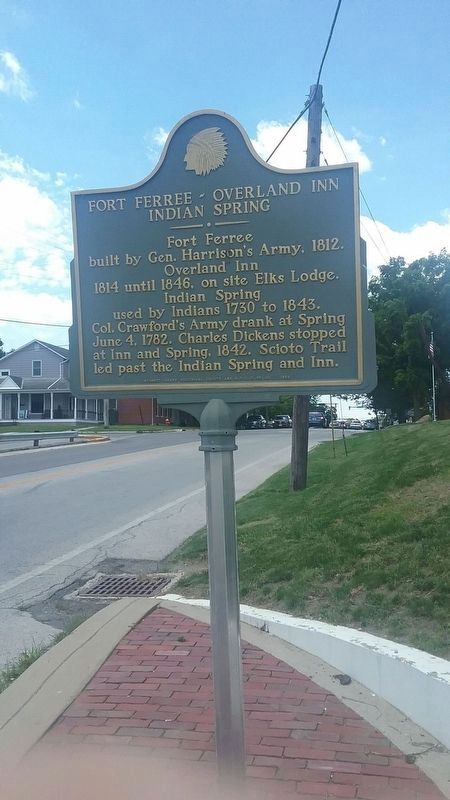
Photographed by Richard Lawson, June 26, 2019
8. Fort Ferree - Overland Inn - Indian Spring Marker
Returned to it's location in front of the BPOE on East Wyandot Street.
Credits. This page was last revised on July 19, 2019. It was originally submitted on April 19, 2009, by Dale K. Benington of Toledo, Ohio. This page has been viewed 2,335 times since then and 84 times this year. Last updated on March 2, 2018, by Michael Baker of Lima, Ohio. Photos: 1, 2, 3, 4. submitted on April 19, 2009, by Dale K. Benington of Toledo, Ohio. 5, 6, 7. submitted on April 17, 2016, by Dale K. Benington of Toledo, Ohio. 8. submitted on June 28, 2019, by Richard Lawson of Roundhead, Ohio. • Bill Pfingsten was the editor who published this page.
