Near Falling Spring in Alleghany County, Virginia — The American South (Mid-Atlantic)
Falling Spring Falls
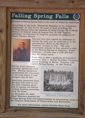
Welcome to Falling Spring Falls in the Heart of the Alleghany Highlands.
According to the book, “Historical Sketches of the Alleghany Highlands” by Gay Arritt, 82 acres of land including, the Falling Spring Falls was granted by King George III of Great Britain to Gabriel Jones in August 1771. In 1780 Thomas Jefferson, as Governor of Virginia, granted the property to Major Thomas Massie.
The site was once visited by Jefferson to survey the falls and he mentions it in his manuscripts “Notes on the State of Virginia” written in 1781. “The only remarkable cascade in this country is that of the Falling Spring in Augusta,” wrote Jefferson, “...it falls over a rock 200 feet into the valley below.”
From 1914 to 1926 a producer of travertine material, Ohio C. Barber Fertilizer Company, mined fertilizer in Barber, Virginia, now called Falling Spring. In 1927 Falling Spring Lime Company assumed operations until 1941. Mining operations necessitated the relocation of the falls where it now plunges only 80 feet.
Electricity generated from the falls was used to run the lime crushing plant and to operate an electric railway hauling travertine from the mine.
On November 28, 2004, Mead Westvaco donated the Falling Spring Falls and approximately 19 surrounding acres to the Virginia Department of Conservation and Recreation.
For more information contact Douthat State Park.
Topics. This historical marker is listed in these topic lists: Environment • Industry & Commerce • Natural Resources. A significant historical month for this entry is November 1913.
Location. 37° 52.054′ N, 79° 56.829′ W. Marker is near Falling Spring, Virginia, in Alleghany County. Marker is on Hot Springs Road (U.S. 220) just south of Falls Road (County Route 640). Touch for map. Marker is in this post office area: Hot Springs VA 24445, United States of America. Touch for directions.
Other nearby markers. At least 8 other markers are within 7 miles of this marker, measured as the crow flies. The Road to the Kanawha (approx. 1.3 miles away); Fort Breckenridge (approx. 1˝ miles away); Alleghany's Heroic Dead (approx. 5.8 miles away); a different marker also named Alleghany's Heroic Dead (approx. 5.8 miles away); Alleghany's Heroic Dead. (approx. 5.8 miles away); Alleghany County Confederate Soldiers Monument (approx. 5.8 miles away); Low Moor Iron Company Coke Ovens (approx. 6.2 miles away); Oakland Presbyterian Church and Cemetery (approx. 6.6 miles away). Touch for a list and map of all markers in Falling Spring.
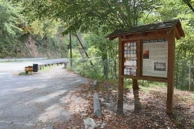
More about this marker. Marker is at a small parking area on a wide spot of the road just north of the falls.
Regarding Falling Spring Falls.
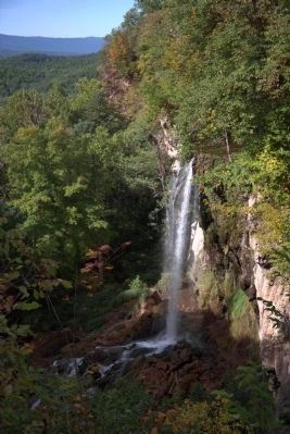
The falls are visible from the road. A protected walkway on the shoulder of the road leads from the parking area north of the falls back to the viewing area.
Also see . . .
1. Falling Spring Falls Earthcache. This page contains excellent photographs of the falls. “The stream rises in Warm River Cave, located on private property about a mile away. The water at its source, a mixture of warm thermal spring water and cold ground water, is approximately 85 degrees Fahrenheit year round and is rich in carbonate. As the stream flows out of the cave, it releases carbon dioxide, causing the water to become supersaturated with carbonate. When the stream spills over the ledge at Falling Spring Falls, even more carbon dioxide is released, and the carbonate precipitates and is deposited as a type of limestone called travertine. The beautiful, fragile terraces of travertine below the falls are visible from the overlook.” (Submitted on September 27, 2014.)
2. Wikipedia Entry for Travertine. “Travertine is a form of limestone deposited by mineral springs, especially hot springs. Travertine often has a fibrous or concentric appearance and exists in white, tan, cream-colored, and even rusty varieties. It is formed by a process of rapid precipitation of calcium carbonate, often at the mouth of a hot spring or in a limestone cave. ... It is frequently used in Italy and elsewhere as a building
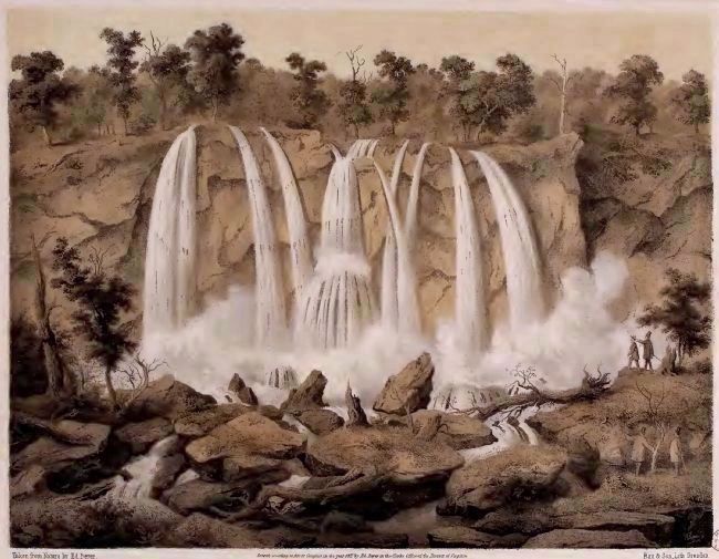
Lithograph of artwork by Edward Beyer, 1857
3. The Original 200 Foot High Falling Spring Falls
From the 1858 picture book Album of Virginia; or Illustration of the Old Dominion by Edward Beyer. The text at the bottom of the lithograph reads “Taken from Nature by Ed. Beyer.” “Entered according to Act of Congress in the year 1857 by Ed Boyer in the Clerks Office of the District of Virginia” “Rau & Son, Lith Dresden.”
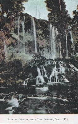
J.J. Prats Postcard Collection, circa 1907/1915
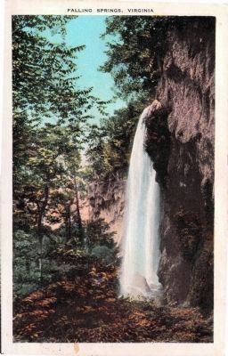
5. Falling Springs, Near Hot Springs, Va.—(17)
Divided-back unused undated postcard “printed and published by J. P. Bell Co, Lynchburg, VA.” has this caption: “Falling Springs, near Covington, Va., are unique among waterfalls of the world. The clear spring water by calcium deposit has built a stalagmite precipice, ever pushing farther down the valley, and ever growing in height until to-day its crystal waters are falling nearly 150 feet into the basin below, while in the fluted wall it has builded lurks every shade of cream to violet, giving a setting of rare beauty seldom seen and never to be forgotten.”
Credits. This page was last revised on April 21, 2018. It was originally submitted on September 27, 2014, by J. J. Prats of Powell, Ohio. This page has been viewed 2,883 times since then and 152 times this year. Last updated on March 7, 2018, by Roy Forbes of Roanoke, Virginia. Photos: 1, 2, 3, 4. submitted on September 27, 2014, by J. J. Prats of Powell, Ohio. 5, 6. submitted on October 3, 2014, by J. J. Prats of Powell, Ohio. • Bill Pfingsten was the editor who published this page.
