Islip in Suffolk County, New York — The American Northeast (Mid-Atlantic)
St. Mark's
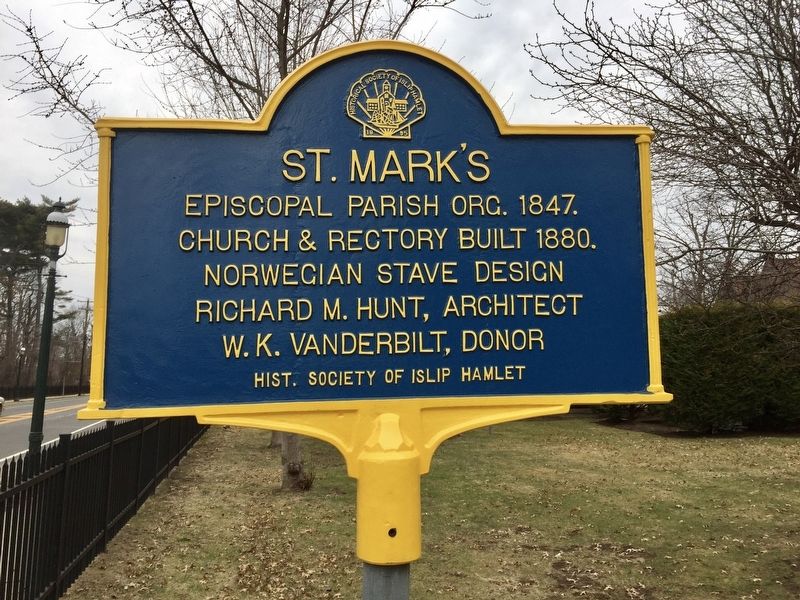
Photographed by Andrew Ruppenstein, March 1, 2018
1. St. Mark's Marker
Church & rectory built 1880.
Norwegian stave design
Richard M. Hunt, Architect
W.K. Vanderbilt, donor
Erected 1995 by Historical Society of Islip Hamlet.
Topics. This historical marker is listed in this topic list: Religion & Religious Structures. A significant historical year for this entry is 1847.
Location. 40° 43.811′ N, 73° 12.41′ W. Marker is in Islip, New York, in Suffolk County. It is at the intersection of Montauk Highway and St. Marks Lane on Montauk Highway. Touch for map. Marker is at or near this postal address: 754 Montauk Highway, Islip NY 11751, United States of America. Touch for directions.

Regionally, this marker is in the New York City Metropolitan Area and on Long Island. It is also in the American Northeast, in the Mid-Atlantic, and on the Eastern Seaboard. Globally, it is in the North Atlantic Region, North America, the Western Hemisphere, the Western World, and the Anglosphere. Historically, it finds itself in what was once New Netherland and also one of the original Thirteen Colonies.
Other nearby markers. At least 8 other markers are within walking
this page online
Also see . . . History of St. Mark's Episcopal Church. Historical Society of Islip Hamlet entry:
"St. Mark's was organized in 1847 as a mission of St. John's Church, which still stands on Montauk Highway in Oakdale. The first cornerstone is dated July 4, 1847. It was a popular and successful parish from the beginning and over the years founded five other churches in the area: Christ Church, Babylon; St. Peter's Church, Bay Shore; Emmanuel Church, Great River; The Church of the Messiah, Central Islip; and Christ Church, Brentwood...." (Submitted on March 10, 2018.)
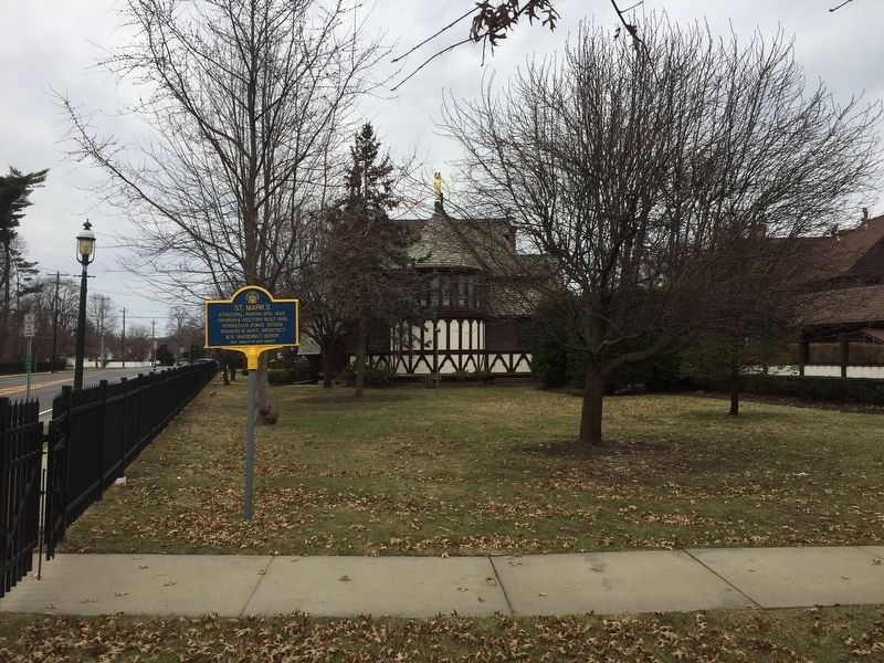
Photographed by Andrew Ruppenstein, March 1, 2018
2. St. Mark's Church and Marker - Looking east along Montauk Highway
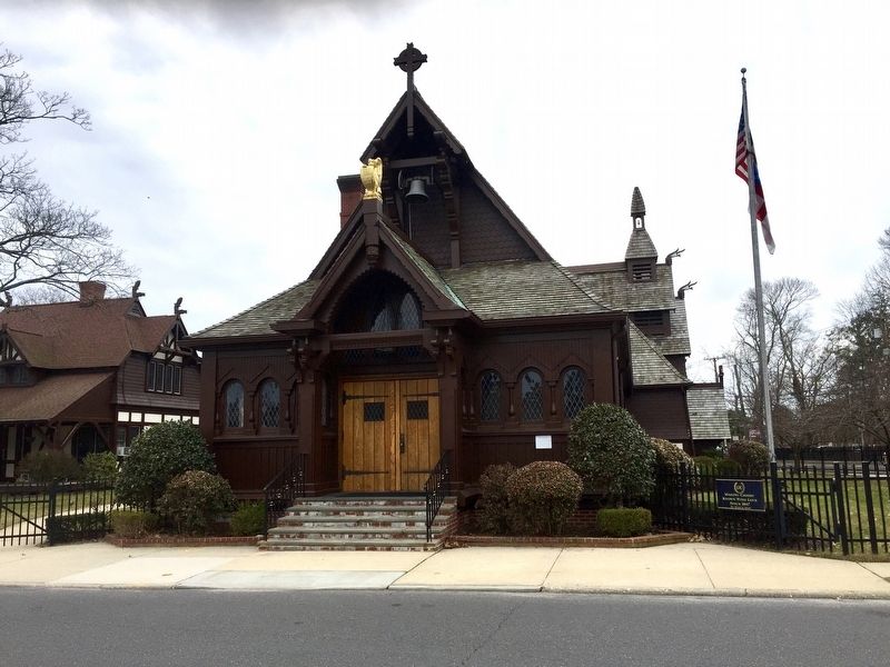
Photographed by Andrew Ruppenstein, March 1, 2018
3. St. Mark's Church - looking east across St. Marks Lane to the church entrance
Credits. This page was last revised on August 24, 2024. It was originally submitted on March 10, 2018, by Andrew Ruppenstein of Lamorinda, California. This page has been viewed 960 times since then and 94 times this year. Photos: 1, 2, 3. submitted on March 10, 2018, by Andrew Ruppenstein of Lamorinda, California.
