Eastport in Annapolis in Anne Arundel County, Maryland — The American Northeast (Mid-Atlantic)
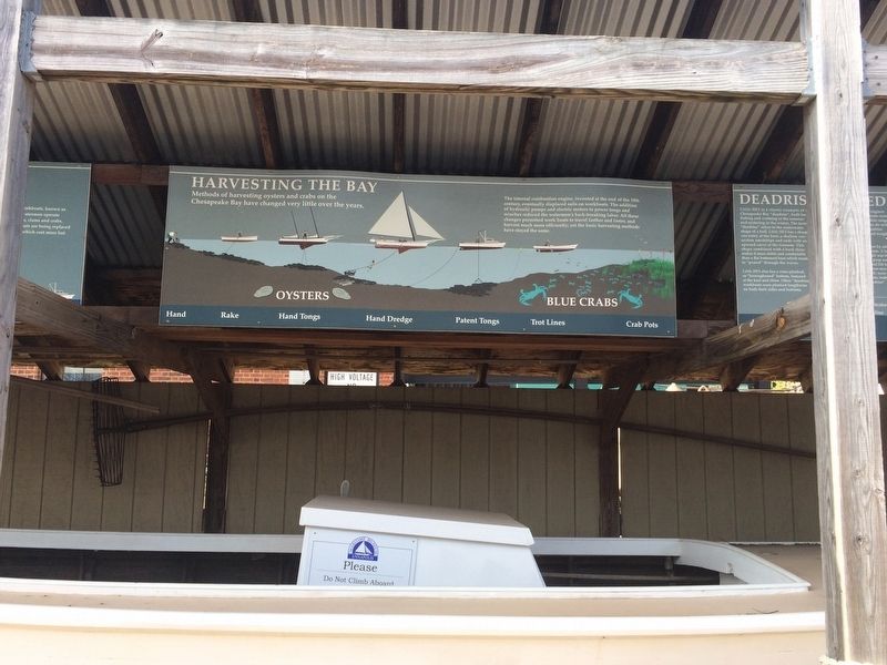
Harvesting the Bay
Methods of harvesting oysters and crabs on the Chesapeake Bay have changed very little over the years.
The internal combustion engine, invented at the end of the 19th century, eventually displaced sails on workboats. The addition of hydraulic pumps and electric motors to power tongs and winches reduced the watermen's back-breaking labor. All these changes permitted work boats to travel farther and faster and harvest much more efficiently; yet the basic harvesting methods have stayed the same.
Topics. This historical marker is listed in these topic lists: Industry & Commerce • Waterways & Vessels.
Location. 38° 58.158′ N, 76° 28.593′ W. Marker is in Annapolis, Maryland, in Anne Arundel County. It is in Eastport. Marker can be reached from Bay Shore Avenue east of 2nd Street, on the right. Touch for map. Marker is at or near this postal address: 129 Bay Shore Avenue, Annapolis MD 21403, United States of America. Touch for directions.
Other nearby markers. At least 8 other markers are within walking distance of this marker. Deadrise Defined (here, next to this marker); Cap'n Herbie Sadler (here, next to this marker); Bay Workboats (a few steps from this marker); Skipjack Lydia D (a few steps from this marker); Welcome to Eastport (within shouting distance of this marker); Draketail Peg Wallace (within shouting distance of this marker); From this spot, you can see 1774 - The "Annapolis Tea Party" (within shouting distance of this marker); From this spot, you can see 1672 - Providence: Settlement on the Severn (within shouting distance of this marker). Touch for a list and map of all markers in Annapolis.
Credits. This page was last revised on September 13, 2023. It was originally submitted on March 11, 2018, by Devry Becker Jones of Washington, District of Columbia. This page has been viewed 137 times since then and 10 times this year. Photos: 1, 2. submitted on March 11, 2018, by Devry Becker Jones of Washington, District of Columbia. • Bill Pfingsten was the editor who published this page.

