Memphis in Shelby County, Tennessee — The American South (East South Central)
Point a La Hache, Louisiana/Magnolia Plantation, Louisiana
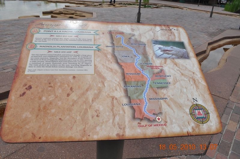
Panel #4 Mississippi Riverwalk
Inscription.
A) Point a La Hache, Louisiana
Mile 45.0 AHP
French explorers named the slight curve in the river bank “Point of the Axe.” It is the end of the Mainline Levee System on the east bank.
B) Magnolia Plantation, Louisiana
Mile 47.0 AHP
Two sea captains named Bradish and Johnson bought a large piece of land here and established a plantation in 1708. Its magnificent ten-room mansion, Magnolia, was the showplace of the territory. The levee in front of Magnolia Plantation gave way in 1903, opening a wide crevasse. Flood fighters had anticipated the emergency and a trainload of repair materials was standing by in Algiers. The train picked up workers on the way, reaching Magnolia in time to close the break before serious damage was done.
Photo credit: Alligator at Bayou Gator Park, Natchitoches, Louisiana - Louisiana Office of Tourism
Erected by Mississippi Riverwalk. (Marker Number 4.)
Topics. This historical marker is listed in these topic lists: Architecture • Exploration • Railroads & Streetcars • Waterways & Vessels. A significant historical year for this entry is 1708.
Location. 35° 8.968′ N, 90° 3.507′ W. Marker is in Memphis, Tennessee , in Shelby County. Marker can be reached from Island Drive, 0.8 miles south of West A.W. Willis Avenue when traveling south. Located in Mud Island River Park. Touch for map. Marker is at or near this postal address: 125 N Front St, Memphis TN 38103, United States of America. Touch for directions.
Other nearby markers. At least 8 other markers are within walking distance of this marker. The Mississippi Riverwalk (here, next to this marker); Ohio River (here, next to this marker); Cairo, Illinois (here, next to this marker); Islands No. 2, 3, and 4 / Fort Jefferson, Kentucky / Bird’s Point, Missouri (here, next to this marker); Island No. 5 (Wolf Island)/Belmont, Missouri/Columbus, Kentucky (here, next to this marker); Donaldson Point, Missouri/Island No. 8/Hickman, Kentucky/Dorena Crevasse (here, next to this marker); New Madrid, Missouri/Cates Casting Field/Island No. 10 (here, next to this marker); Tiptonville, Tennessee/Bixby Towhead (here, next to this marker). Touch for a list and map of all markers in Memphis.
Also see . . . Pointe à la Hache, Louisiana. Ruins remain of the early 18th-century French installation, Fort de La Boulaye, that was built by French colonists to defend their claim of territory against the Spanish and English interests. The land there is mostly marshland, with a strip of higher land less than a mile wide between the wetlands and the Mississippi River. (Submitted on March 12, 2018, by Sandra Hughes Tidwell of Killen, Alabama, USA.)
Credits. This page was last revised on March 13, 2018. It was originally submitted on March 12, 2018, by Sandra Hughes Tidwell of Killen, Alabama, USA. This page has been viewed 242 times since then and 44 times this year. Photo 1. submitted on March 12, 2018, by Sandra Hughes Tidwell of Killen, Alabama, USA. • Bernard Fisher was the editor who published this page.
Editor’s want-list for this marker. Wide shot of marker and its surroundings. • Can you help?
