Memphis in Shelby County, Tennessee — The American South (East South Central)
Bonnet Carre Spillway/Lake Pontchartrain
Mississippi River Walk
Photographed by Jason Voigt, August 2, 2024
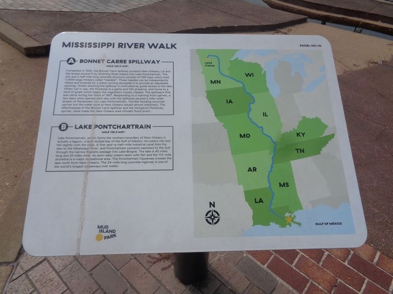
1. Bonnet Carre Spillway/Lake Pontchartrain Marker
Marker was replaced with one put up by Mud Island Park
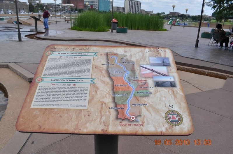
A) Bonnet Carre Spillway
Mile 128.0 AHP
Completed in 1935, the Bonnet Carre Spillway protects New Orleans, LA and the levees around it by diverting flood waters into Lake Pontchartrain. The one and a half mile long concrete structure consist of 350 bays which hold 7,000 large timbers called “needles”. These needles can be independently raised and lowered by a crane running alongside it to provide an adjustable opening. Water entering the spillway is channeled by guide levees to the lake. When not in use, the floodway is a game and fish preserve, and home to a herd of goats which keeps the vegetation closely clipped. The spillway’s first test came during the flood of 1937. Responding to a warning from upriver, a few bays were opened each day until the spillways poured a mile wide stream of floodwater into Lake Pontchartrain. Terrible flooding occurred upriver but the water level at New Orleans stayed almost stationary. The effectiveness of the Bonnet Carre Spillway and the Morganza Floodway, upriver, have made the New Orleans area virtually flood proof.
B) Lake Pontchartrain
Mile 128.5 AHP
Lake Pontchartrain,
this page online
Photo Credit:(1) Lake Pontchartrain Coastline, Louisiana Office of Tourism (2) Bonnet Carre Spillway, courtesy of USACE, (3) Lake Pontchartrain Causeway, Louisiana Office of Tourism
Erected by Mississippi Riverwalk. (Marker Number 10.)
Topics. This historical marker is listed in these topic lists: Disasters • Industry & Commerce • Waterways & Vessels.
Location. 35° 8.785′ N, 90° 3.544′ W. Marker is in Memphis, Tennessee, in Shelby County.
Photographed by Sandra Hughes, May 18, 2010
2. Bonnet Carre Spillway/Lake Pontchartarian Marker

Regionally, this marker is in West Tennessee. It is also in the American South, specifically in the Deep South, in the Upper South, in the Mississippi Delta, and in the Great River Road Region. Globally, it is in North America, the Western Hemisphere, the Western World, and the Anglosphere. Historically, it finds itself in what was once the territory of the Mississippian Culture, one of the Confederate States of America, and the Antebellum South.
Other nearby markers. At least 8 other markers are within walking distance of this marker: Hymelia Crevasse/Bonnet Carre Crevasse/Laplace, Louisiana/Reserve, Louisiana (a few steps from this marker); Kenner, Louisiana/Davis Crevasse/Ormand Landing, Louisiana (a few steps from this marker); New Orleans, Louisiana (a few steps from this marker); Lutcher, Louisiana/Oak Alley/St. James Landing, Louisiana (a few steps from this marker); The Battle of New Orleans (a few steps from
Photographed by Jason Voigt, August 2, 2024
3. Bonnet Carre Spillway/Lake Pontchartrain Marker
Marker is in the back
Also see . . . Lake Pontchartrain. Lake Pontchartrain is named for Louis Phélypeaux, comte de Pontchartrain. He was the French Minister of the Marine, Chancellor, and Controller-General of Finances during the reign of France's "Sun King", Louis XIV, for whom the colony of La Louisiane was named. (Submitted on March 12, 2018, by Sandra Hughes Tidwell of Killen, Alabama, USA.)
Credits. This page was last revised on August 30, 2024. It was originally submitted on March 12, 2018, by Sandra Hughes Tidwell of Killen, Alabama, USA. This page has been viewed 502 times since then and 37 times this year. Photos: 1. submitted on August 30, 2024, by Jason Voigt of Glen Carbon, Illinois. 2. submitted on March 12, 2018, by Sandra Hughes Tidwell of Killen, Alabama, USA. 3. submitted on August 30, 2024, by Jason Voigt of Glen Carbon, Illinois. • Bernard Fisher was the editor who published this page.
