
Wright-Patterson Air Force Base in Montgomery County, Ohio — The American Midwest (Great Lakes)
8th Air Force Control Tower
Photographed by Michael Herrick, February 28, 2018
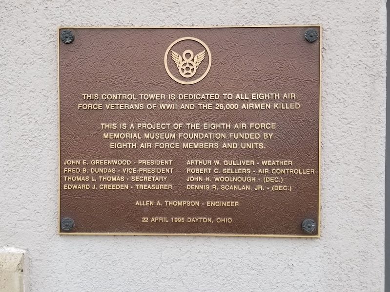
1. Control Tower Marker
Air Force Veterans of WWII and the 26,000 airmen killed
This is a project of the Eighth Air Force
Memorial Museum Foundation Funded by
Eighth Air Force Members and Units
John E. Greenwood – President · Fred B. Dundas – Vice-President · Thomas L. Thomas – Secretary · Edward J. Creeden – Treasurer · Arthur W. Gulliver – Weather · Robert C. Sellers – Air Controller · John H. Woolnough – (dec.) · Dennis R. Scanlon, Jr. – (dec.) · Allen A. Thompson - Engineer ·
22 April 1995 Dayton, Ohio
Erected 1995 by Eighth Air Force Memorial Museum Foundation.
Topics. This memorial is listed in this topic list: War, World II.
Location. 39° 47.037′ N, 84° 6.544′ W. Memorial is in Wright-Patterson Air Force Base, Ohio, in Montgomery County. It can be reached from the intersection of Spaatz Street and Bong Street, on the right when traveling east. Located next to the National Museum of the United States Air Force. Touch for map. Memorial is at or near this postal address: 1100 Spaatz Street, Dayton OH 45431, United States of America.
this page online

Regionally, this memorial is in Ohio’s Dayton Metro and in the Miami Valley. It is also in the American Midwest and in the Corn Belt. Globally, it is in North America, the Western Hemisphere, the Western World, and the Anglosphere. Historically, it finds itself in what was once the Haudenosaunee (Iroquois) Confederacy, the territory of the Mississippian Culture, and the Northwest Territory.
Other nearby markers. At least 8 other markers are within walking distance of this marker: American Air Forces in England, WWII (a few steps from this marker); The Belly Tank (a few steps from this marker); White Square (a few steps from this marker); Conair NC-131H Total In-Flight Simulatot (TIFS) (a few steps from this marker); Boeing EC-135E ARIA (within shouting distance of this marker); Lockheed AC-130A (within shouting distance of this marker); Boeing KC-135R Stratotanker (about 300 feet away, measured in a direct line); McDonnell Douglas F-15A Eagle (about 500 feet away). Touch for a list and map of all markers in Wright-Patterson Air Force Base.
Photographed by Michael Herrick, February 28, 2018
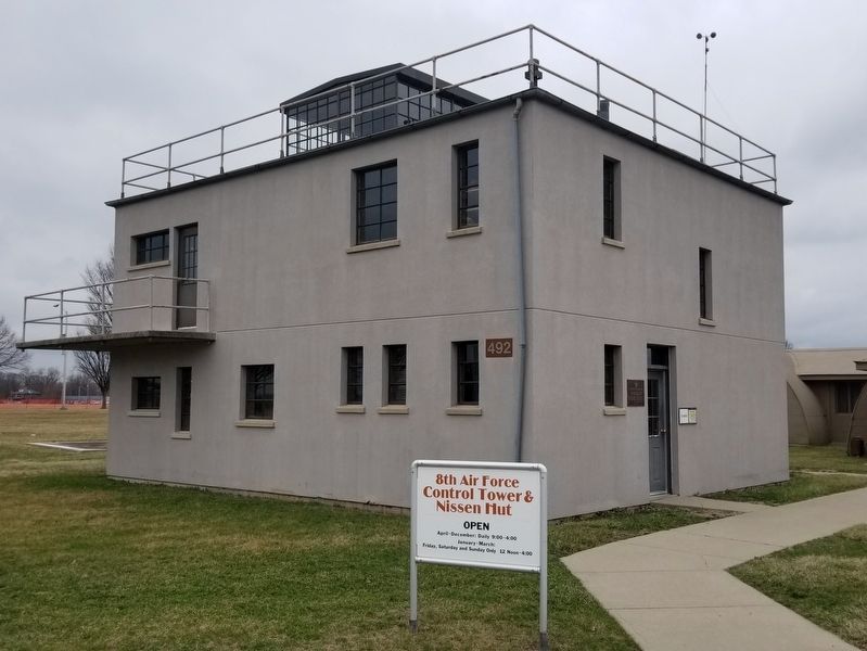
2. 8th Air Force Control Tower
Photographed by Michael Herrick, February 28, 2018
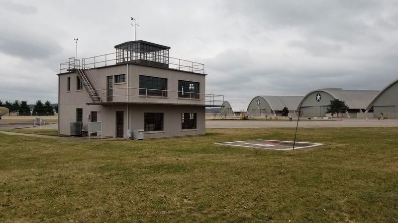
3. 8th Air Force Control Tower
Next to the Control Tower is the small version of the “White Square.” Behind the Control Tower are hangars of the United States Air Force Museum.
Photographed by Michael Herrick, February 28, 2018
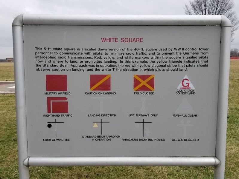
4. White Square
This 5-ft. white square is a scaled down version of the 40-ft. square used by WW II control tower personnel to communicate with pilots, to minimize radio traffic and to prevent the Germans from intercepting radio transmissions. Red, yellow, and white markers within the square signaled pilots how and where to land, or prohibited landing. In this example, the yellow triangle indicates that the Standard Beam Approach was in operation, the red with yellow diagonal stripe that pilotes should observe caution on landing, and the white T the direction in which pilots should land.
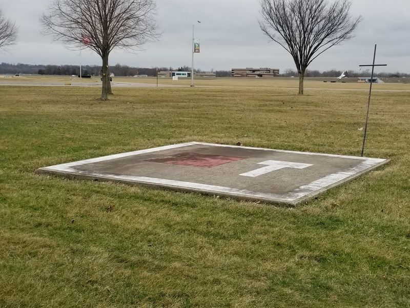
Photographed by Michael Herrick, February 28, 2018
5. The White Square
Credits. This page was last revised on August 26, 2022. It was originally submitted on March 12, 2018, by Michael Herrick of Southbury, Connecticut. This page has been viewed 930 times since then and 33 times this year. Photos: 1, 2, 3, 4, 5. submitted on March 12, 2018, by Michael Herrick of Southbury, Connecticut.
